Lago Sarez
Sarez Lake
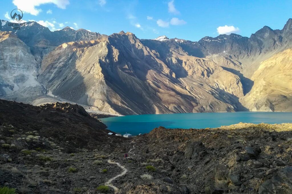
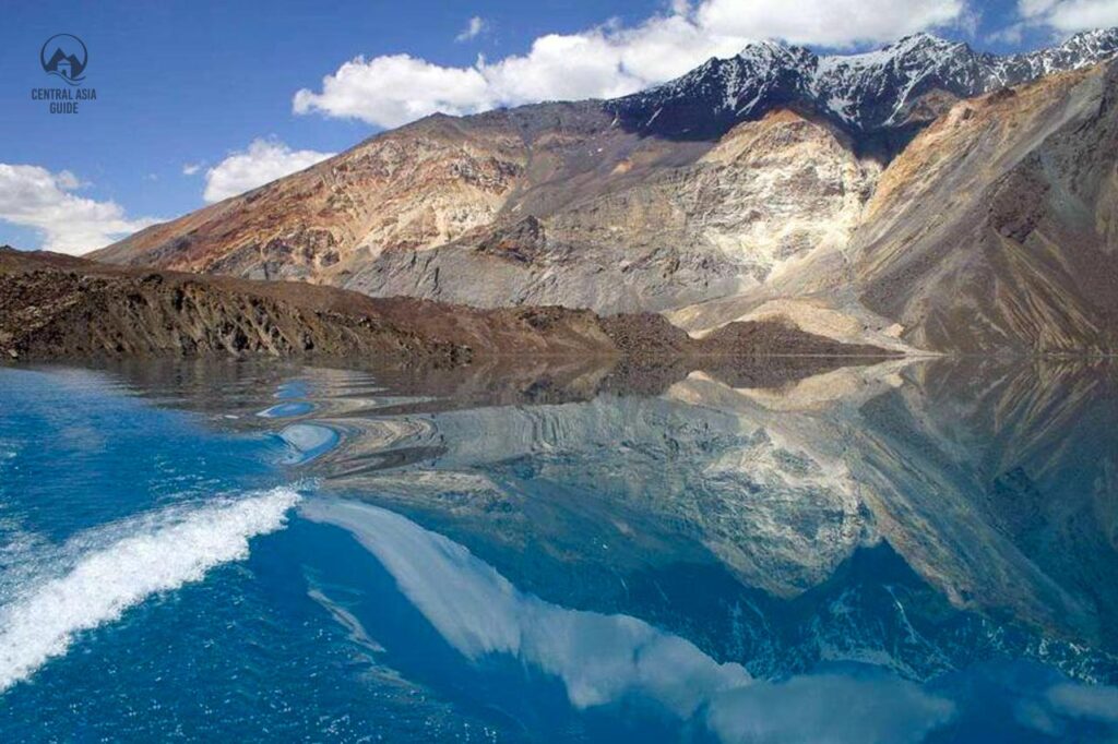
Sarez lake is one of the gems of the Pamir Mountains and is often referred to as the “Sleeping dragon”. Sarez is one of the most beautiful and mysterious lakes of Tajikistan that covers a large area of 80 sq km and is about 60 km long. The Sarez Lake lies in the deep in the very inaccessible area of the Pamir Mountains in the Gorno Badakhshan region of Central Tajikistan and is considered as one of the greatest natural wonders of Asia as it is the largest naturally rock slide formed lake in whole Asia. We offer vistis to Sarez lake as a part of some of our Tajikistan Pamir Tours. It is also possible to have a boat ride in the lake and to continue hiking on the other side or visit the weather station. A similar, much smaller but also amazingly beautiful mountain lake with a natural dam that water flows through, is the Kel Suu (Kol Tetiri) in Kyrgyzstan.
Formación del lago Sarez
El lago Sarez se formó debido a un terremoto estimado en 7,0 en la escala de Richter, que se produjo hacia la medianoche del 5 al 6 de febrero de 1911. El siguiente corrimiento de tierras, de 2,2 millones de metros cúbicos, formó una enorme barrera natural conocida como la presa de Usoi. Había un pueblo llamado Usoi que quedó completamente sepultado bajo los escombros y las rocas, incluso junto con sus habitantes. El terremoto también causó la destrucción de otras 50 casas en otros cuatro pueblos de la región. La obstrucción recién formada sigue siendo la presa natural más alta del mundo (567 m, volumen 2,2 km3). En la época del suceso, la noticia tardó mucho en llegar al público debido a la ubicación extremadamente aislada y a las malas conexiones. Pasaron hasta seis semanas antes de que la noticia llegara a los puestos rusos de Murghab y Khorog.
Si se produjera otro terremoto fuerte, o como dicen los lugareños: el dragón dormido, podría despertarse y la presa de Usoi podría destruirse o un cuerpo de tierra y roca parcialmente derrumbado con una masa de unos 3 kilómetros cúbicos podría caer en el lago por su orilla derecha. El desplazamiento podría generar una ola lo suficientemente grande como para arrasar la presa de Usoi y liberar un muro de agua que podría inundar a unos 6 millones de personas que viven río abajo a lo largo de los ríos Bartang, Pyanj y Amu-Darya en Afganistán, Uzbekistán, Turkmenistán, así como, por supuesto, en Tayikistán. Los expertos advierten que sería la mayor inundación jamás presenciada por ojos humanos.


Características del lago Sarez
Sarez es uno de los lagos más jóvenes del mundo. En 1913, las primeras investigaciones demostraron que el lago tenía 28 km de largo, 1,5 km de ancho y 279 m de profundidad. Desde entonces el nivel del agua ha aumentado 36 m y sólo en 1914 el lago Sarez creó un desagüe a través de la presa y dio salida al río Bartang, uno de los afluentes del Pyanj. Desde entonces el lago ha crecido hasta su tamaño actual de 500 m de profundidad en su punto más hondo.
El volumen del lago es actualmente de 16 074 km3, lo que equivale a la descarga anual del Oxus (Amu Darya). En 1939 se inauguró un observatorio hidrometeorológico en la orilla del lago para controlar permanentemente sus aguas debido a los posibles riesgos para las comunidades de las zonas bajas.


Tours Including Sarez Lake
Sarez lake legend
As very often in Central Asia, there is also a legend related to Sarez lake. According to it, the people of Usoi lived in luxury and had bad manners. They were not God fearing and therefore were punished by an earthquake. This story is to remind people to maintain integrity, hospitality, belief and live-in harmony and peace with nature in these hazardous mountainous areas.


Travel to Sarez Lake
If you are interested to visit Lake Sarez you are required to obtain a GBAO permit and a permit from the Ministry of disaster management which usually takes about 2-3 weeks. If you need the proper permissions for the lake, please get in touch with us. For processing the permit, we need a copy of our passport, a copy of your visa (depending on your citizenship), and a copy of your travel insurance. If your tour purchased from us includes a trek to Sarez lake, the permits will be handled by us.
There is no road connection to the lake, so the only way to reach it is to hike all the way to the lake. The most used Sarez trailhead is at Barchadiev village in Bartang valley which, along with nearby Savnob village has homestays. otherwise there is no tourist infrastructure here. Additionally, it isn’t easy to reach the lake as a disastrous earthquake, measuring 7,2, hit Bartang Valley in December 2015 destroying what was already a minimal slip of road and leaving 800 families homeless at the same time. Access to the lake reopened in 2017 but the way remains very rough and is only recommended for experienced hikers.
A second hiking or climbing route to Sarez can be taken by lovers of adventure and trekkers from Bulunkul, Bachor or Bardara villages. The routes from these destination merge in Wukhinch (name of the pasture) and from there it descends to Irkht and Sarez lake. The third and very least taken route comes from the Murghob side along the river Murghob that leads to Sarez.
Other Pamir sights & Destinations
Página actualizada el 23.2.2023