Sarez Lake
Sarez Lake
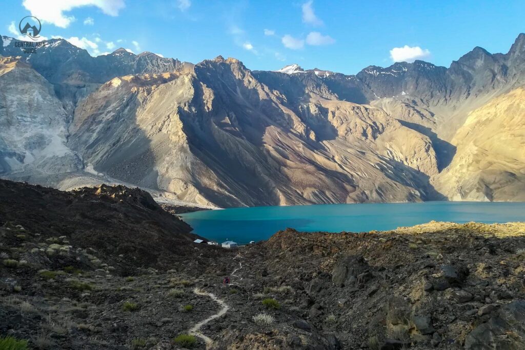
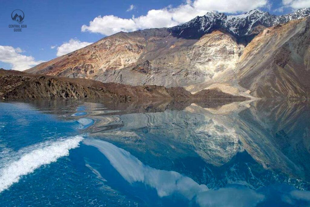
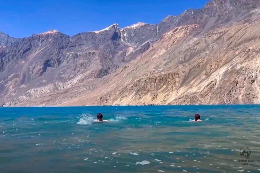
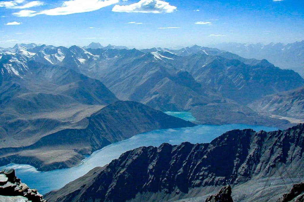
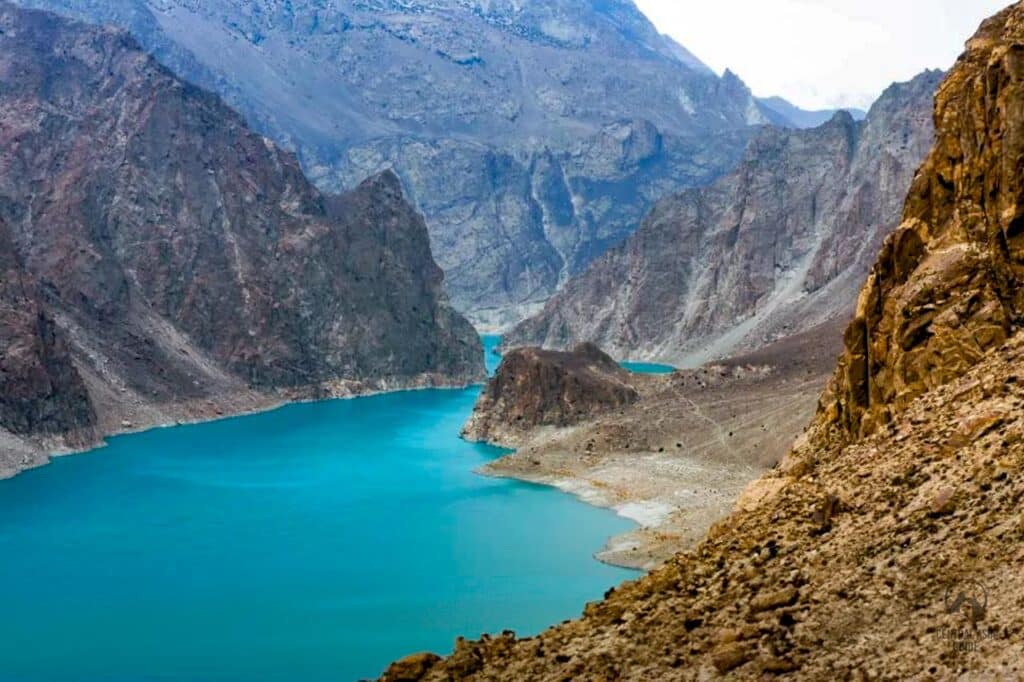
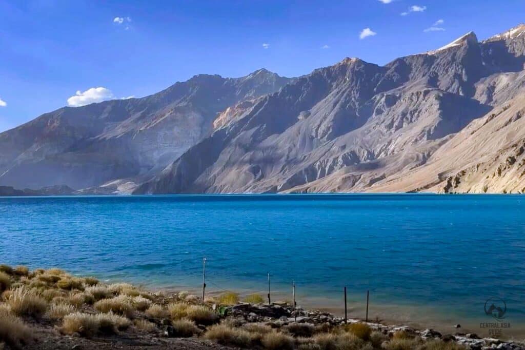
Sarez lake is one of the gems of the Pamir Mountains and is often referred to as the “Sleeping dragon”. Sarez is one of the most beautiful and mysterious lakes of Tajikistan that covers a large area of 80 sq km and is about 60 km long. The Sarez Lake lies in the deep in the very inaccessible area of the Pamir Mountains in the Gorno Badakhshan region of Central Tajikistan and is considered as one of the greatest natural wonders of Asia as it is the largest naturally rock slide formed lake in whole Asia. We offer vistis to Sarez lake as a part of some of our Tajikistan Pamir Tours. It is also possible to have a boat ride in the lake and to continue hiking on the other side or visit the weather station. A similar, much smaller but also amazingly beautiful mountain lake with a natural dam that water flows through, is the Kel Suu (Kol Tetiri) in Kyrgyzstan.
Lake Sarez Formation
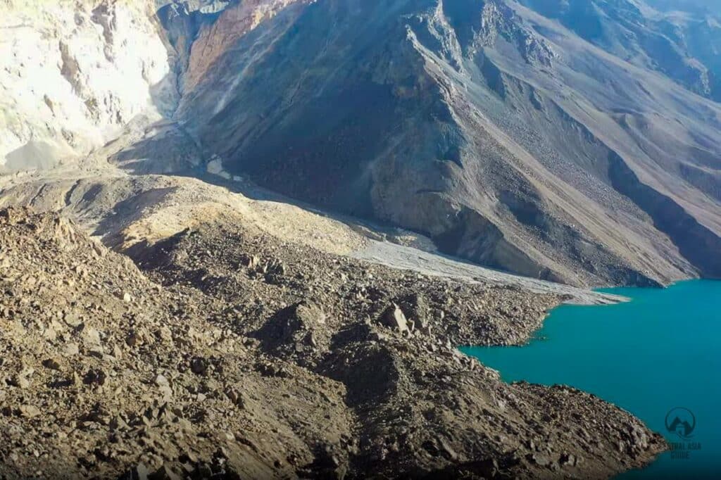
The Sarez lake was formed due to an earthquake that was estimated at 7,0 on the Richter Scale and occurred about midnight, 5–6 February 1911. The following landslide of 2,2 million cubic meters, formed a huge natural barrier known as the Usoi Dam. There was a village called Usoi that was completely buried under the debris and the rocks, even together with its inhabitants. The earthquake also caused the destruction of another 50 houses in four other villages in the region. The newly formed obstruction is still the highest natural dam in the world (567 m, volume 2,2 km3). During the time of the event, it took a long time for the news to travel to the public due to the extremely isolated location and bad connections. It took up to six weeks before word reached the Russian posts at Murghab and Khorog.
Should another strong earthquake happen or as the locals say: sleeping dragon might wake up and the Usoi dam could be destroyed or a partially collapsed body of soil and rock with a mass of roughly 3 cubic kilometers might fall into the lake on its right bank. The displacement could generate a wave large enough to wash away Usoi dam and release a wall of water that could flood about 6 million people living downstream along the Bartang, Pyanj and Amu-Darya rivers in Afghanistan, Uzbekistan, Turkmenistan, as well as of course in Tajikistan. Experts warn that it would be the largest flood ever witnessed by human eyes.
Sarez Lake Characteristics
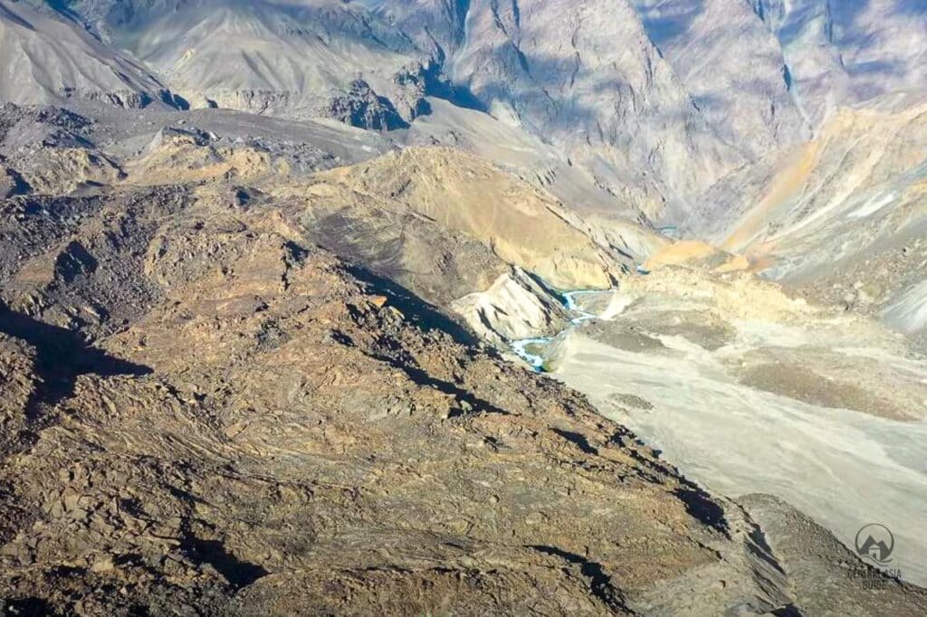
Sarez is one of the youngest lakes in the world. In 1913 the first research has shown the lake to be 28 km long, 1,5 km wide, and 279 m deep. Since then the water level has been increased for 36 m and only in 1914 Sarez lake created an outflow through the dam and gave a start to the Bartang River – one of the Pyanj tributaries. Since then the lake has grown to its current size 500 meters depth at its deepest point.
The lake’s volume is currently 16 074 km3 which is equal to Oxus (Amu Darya) annual discharge. In 1939 a hydro-meteorological observatory was opened on the lake’s shore for permanent control over the lake’s waters due to the possible risks for the lower communities.
Tours Including Sarez Lake
Sarez lake legend
As very often in Central Asia, there is also a legend related to Sarez lake. According to it, the people of Usoi lived in luxury and had bad manners. They were not God fearing and therefore were punished by an earthquake. This story is to remind people to maintain integrity, hospitality, belief and live-in harmony and peace with nature in these hazardous mountainous areas.
Travel to Sarez Lake
If you are interested to visit Lake Sarez you are required to obtain a GBAO permit and a permit from the Ministry of disaster management which usually takes about 2-3 weeks. If you need the proper permissions for the lake, please get in touch with us. For processing the permit, we need a copy of our passport, a copy of your visa (depending on your citizenship), and a copy of your travel insurance. If your tour purchased from us includes a trek to Sarez lake, the permits will be handled by us.
There is no road connection to the lake, so the only way to reach it is to hike all the way to the lake. The most used Sarez trailhead is at Barchadiev village in Bartang valley which, along with nearby Savnob village has homestays. otherwise there is no tourist infrastructure here. Additionally, it isn’t easy to reach the lake as a disastrous earthquake, measuring 7,2, hit Bartang Valley in December 2015 destroying what was already a minimal slip of road and leaving 800 families homeless at the same time. Access to the lake reopened in 2017 but the way remains very rough and is only recommended for experienced hikers.
A second hiking or climbing route to Sarez can be taken by lovers of adventure and trekkers from Bulunkul, Bachor or Bardara villages. The routes from these destination merge in Wukhinch (name of the pasture) and from there it descends to Irkht and Sarez lake. The third and very least taken route comes from the Murghob side along the river Murghob that leads to Sarez.
Other Pamir sights & Destinations
Page updated 23.2.2023