Murghab
Murghab
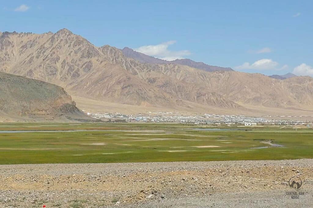
Murghab is a small mountain town with a population of about 6000 people who are mostly of Kyrgyz ethnicity but their lifestyle has also taken somea features from the Tajiks or the Pamiri people, including the types of dwellings (not taking into account the yurts). The village is located on the Murghab Plateau in eastern Tajikistan GBAO (Gorno-Badakhshan Autonomous Oblast), the Pamir area. The desolate town of Murghab is a fascinating example of a rural life lived in extreme conditions at the altitude of 3650 m above sea level.
Murghab lies at the junction of the Pamir Highway, which runs through the center of town and connects the regions with Kyrgyzstan, rest of Tajikistan, Afghanistan, and the main road linking Tajikistan with China over the Kulma Pass. For this reason, it was built during Soviet times as a checkpoint and it is still an important transportation hub as well as the biggest town in the eastern half of Pamir. The Murghab River flows along the base of the town, where livestock graze. Lately, it has also become an essential tourist base for anyone traveling the Pamir Highway or taking a Pamir tour.
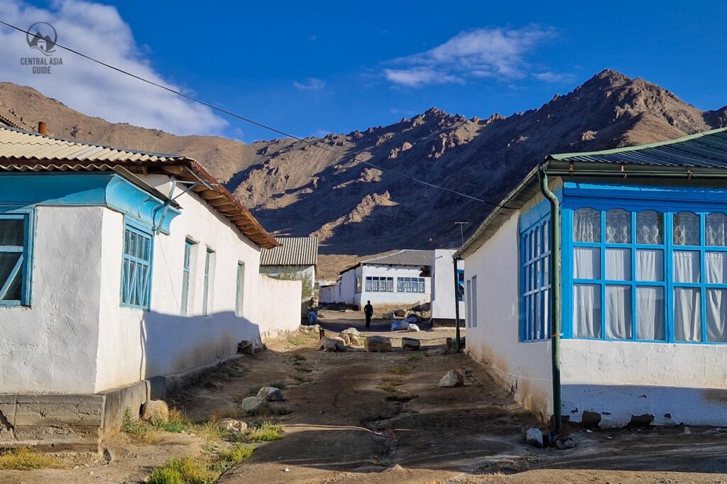
The first impression while arriving to Murghab is highly likely related to the emptiness, coldness, and abandoned houses with ruined whitewashed walls that have exposed the mud-bricks beneath.
As there is no regular electricity supply, residents rely on gas generators or small solar panels. A few years back, a small hydropower plant was introduced but it is also only working according to a certain schedule. Most residents burn coal or dried dung for the heating and cooking purposes. Guesthouses in Murgab have become popular in recent years, they provide electricity to the guest through the generators. The conditions are quite basic, but it is the best what you can get in the eastern part of Pamir.
Harsh climate of Murgab
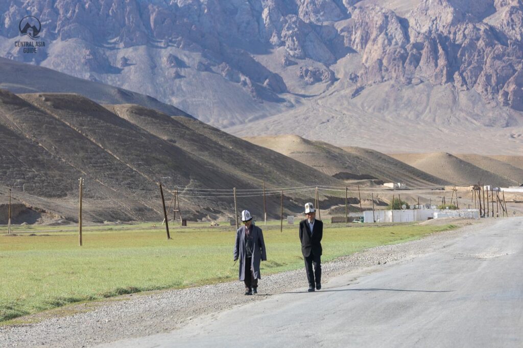
The weather in the Murghab area is extreme. Winter lasts from mid-September to late May, and temperatures in winter may reach -50 C (-60 F). In summer, temperatures can reach +25 C in July and August. The area is considered a high altitude desert, with little rainfall, though downpours do occur. Strong winds blow all year and severe storms may appear suddenly, it may snow any day of the year, even in the valleys.
History of Murghab
Pamir with its trade roads and harsh climate was a confrontation field of the world powers at the end of the 19th century. Russia, England, and China aspired to strengthen their grasp of this high-altitude region. Murghab was formerly known as “Pamyrsky post” and it is the capital of Murghob District in the Pamir Mountains of the Gorno-Badakhshan Autonomous Region. Russians founded Murgab during the colonization period in 1892 to strengthen the borders against China by introducing a military post and the Soviets further strengthened the presence here. Before the Russian colonization, the area used to be lightly inhabited by the few Kyrgyz nomadic yaks and sheepherders tough enough to withstand its extreme climate.
At the time of founding, Murghab was known as a Pamir post and there are still military facilities about 10 km away from the Murghab center but they are now deserted. Next to the military complex, there is a lake called the “Muz-Kol” (Ice Lake). The name was given by the locals as the lake is frozen for most of the year.
When the Russian Empire extended to the east and south, this area gained a status of a strategic location, near the borders with China and the British Empire (today Pakistan). The soviets wanted to strengthen their claim by closing the borders and building the Pamir Highway, linking Tajikistan’s capital of Dushanbe with Osh, in Kyrgyzstan. Murghab was also a support post for the road. Soviets took efforts to make sure that the town was well supplied and that its residents were well taken care of as people making the “choice” to live in such a strategic, unpleasant, and insalubrious place, should be well granted.
Murgab Sights
The town owns a hospital, military base, bazaar, bank, and several guesthouses. Several cafes that operate here are focused around the bazaar. Just 7 km out of town, to the east, lies an ancient colony tomb site at Kana-Kurgan. The main sight of Murghab is though the rural way of life at high altitude with the grazing animals, milk and cheese production and the daily chores of the local people and the children playing in the streets and in the nature. There are more natural and historical sights not far from Murghab though.
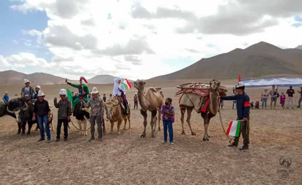
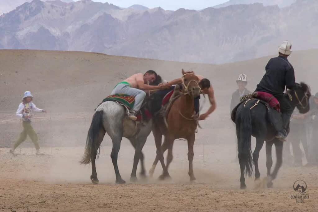
One of the highlights of Murghab takes place in August when a horse festival is organized with all the traditional horse related sports. As the people here are mostly Kyrgyz, they follow the Kyrgyz game traditions. The event is called the At Chabysh.
Murghab Mosque
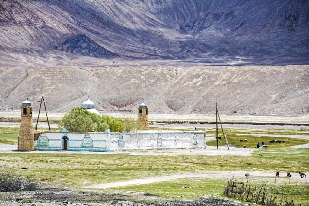
Murgab has a small extraordinary Ismaili Shia Mosque with a Minaret (image above). The mosque stands away from the other parts of the village, in the green pasture area near the Murghab river.
Murgab Bazaar
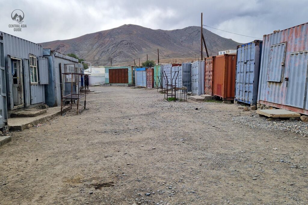
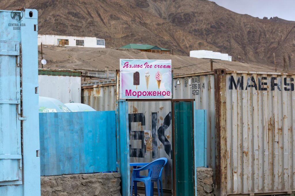
Murghab bazaar made of shipping containers sells cheap Chinese goods, food products of varying quality, and a few local handicrafts. It is also ap place to buy supplies for your trip if you continuing south or want to have treks in the area near Murghab. There are also few shops in Murghab but there is more choice available on the market and of course the feeling of a Kyrgyz bazar in Tajikistan. A specialty in Pamir and Murghab is the ice cream made from Yak milk.
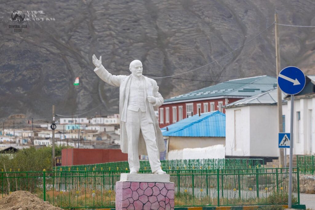
Murghab Lenin Statue
White Lenin statue stands on the southern edge of the town pointing somewhere west possible to Khoroh or Dushanbe. Lenin and Soviet union are still much remembered as good times in Murghab and in Pamir in general as during that time the area was heavily developed and people living received a lot of privileges. Russia and Soviet Union also helped the Pamiris to defend against Chinese and Afghan invaders.
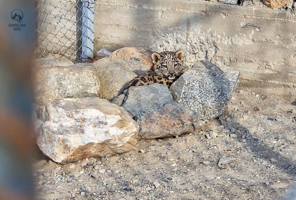
Murghab Snow Leopard sanctuary
10 kilometers south from Murghab, along the Pamir Highway and the Murghab river, there is a sanctuary for the endangered snow leopards. They catch and take care of snow leopards that for some reason have descended from the mountains and are not in the condition to survive in the Pamir nature. The turn to the sanctuary is next to a hill, and the sanctuary is located behind it, just next to the shore of the Murghab river.
The snow leopards of the sanctuary are in large metallic cages that are also covered from the top as otherwise the inhabitants escape. There have been occasions when the snow leopards have mated and cubs have been also taken care of before their release to the nature. It is possible to get very near the snow leopards here but please do not try to touch them.
Sights around Murghab
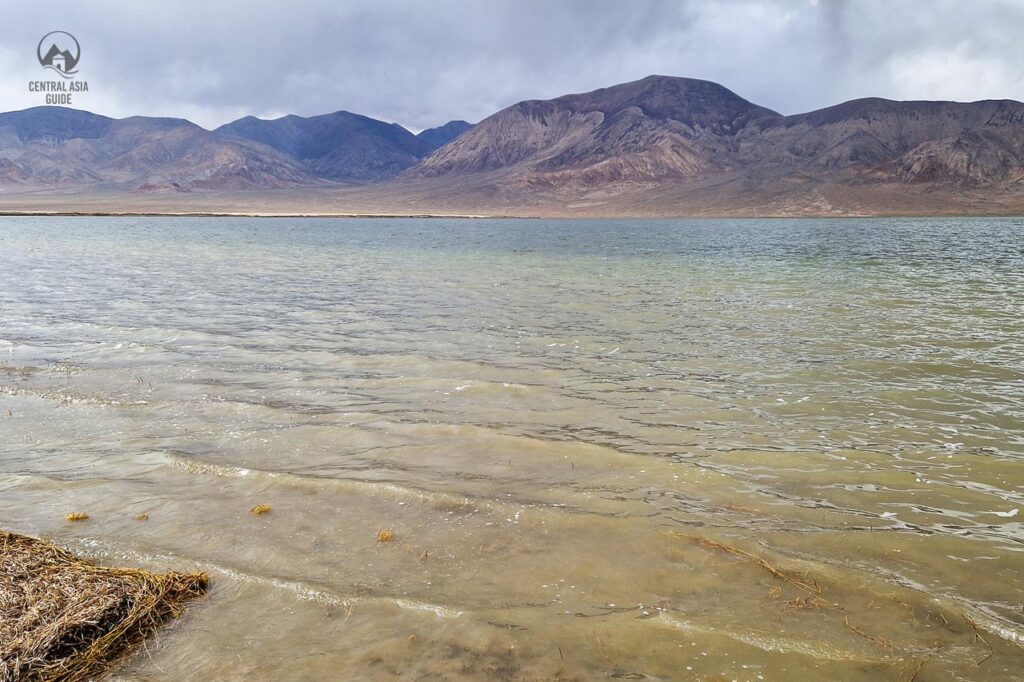
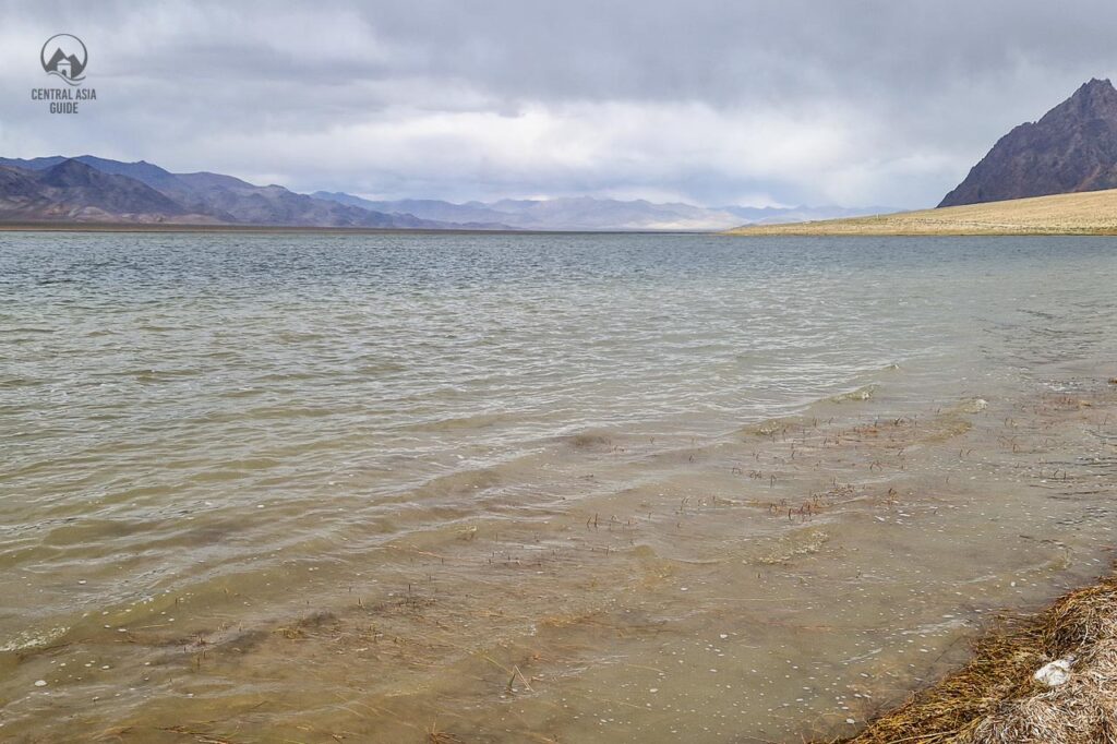
Rangkul and Shorkul Alpine lakes
If you still have some time in Murhab, take a half-day excursion to Rang-Kul and the neighboring Shor-Kul lake. Those lakes are situated 45 km from Murghab at the height of 3754 m above sea level in the most eastern part of Tajikistan. The lakes are surrounded by amazing mountain desert scenery. The lakes are fed by the melting glaciers. Further east from the lakes, sits the Rangkul settlement. However, the village is sometimes inaccessible due to the security issues with the border of China. Depending on the season, the lakes are a good place to spot some mountainous birds.
Shakhty Cave Drawings
Shakhty Cave Drawings is one of the most famous of these landmarks along with the Pamir Highway. This little cave, located around 50 km away from Murghab in the Kurteskei Valley in the Pamir Mountains. The caves date back tens of thousands of years, but they were only uncovered in the late 1950s accidentally by a group of Soviet archaeologists.
They were researching the surrounding site in the area and were caught in a strong storm and had to take cover in an overhang they found, now known as the caves at Shakty. After spending the night in the cave, they woke up to find the cave walls were filled with some of the best-preserved rock art paintings they had ever seen. The art, painted many thousands of years ago with a red mineral pigment, represents a bear hunting scene with double-tipped swords and what appears to be an odd merging of a man and a bird.
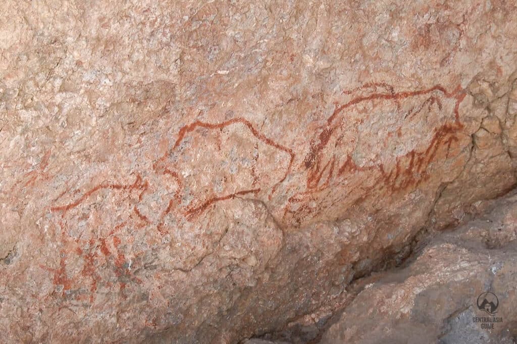
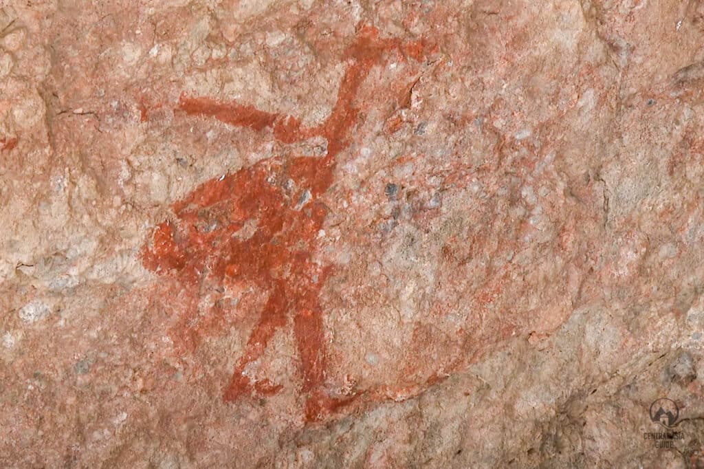
There is not much known about the people who created these ancient pieces of rock art but several archaeological studies have provided estimations. Despite often being referred to as Neolithic art, according to the studies of G. Kuhn, the themes and semi-figurative style is resembles in likeness to Paleolithic art. Furthermore, it is unlikely that these paintings could have been created before the first humans arrived in the Eastern Pamirs, believed to be somewhere between 8 000 and 5 000 B.C, which means that the Shakhty Cave rock paintings are more likely from the Mesolithic era.
You can see this impressive Mesolithic painting at Shakhty Cave by taking a day trip from Murghab or detouring from the Pamir Highway. You can get there by heading towards Khorog, by turning away from the main road to a remote gravel track. It eventually leads to the site of the Shakhty caves, located in a V-shaped valley surrounded by endless other V-shaped valleys and an arid landscape with very few landmarks.
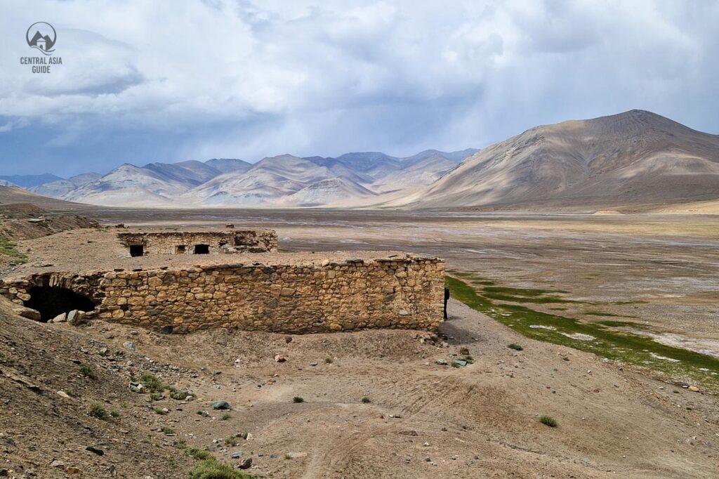
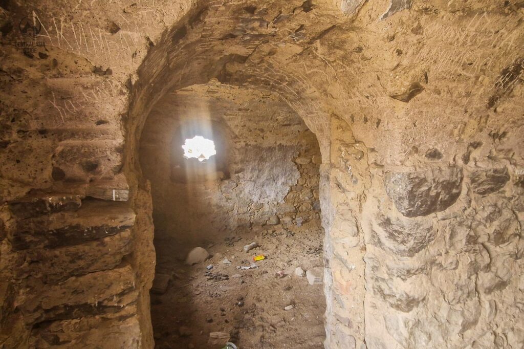
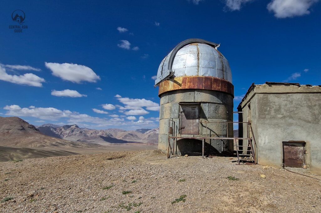
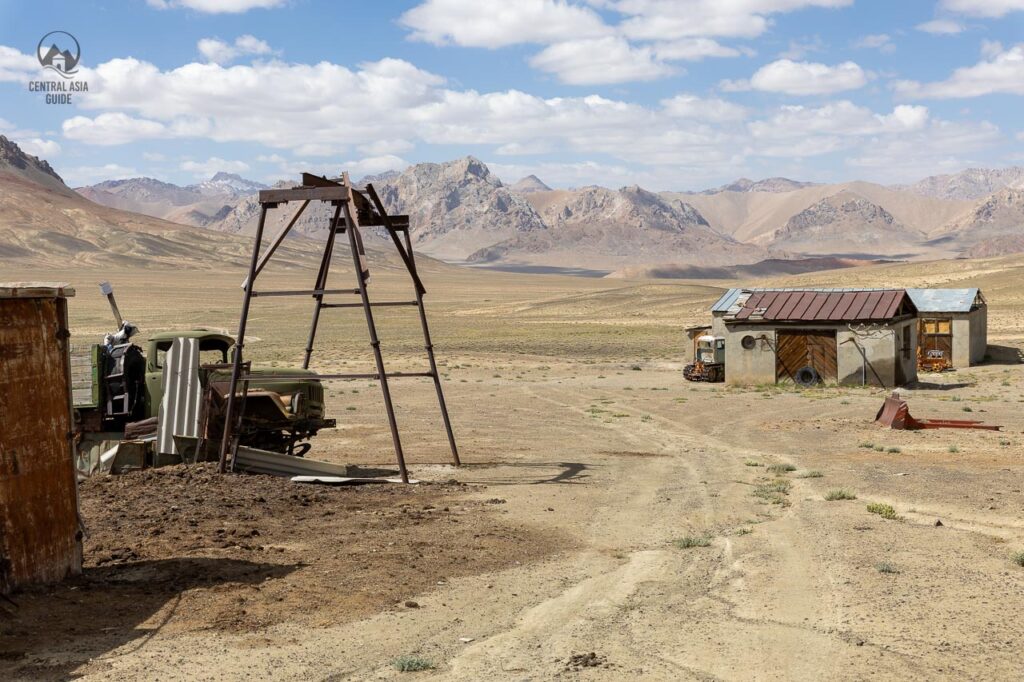
Shorbulak obserbvatory
The Shorbulak Observatory is part of the legacy of Soviet-era scientific investment in Central Asia, where observatories were built to take advantage of the high-altitude, clear-sky conditions across the region. The site has not been used since the ending of Soviet Union and most of the equipment have been sold. There is still an intact researcher base near the observatory that is guarded by the local gamekeepers. The base is a fascinating site to observe the machinery left by the Soviets and the Russian style wooden buildings where time has really stopped.
Trekking from Murghab
Murghab is also a good base for short treks in the high Pamir area. Best trekking locations include the Rangkul, where with luck you can observe rare geese or other birds and to hike in the high altitude desert dunes. In Rangkul it is also possible to organize camel trekking. From the Ak Tal village in Madiyan valley it is possible to trek to Madiyan hot springs but you need to cross a river or make it a longer trek from Pshart Valley through the Gumbezkul pass. It is also possible organize a transportation between the two hikes/treks to save time and legs.
Travel to Murghab
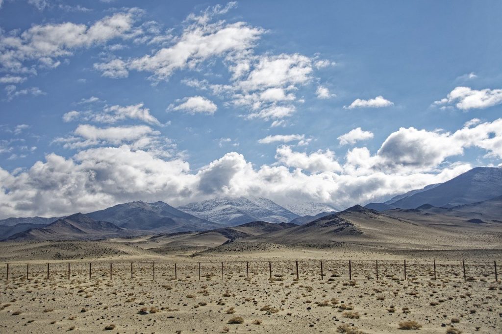
From the Kyrgyzstan side, private or shared cars are available from Osh to Murghab. Usually, taxi drivers try to leave very early at 4-5 in the morning to finish the trip during the daylight. Traveling time depends on the road conditions and may take up to 14-16 hours. Sary-Tash is the last Kyrgyz village in Alai Valley before crossing the border. The next village on the Tajik side with food and fuel will be at the shoreline of Karakul lake, after 100 km. As the road up the border can be slow, it might be a good idea to get a meal there and stay for the night before the long and challenging road upwards to Pamir.
This dirt road appeared at the end of the 19th century after a building period of almost 40 years when Pamir was occupied by the Russian Empire. The road is mostly empty and without any service but the views are stunning. If you are lucky with the weather, you can see Lenin peak (7134 m) when approaching the border control. There will be few 4000 m height altitudes passes with the most tricky one being the Kozel Art. In the springtime, the mountains serpentine roads turn sometimes into an ice slide so make sure to travel with proper cars and equipment.
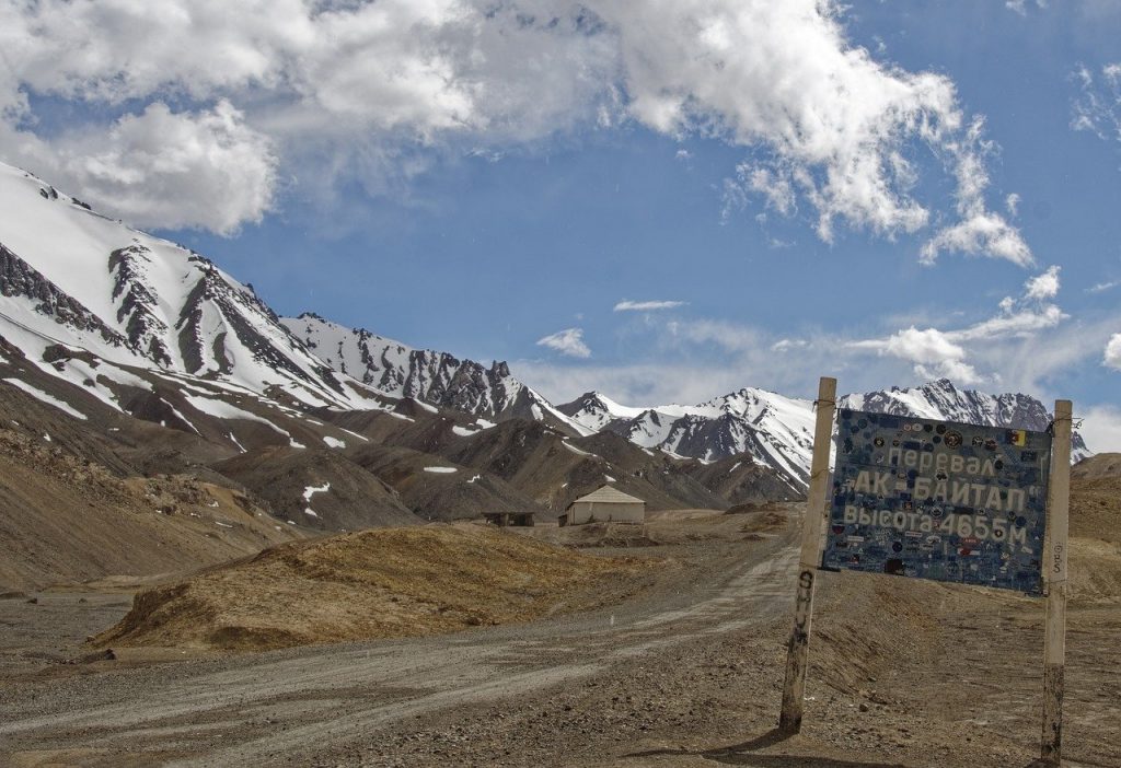
After crossing the border control and passing a moonlike high plateau and Karakul lake, you will arrive at the highest pass in Central Asia called Ak-Baital (4655 m above sea level). On the way, you will notice some trucks going from Murgab to Kashgar in China through the Kulman pass. For a long time, this pass did not function, first due to the deterioration of the Soviet-China relationship and later due to the Civil war in Tajikistan. Onwards, you will drive along with the Tajik-Chinese border marked by wooden poles with barb wire. Those places were strictly guarded by the soviet guards and later by the Russians till the 2000s.
From Khorog direction you can take vans or shared taxis to Mughrab at the local bazaar. They depart usually when the vehicle is full.
In Murghab, you can find taxis from the Murbag bazaar. In general, transportation costs are high due to the remoteness and difficulty of importing fuel. Best way to visit Murghab is as a part of a tour stopping there.
Tours including Murghab
More Pamir Sights and Destinations
Page updated 28.10.2025