

Yashikul and Bulunkul Lakes
A turquoise landslide lake 22 km long and a shallow bird lake beside one of the coldest villages in Central Asia, 15 km off the Pamir Highway, with hot springs, a Chinese stele from 1759 and homestays with fish for dinner.
Yashikul and Bulunkul Lakes
On the high plateau of the eastern Pamirs, about 15 km north of the Pamir Highway, lie two very different lakes. Yashikul is long, deep and turquoise between bare, colourful mountains; little Bulunkul is shallow, reedy and full of water birds. Between them is the village of Bulunkul, often called the coldest place in Central Asia, where a few families take in guests for the night.
The area is good for short walks, birdwatching and yak watching, with hot springs on the shores and the ruins of Sumantash, where a Chinese army put up a victory stone in 1759. The lakes are a short detour from the highway between the Koi-Tezek pass and Alichur, so many Pamir tours stop here for a night.
Yashikul and Bulunkul at a glance
- Yashikul Lake: 3,734 m, about 22 km long and 52 m deep, the source of the Gunt River
- Bulunkul Lake: small and shallow, the best place for birds
- Bulunkul village: homestays with dinner and breakfast, about 15 km of dirt road from the Pamir Highway
- Sumantash: site of a Chinese victory stone of 1759, a mausoleum and caravanserai ruins at the east end of Yashikul
- Hot springs: on the south shore of Yashikul and in the Alichur valley, with a small geyser
- Permit: the GBAO permit for Gorno-Badakhshan is needed
The tours below stop at Yashikul and Bulunkul on the Pamir Highway, and on a private tour you can stay an extra day for the walks and hot springs.
 12 days


Pamir Grand Tour
Tulpar-Kol, Karakul, Murghab, Bulunkul, the Wakhan Valley, Khorog and a trek to remote Sarez Lake in the Pamirs.
- Culture
- Hiking
- +3
Starts in Osh Private departures on request
 10 days
Pamir Highway and Bartang Valley Tour from Dushanbe
A 4x4 loop along the Afghan border to Khorog and the Wakhan, on to Karakul Lake and back through the Bartang Valley.
- Culture
- Hiking
- +2
Starts in Dushanbe Private departures on request
 7 days
Pamir Highway and Wakhan Corridor Tour from Osh to Dushanbe
Car with an English-speaking driver; homestays and meals paid locally (about 30 USD a day)
- Culture
- Hiking
- +3
Starts in Osh Next departure 14/05/2027
Yashikul Lake
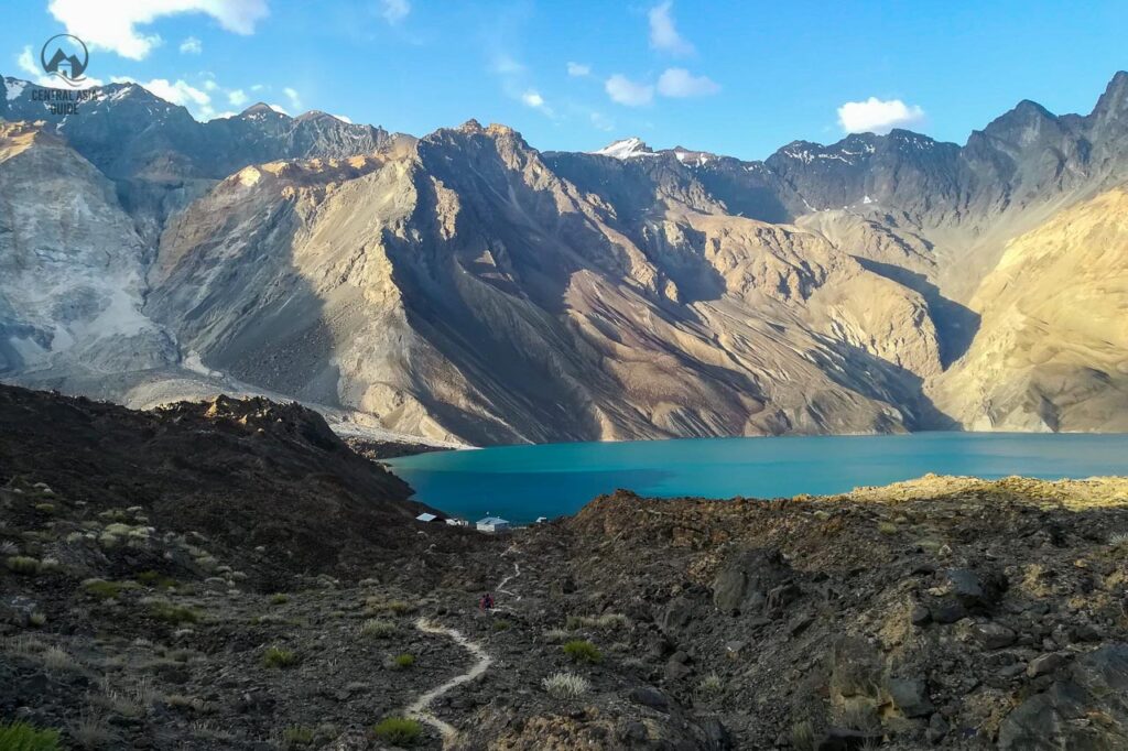
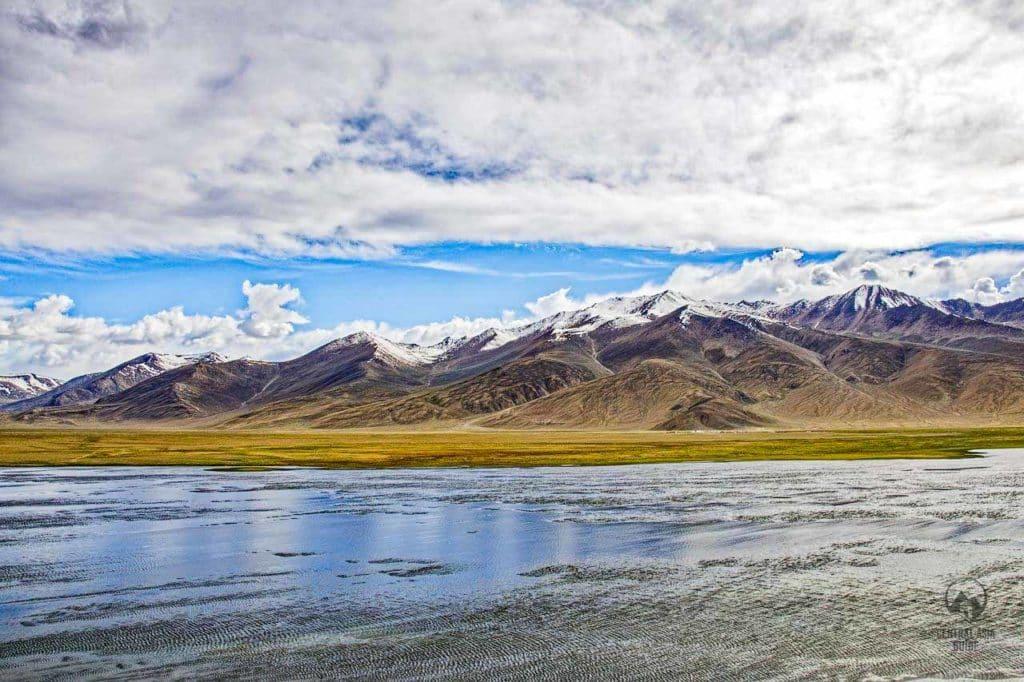
Yashikul, also written Yashilkul, means “green lake” in Kyrgyz, and its water is a deep turquoise. The lake formed when a huge landslide blocked the Alichur River; at its western end the river leaves the lake again as the Gunt, which flows some 200 km west to join the Panj at Khorog. Yashikul lies at 3,734 m, covers about 36 square kilometres and is about 22 km long, up to about 4 km wide and 52 m deep. The water is clear and cold, reaching only 12–14 °C in summer, and the lake is frozen for three to four months a year.
The native fish are osman and marinka, and the osman of Yashikul has split into four different forms that live side by side. In Soviet times fishery experts released carp and peled, which did not survive, and Sevan trout from Armenia, which did. The wet meadows at the mouth of the Alichur at the east end are summer pastures for yaks.
A track follows the north shore, where there are stone circles and old burial sites, but the Alichur has to be forded at the east end, which is hard in spring and early summer. Local Kyrgyz herders say a giant “water camel”, the tuya suu, lives in the lake. Yashikul is part of the Tajik National Park, a UNESCO World Heritage site.


Bulunkul Lake
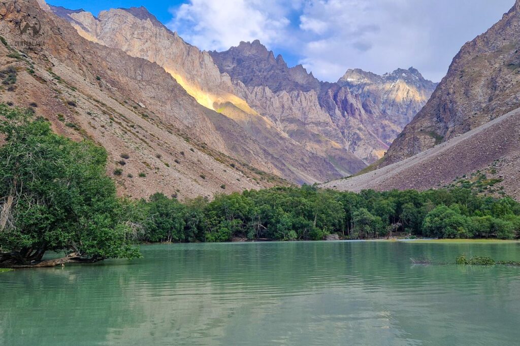
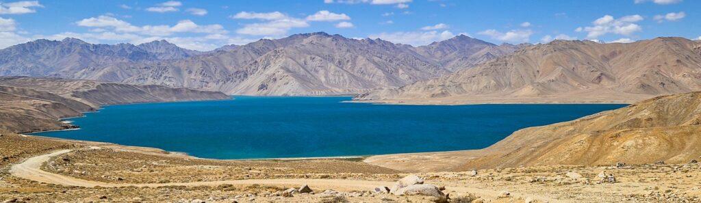
Bulunkul is a small lake of about 3.4 square kilometres just south of Yashikul and a few metres higher, joined to it by a channel. It is shallow, only a few metres deep, overgrown with water plants and frozen until about late May. Ducks and geese swim on the lake and gulls fly over it, and in late summer thousands of migrating birds stop here on their way south.
Together the two lakes and the mountains around them are an Important Bird Area with 124 bird species. Bar-headed geese and brown-headed gulls breed here, up to 2,500 ruddy shelducks pass through, and lammergeiers, Himalayan griffons and golden eagles hunt over the valley. In Soviet times the lake was stocked with fish for commercial fishing; today the villagers catch fish for their own tables and for their guests.

Bulunkul village
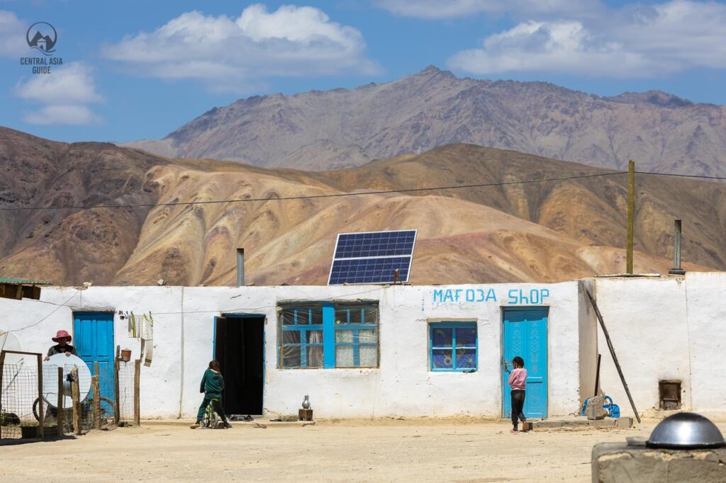
The village of Bulunkul was founded in 1948 and stands on a small plateau at about 3,740 m between the lake and the mountains, about 15 km from the Pamir Highway. Around 300 people live in a few dozen houses with a school and a national park information board. Bulunkul is often called the coldest place in Central Asia: winter temperatures of about −60 °C have been reported here.
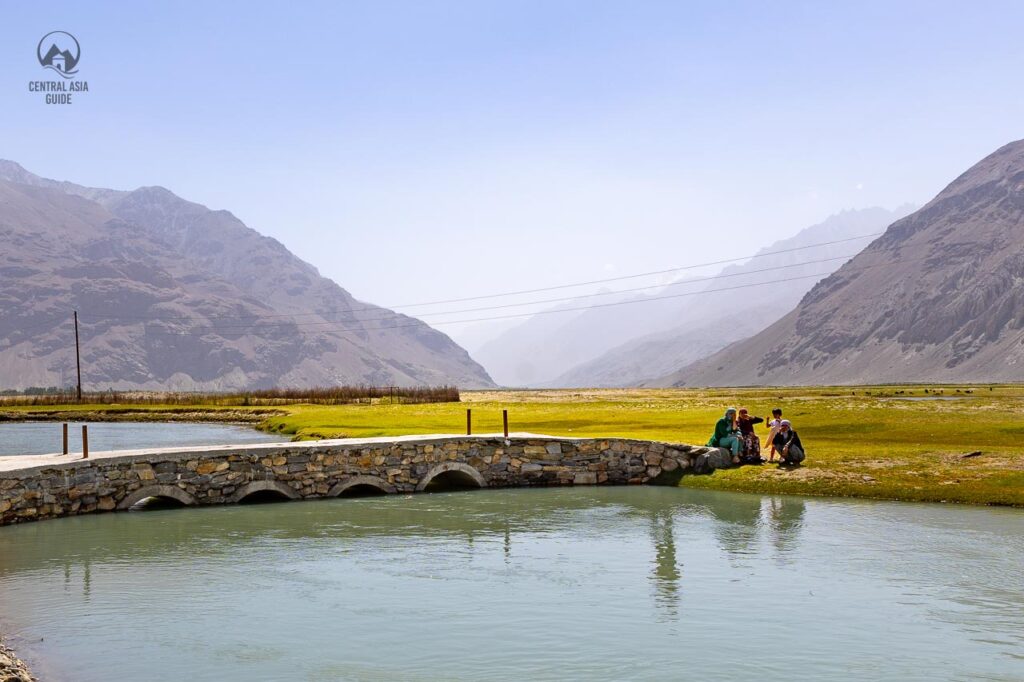
Life in Bulunkul depends on the yak. People drink its milk and make butter from it, eat its meat, use its wool against the cold and heat their houses with dried yak dung, as there is no wood on the plateau. Since 2025 a solar power plant supplies the village, but electricity can still be limited to a few hours a day. Several families run simple homestays, and fried fish from the lakes is often on the table.
A local legend says that the lake was born in a flood sent to punish the villagers for turning away a holy man; only one woman invited him in and shared her meal, and she was saved by walking on the water.



Sumantash: the Chinese stone and the bek's mausoleum
At Sumantash, on the north bank of the Alichur just east of Yashikul, stand the ruins of the Bekbulat mausoleum, old Kyrgyz tombs and the remains of a caravanserai. In 1759 a Qing Chinese army defeated the Khoja brothers, the rulers of Kashgar, near the lake, and the Chinese set up a carved stone with an inscription to celebrate the victory.
In July 1892 Russian troops fought a short battle with Afghan soldiers at the same place, which ended Afghan and Chinese claims to the eastern Pamirs. The Russians took the inscribed panel to Tashkent. The stone itself was later moved to Khorog, and only its base remains at Sumantash. The site is about 1.5 km from the lake shore and is reached by 4WD or on foot from the east end of Yashikul.
Hot springs and the geyser
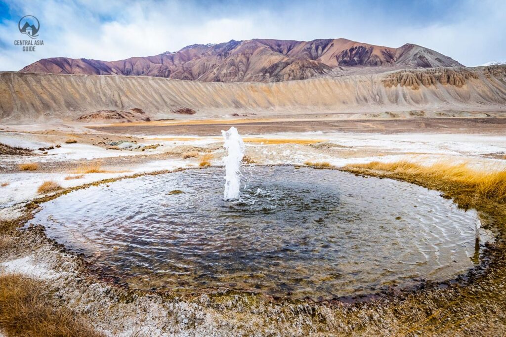
About 7 km from the village, near the south shore of Yashikul, is the hot spring of Sasik Bulak (Khingchashma), which the people of Bulunkul use as a natural laundry. It can be reached on foot from the village. Another hot sulphur spring, sacred to the locals and reported at 60–70 °C, rises near the mouth of the Alichur at the east end of the lake, and a small geyser spouts in the Alichur valley east of Yashikul, on the track towards Alichur.

Walks and treks
Yashikul is about an hour’s walk from Bulunkul village. An easy route follows the north shore of the lake after crossing the Alichur at the east end, which is difficult when the water is high in spring and early summer. From the western end of the lake trails continue down to Bachor and the Gunt valley, or north over high passes and past Chapdara Lake to Sarez Lake; these longer treks need a guide and a Tajik National Park permit.
Getting there
The dirt road to Bulunkul leaves the Pamir Highway about 185 km from Khorog, 32 km east of the Koi-Tezek pass (4,271 m) and about 25 km west of Alichur. From the turn-off it is about 15 km to the village; a 4WD is recommended and the road can be closed by snow in winter. Just east of the turn-off, right by the highway, are two small salt lakes, Tuz-Kul and Sasyk-Kul, an easy stop on the way to Alichur and Murghab.
Like the rest of Gorno-Badakhshan, the lakes need a GBAO permit.
Tips for visiting
- Best time: June to September. Bulunkul Lake is frozen until about late May, and in winter the village is one of the coldest places in Central Asia.
- Stay the night: homestays cost about USD 15–25 per person with dinner and breakfast (2025). Bring cash in somoni.
- Bring: warm clothes even in summer, a power bank and a torch. Expect little or no mobile signal.
- Altitude: at about 3,740 m, take it easy on the first evening, especially if you come straight up from Khorog.
- Birds: bring binoculars; early morning on Bulunkul Lake is the best time for birdwatching.
Map of Yashikul and Bulunkul
The map shows the outlines of both lakes, Bulunkul village, Sumantash, the hot springs and the geyser, and the salt lakes by the Pamir Highway. Click a marker for a short description and a link to its section.
Yashikul and Bulunkul FAQ
How do I get to Bulunkul?
About 15 km of dirt road leads from the Pamir Highway to the village. The turn-off is about 185 km from Khorog and about 25 km west of Alichur. A 4WD is recommended.
Can I stay overnight in Bulunkul?
Yes. Several families run simple homestays at about USD 15–25 per person with dinner and breakfast, and fish from the lakes is often served.
How big and deep is Yashikul?
About 36 square kilometres, 22 km long and up to 52 m deep, at 3,734 m. It is a landslide-dammed lake on the Alichur River and the source of the Gunt.
Is Bulunkul really the coldest place in Central Asia?
It is often called that, and winter temperatures of about −60 °C have been reported, although an official station record is hard to find.
Do I need a permit?
Yes, the GBAO permit for Gorno-Badakhshan. Treks from Yashikul to Sarez Lake also need a Tajik National Park permit.
When is the best time to visit?
June to September, when the road is open and the lakes are free of ice. Late summer is best for migrating birds.
Sights and destinations near Yashikul and Bulunkul
East along the Pamir Highway are Alichur, Murghab and Karakul Lake; to the west the road descends along the Gunt to Khorog. From the junction near the Bulunkul turn-off a road crosses the Khargush pass to the Wakhan Valley and the Panj River. Experienced trekkers can walk from Yashikul to Sarez Lake. See all sights of the Pamirs.
Written by Anssi Karppinen, Central Asia Guide · Page updated