Pamir
Pamir
The most exciting destination for travel adventurers in Tajikistan and possibly in all Central Asia is the impressive, vast, magical and truly the wildest destination of Central Asia, the Pamir. This high and remote mountain area is located in the Eastern Tajikistan and covers almost half of the total land area of Tajikistan while only about 220 000 people live in the area. In the north, the Pamir mountains meet with the Tian Shan mountains of Kyrgyzstan through the Alai valley and in the South, Pamir borders with Afghanistan and the Hindu Kush mountain rage, along the Wakhan valley and the more famous Wakhan corridor that is a design of the Great game between Russia and Great Britain.
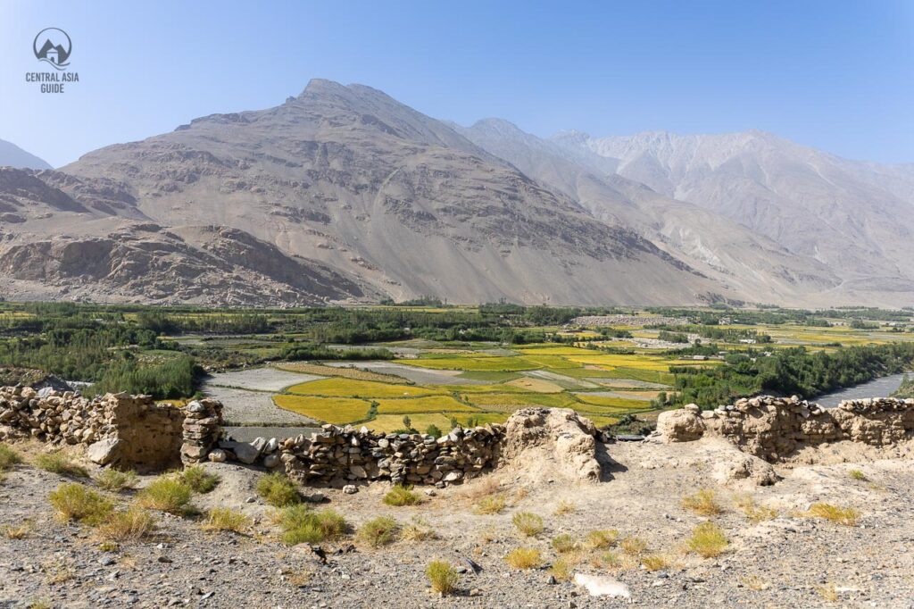
Taklamakan desert lies east from Pamir, in China, where the Eastern Pamirs suddenly falls steeply down to flat desert area with few rivers. The northern and eastern side of Pamir is also very dry and barren highland that has a drastic contrast to the lush river valleys of the Wakhan, Shokhdara and Bartang among others in the South and Southwest parts of Pamir.
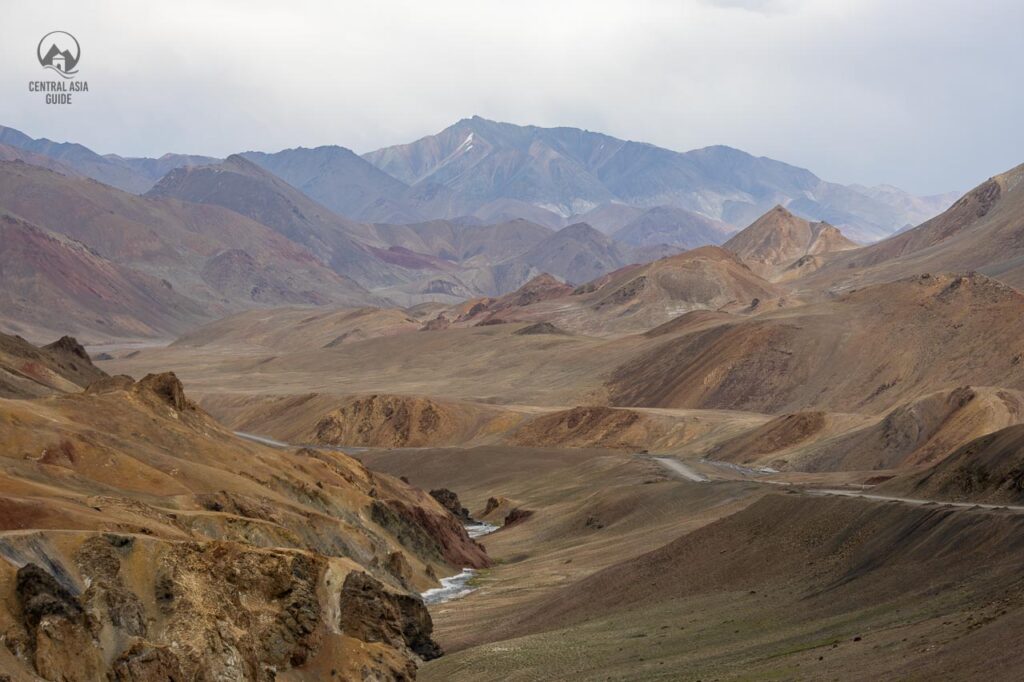
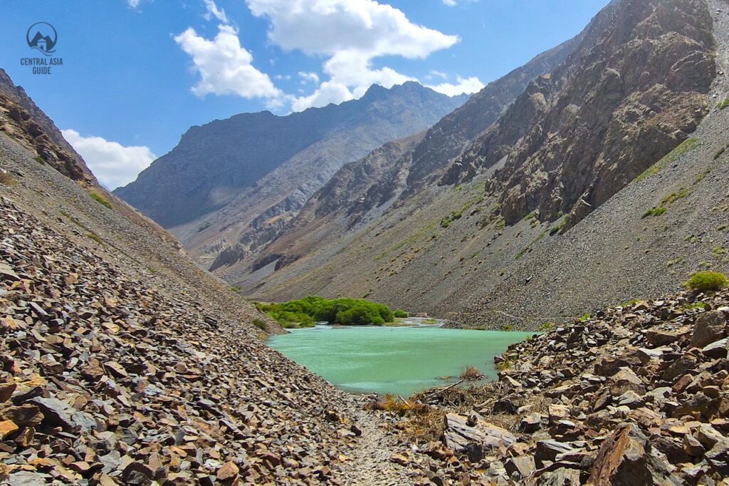
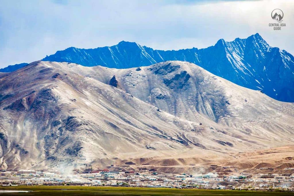
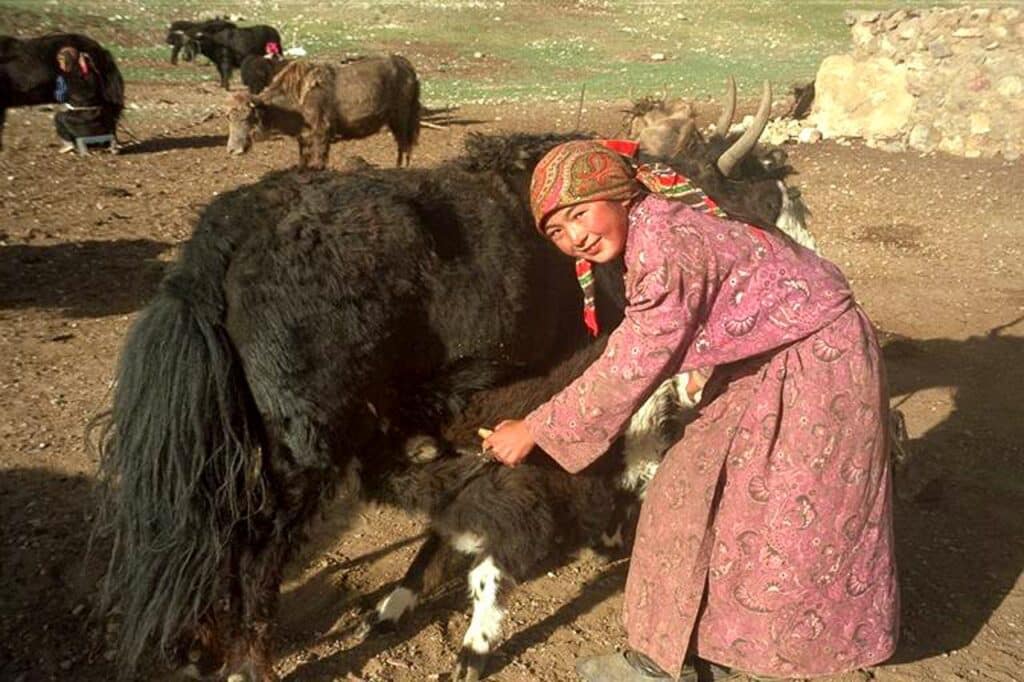
Pamir is largely inhabited by the Pamiris, who are related to Iranians but especially the the Northern Pamir and other high areas are inhabited mostly by Kyrgyz people and they all rely on animal herding as their way of life in this very high altitude area. There are few larger towns like Khorog, Iskashim and Murghab in Pamir but otherwise people live in small villages and even smaller communities and often change places according to the time of year as nomads have been doing in Central Asia for millenia. There are countless valleys between the explicit high peaks and the unattainable mountain massifs exceeding 5600 meters in height, with deep rocky gorges and the rivers at the bottom.
Long ago, Bactrians and troops of Alexander the Great walked here and later many explorers like Tamerlane, Babur, Marco Polo and a number of other pioneers, have left their traces in these majestic mountains and glaciers. Silk road traders also used to travel through the valleys of Pamir with Silk, lapiz lazuli, rubies and other valuables and there are still some ruins of the old fortifications as a reminders of those times. Most of our Tajikistan Tours focus on Pamir.
Pamir History
The Pamir Mountains are a unique region with its own Pamiri culture and historical evolution. The cultural extent of the Pamirs is not limited only to the Gorno-Badakhshan province of Tajikistan, but also stretches out to minor parts of Afghanistan and China, covering altogether the historic region of Badakhshan. The oldest known records of the Badakhshan region go back thousands of years. In antiquity, the region functioned as an important trading corridor as transport routes of the silk road passed through the Pamirs and lapis lazuli (blue colorant) was exported here already more than 5000 years ago. Through the years, Badakhshan has been controlled by many different emperors, kings and nobles (‘mirs’ in islamic tradition). There are evidence of human activities in the Kurteke area area from about 14 000 years ago. Zoroastrianism has been the prevalent religion in the area and the current Ismailism has retained some habits from the times of fire worshipping.
From the late 19th century onward, the Pamirs got involved in territorial disputes between the United Kingdom and the Russian Empire (The Great Game). Eventually, the historic Badakhshan region was divided between UK affected Afghanistan and the Russian controlled territories with the Panj river as an important natural border. The part controlled by the Russian Empire became known as Gorno-Badakhshan in 1925. In 1929, the Soviet Union attached it as the Gorno-Badakhshan Autonomous Oblast (GBAO) to the newly created Tajik SSR.
Soon after the independence of the Tajikistan from the Soviet Union in 1992, the Tajik Civil War started following unrest between local leaders in Gorno-Badakhshan and the government seated in Dushanbe. The civil war was sparked as the Tajik government intervened to suppress anti-government protests. During the civil war that eventually lasted five years, tens of thousands of people were killed while many others lost their homes. An armistice was achieved in 1997 to return the peace, which has remained since then. The war left deep traces in the memory of the Pamiris and and the recent oppression from the Tajik government towards the Pamiris has caused again some dissatisfaction in the region.
Pamir Villages
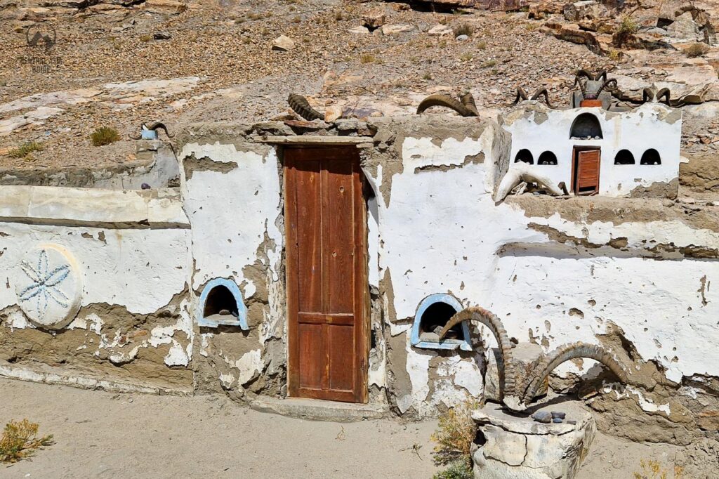
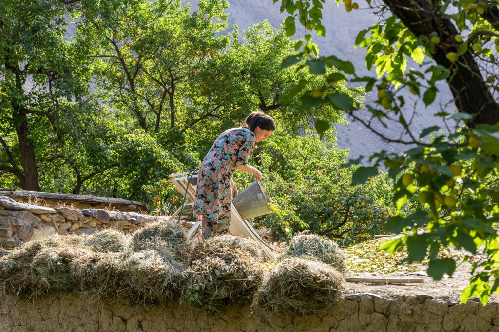
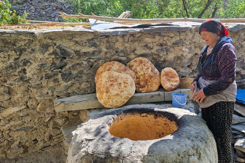
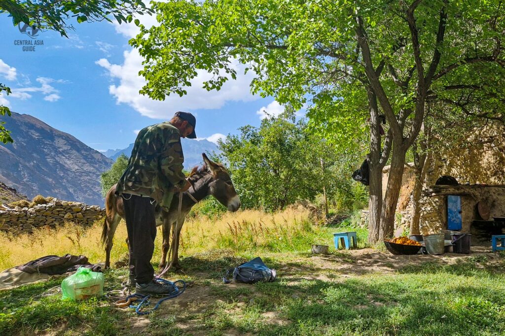
For many visitors, spending time with the locals in their villages are the most memorable events of visiting the Pamir. As the landscape, also the villages of Pamir are very different in different parts of the region. The northern and higher area villages appear like a mix of Soviet and Kyrgyz villages while the Wakhan and Bartang and other lower valley villages have retained the more traditional Pamiri, Wakhi or Tajik features.
What is common to Pamir villages is that people live mostly from the animals and the land, growing what they can in the little flat land that is available for farming or orchards. There are very many villages without road connection and electricity, but for some reason, the people coming from the more developed parts of the World, enjoy experiencing this simple village life the most.
Pamir Trekking
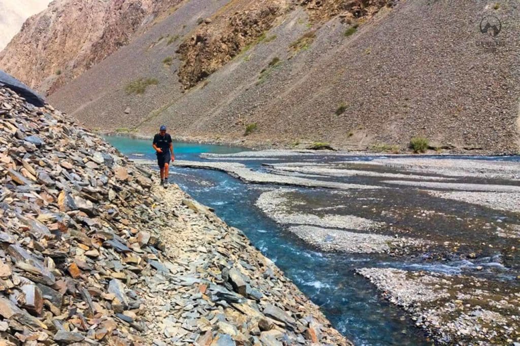
Pamir is the location for trekking in Central Asia for the people who enjoy breathtaking mountain views, remote villages, hidden ancient sites of Silk Road and other ancient events or locations. This being said, Pamir as a trekking destination is also demanding. The elevations of passes during the trekking routes can reach 4 or even 5 kilometers from the sea level and help is not easily available if anything would happen. Solo trekking is definitely not recommended, even for experience trekkers.
Pamir is definitely not the place for first time hikers but more experienced hikers will remember trekking here for the lifetime and having an experienced group and a guide helping you will increase the safety significantly. Many of the most interesting and authentic Pamir villages can only be reached by trekking and there are many other sights that are off the beaten path and not reachable by car. Most known locations for trekking in Pamir are the Bartang Valley, Shokhdara Valley and the Engels peak but there are countless of other routes crossing from one valley to another over the high passes between them. Trekking in Pamir is mostly recommended and safest from June to August.
Pamir Tours
Pamir Mountains
The Pamir Mountains are a mountain range located in Central Asia that have formed by the union or collection of the Tian Shan, Karakoram, Kunlun, and the Hindu Kush ranges that is sometimes also called a knot of mountains. Pamir peaks are among the world’s highest mountains and Pamir is quite commonly known as the “Roof of the World” (translation from Persian). The Pamir range mainly lies in the Tajikistan‘s region of Gorno-Badakhshan but some parts are in Kyrgyzstan, Afghanistan, Pakistan, Indian Kashmir and China.
Pamir Mountains hold countless glaciers including the 77 km Fedchenko Glacier, which is the longest glacier outside the Polar region. The glaciers of the Pamir are the largest water sources for all of Central Asia. They are also the source for the Pyanj and Vakhsh rivers that unite and form the Amu-Darya river providing most of the irrigation water for the extensive agricultural enterprises of Uzbekistan and Turkmenistan and flow all the way to the slowly drying Aral Sea.
The highest peaks in the Pamir mountains are:
- Ismoil Somoni Peak 7 495 m, also formerly known as Stalin Peak and Peak of Communism.
- Ibn Sina Peak 7 134 m is still more known as Lenin Peak
- Peak Korzhenevskaya 7 105 m
- Independence Peak (Revolution) 6 974 m
- Karl Marx Peak 6 726 m
- Engels Peak 6 507 m
- Mayakovsky Peak 6 096 m
Being one of the highest mountain areas on Earth, the area also has some of the harshest climates and natural extremes on the planet. The weather here is cold most of the time of the year and prevents the growth of trees and shrubs in most areas. Therefore, most of the area is only covered by grasses and shrubs, revealing the tortured geological forms of the peaks and valleys. Yearly precipitation is high, which supports grasslands but only few trees survive in the area. Tourist season lasts only few months, from June to August. During other times the roads can be blocked by snow and it is not safe to move in the Pamirs. Especially the spring time is dangerous due to land slides.
Pamir National Park
Pamir National Park, which is also known as the Tajik National Park or Mountains of the Pamirs, covers the territory of 2,6 million hectares meaning it is more than 18% of the total area of Tajikistan, making it the largest conservation area in Central Asia. It is where Central Asia’s tallest mountain ranges, including the Hindu Kush, the Himalayas, Karakoram, Kunlun and Tien Shan meet, forming the so called “knot” of mountains. The largest part of the park lies within GBAO but it also extends west towards Jirgital in the Rasht Valley. The area is truly impressive in geology, landscapes and biodiversity. Pamir National Park has also been listed as a UNESCO World Heritage Site since 2013 for its remarkable natural value. Pamirs are the fourth highest mountain range in the world.
The park is home to various wildlife, landscapes and habitats, from arid deserts and bottomless gorges to mountain lakes, open grasslands and snow-capped alpine glacial peaks. The park holds 40 peaks with heights over 6000 m and there are three peaks reaching to over 7000 m, including Peak Somony, Peak Lenin and Peak Korenevsky. Trekkers and mountaineers are also attracted by several large glaciers like the 77 km long Fedchenko and the 27 km long Grumm-Grzhimaylo glaciers as well as the high altitude lakes like Karakul and Sarez.
The extremely diverse collection of biodiversity, mainly due to its isolation and lack of human existence, consists of more than 2 000 species of plants, of which about 100 are endemic. Species such as the “Melandrium apetalum, and Sibbaldia tetandra” have developed in such a way that they can survive the cold even at the altitude of 4 800 m.
Pamir National Park conditions & nature
Pamir National park is surrounded by still-active tectonic plates that have made the park a rather unwelcoming place for humans. Therefore, it is still home to species of incredible animals and the wildlife watching opportunities within Pamir National Park are therefore unusual.
For those interested in fishing, Pamir National Park’s rivers are home to an array of endemic fish species. With all of that on offer, it is no surprise that Pamir National Park attracts a vast amount of of scientists, researchers and biologists each year.

Pamir Wildlife
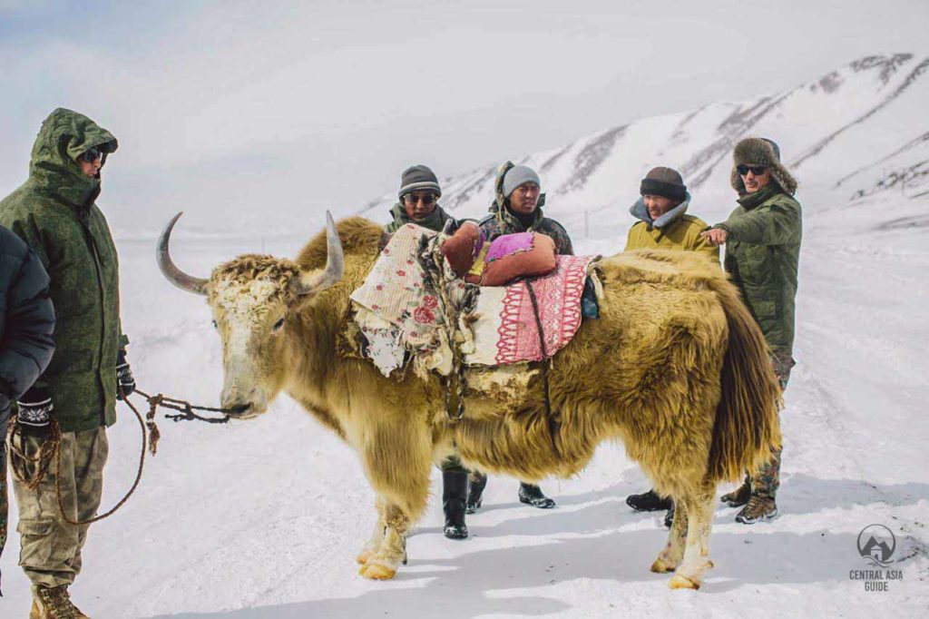
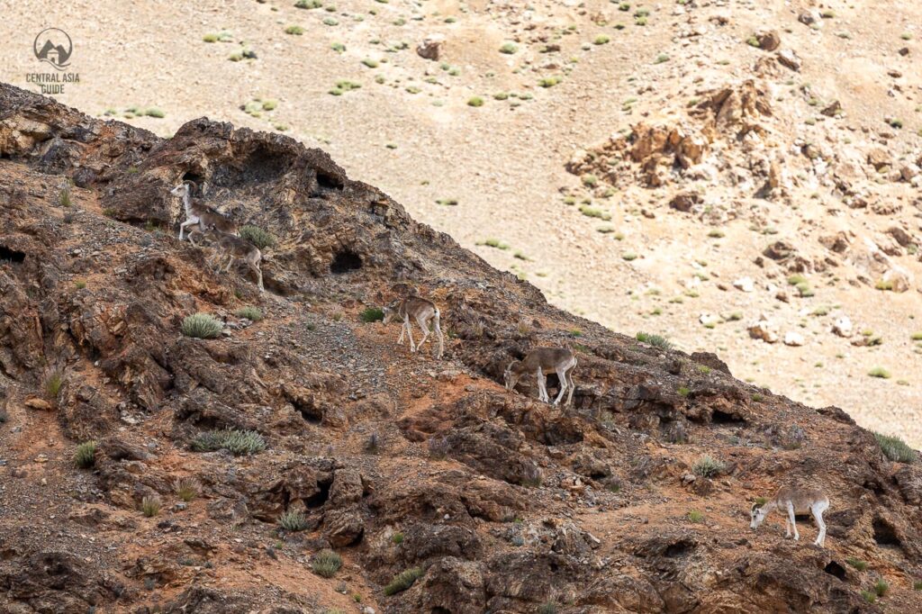
The fauna in Pamir contains rare and majestic threatened species such as Marco Polo sheep (Ovis ammon polii) Markhor (Capra falconeri) and the extremely elusive snow leopard (Uncia uncia). Additional mammalian species known to occur in the region are mountain goats, ibex (Capra ibex sibirica), brown bear (Ursus arctos), wolf (Canis lupus), red fox (Vulpes vulpes), lynx (Lynx lynx), Pallas’ cat (Otocolobus manul), stone marten (Martes foina), Altai weasel (Mustela altaica), stoat (Mustela erminea), long-tailed marmot (Marmota caudata), hare (Lepus tolai), pikas (Ochotona sp.) and a host of smaller mammals. People have with them sheep, goats, camels, cows and yaks. Horses are a rarity in Pamir but there are some.
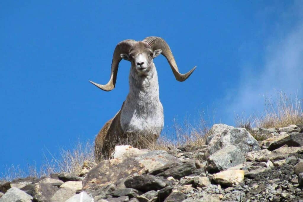
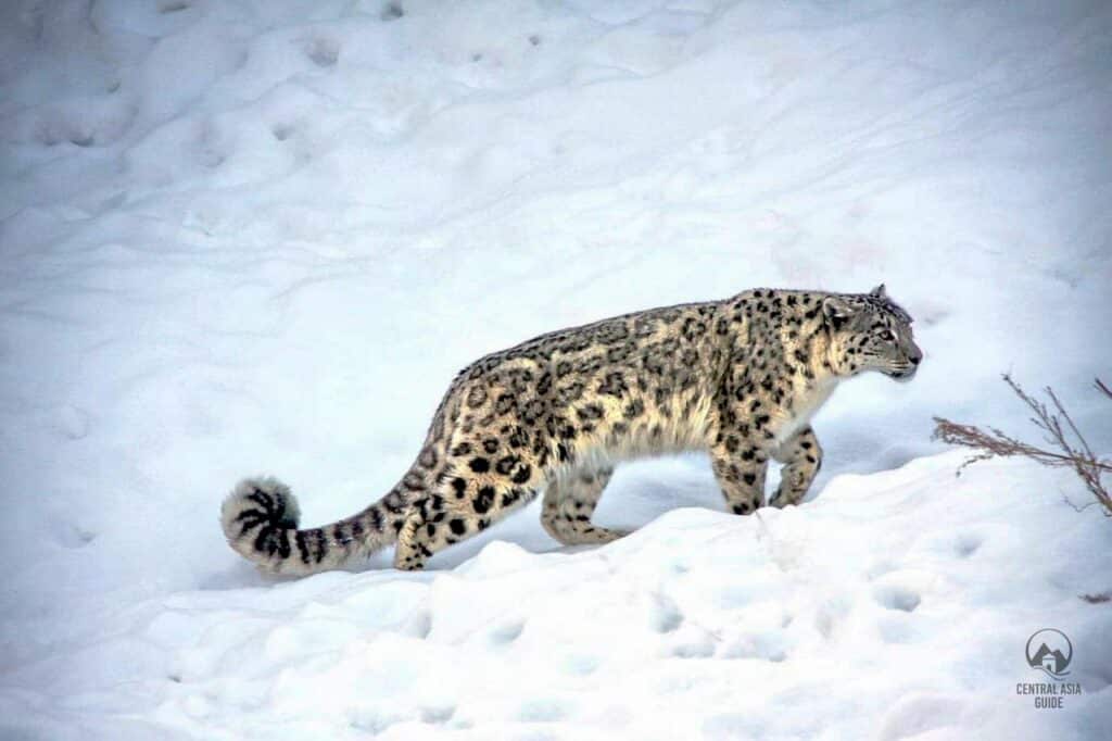
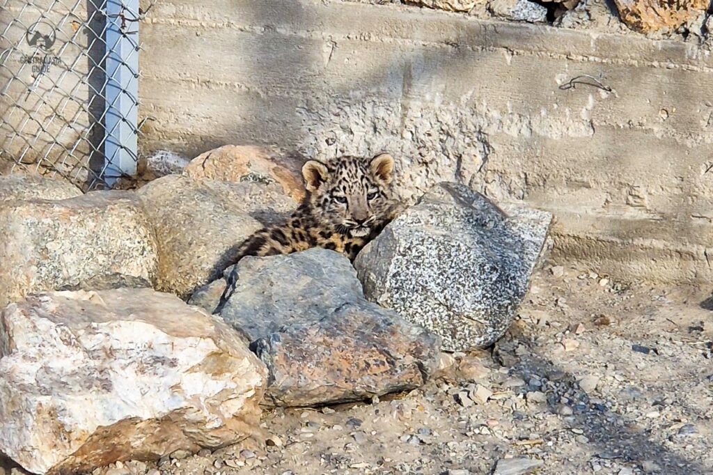
Mountain goats can be seen sometimes also in the summer time but seeing Markhor, Marco Polo sheep and especially the snow leopard is mostly possible only during the winter time when the animals descent from the high mountains to the lower areas. Marmots are a common sight during the tourists season. In Murghab there is a snow leopard sanctuary where it is possible to see snow leopards that have been rescued to be fed and to be returned back to their original habitat after regaining their strength. This sight can be organized as a part of our Pamir tours.
Domestic animals in Pamir
Due to the extreme heights, Pamir has very few horses and people use instead donkeys or even yaks for transportation. Cows are also a rarity while goats and sheep make the largest portion of domestic animals in Pamir. Both donkey rides and yak rides are also available for tourists.
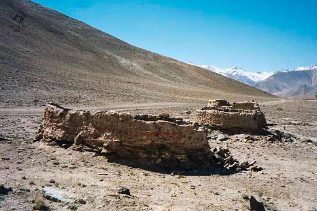
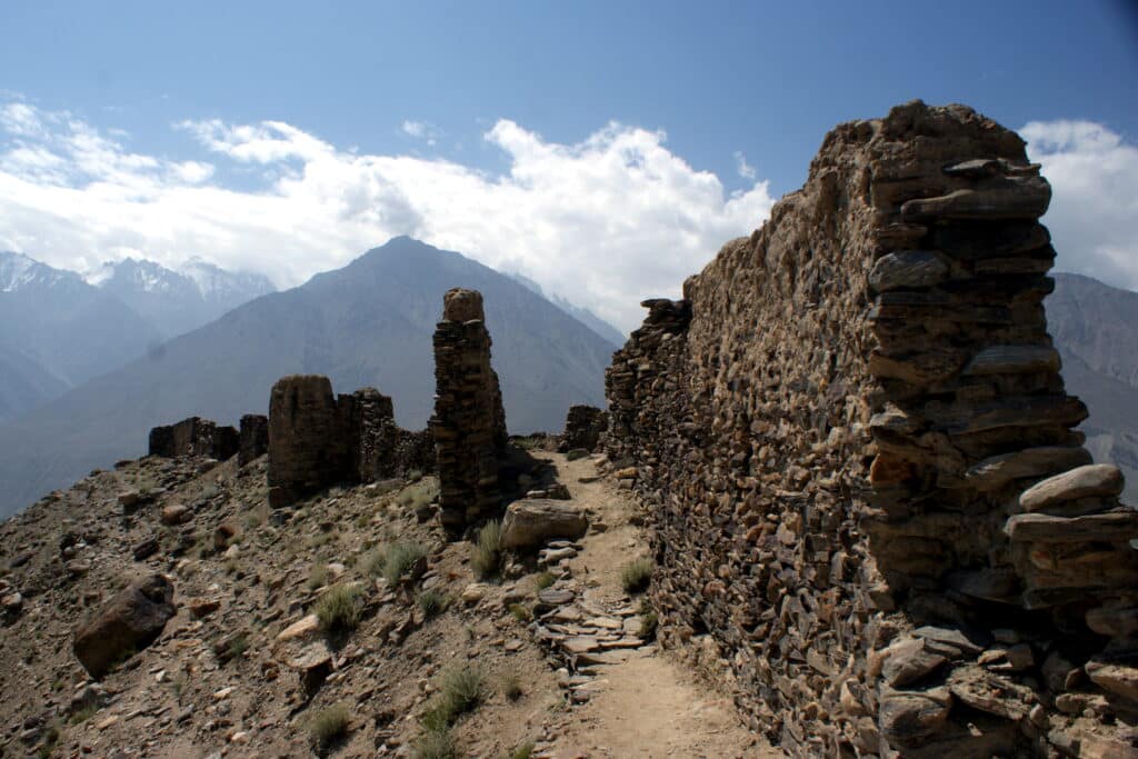
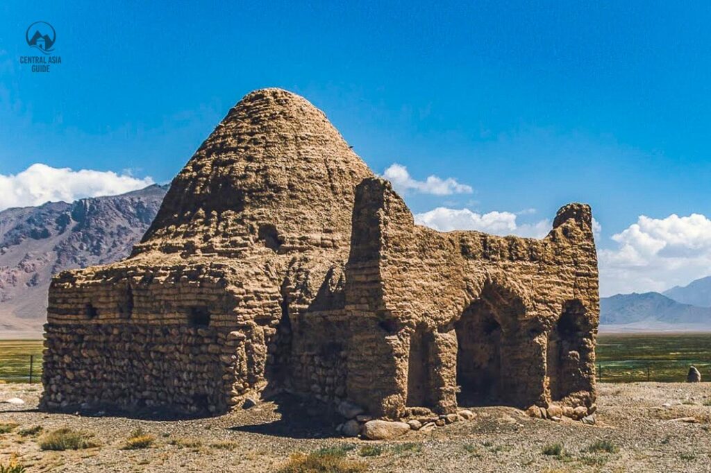
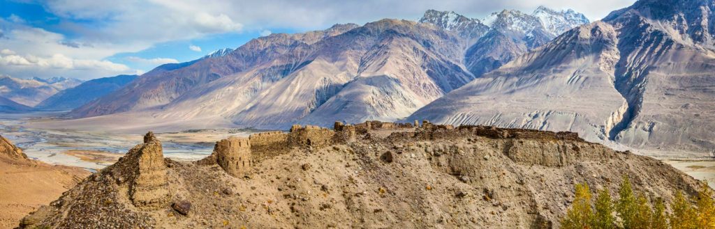
Fortresses of Pamir
Two millennia ago, a key route of the Silk Road traversed the Pamir region, witnessing the construction of a network of fortresses. These structures had a dual purpose: safeguarding traders from raids and protecting the empire from neighboring societies, with traders subject to taxation. Presently, only one fortress continues to serve its original function for border protection, while others have lost their significance, leaving behind scant remains of walls. Some recent findings have also provided information of civilization in the Wakhan area already 4000 years ago.
Yamchun Fortress
Yamchun Fortress stands out as the most well-preserved among these constructions, also known as Zamr-I Atisht Parasht or Kafir-Kala. Positioned between the modern borders of Tajikistan and Afghanistan in the Ishkashim district, this fortress is likely the most impressive and ancient monument in Wakhan. Associated with fire worship, indicative of prevalent Zoroastrianism during that era, the fortress may have housed a fire temple. Archaeological findings suggest its construction in the III-I centuries BCE, spanning extensive areas of the Wakhan Valley and the Hindu Kush Mountains in the northern territories of Afghanistan. The fortress takes on a triangular shape, divided into three sections. There is currently some reconstruction ongoing at the site and part of the walls and the tower have been already reconstructed.
Khakha Fortress
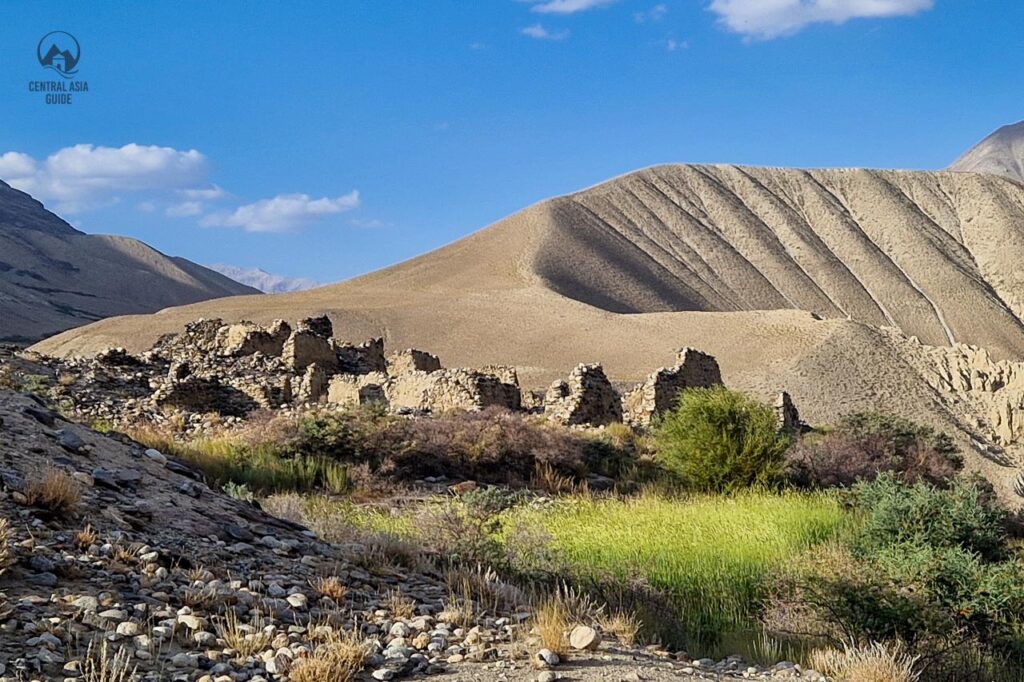
Khakha Fortress (Kaakha), situated on a massive 10-meter cliff, measuring 700×220 m, on the right bank of the Panj River near the Ishkashim village, is another ancient landmark in the Wakhan Valley and the broader Pamir region. Having functioned as a defensive structure on the southern side from the 2nd to the 7th century, it now exists only as ruins, providing evidence of its once robust fortification.
A portion of the Khakha fortress is repurposed as a border checkpoint for controlling the Afghanistan border and entry and photography are therefore officially prohibited in this section.
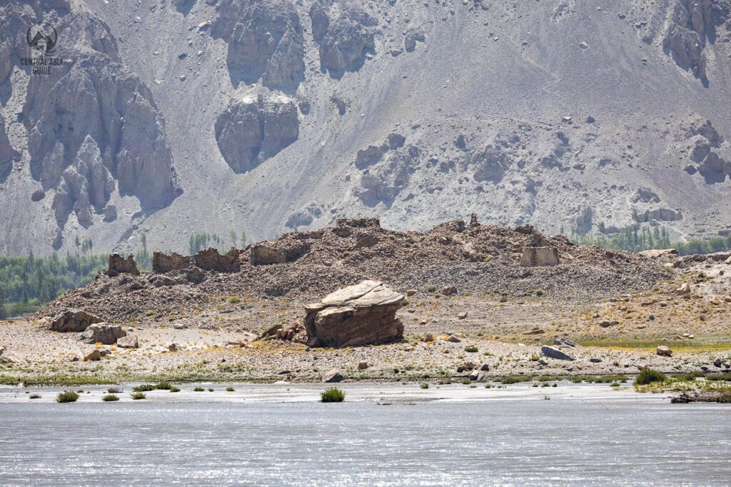
Ratm Fortress
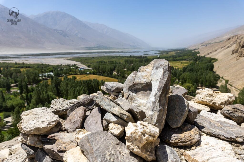
Around 10 km from Langar, on a promontory fortified for at least 2300 years, these castle ruins are signposted off the main Wakhan road. A path of sorts leads through fields and across small streams towards this panoramic viewpoint. As one of the last (or first) views of the mighty Pyanj River, the constant companion of a journey through the Wakhan Valley, it is worth the 20-minute walk from the road to reach here.
One can also find some remains of Soviet era ammunition from the ruins as it has been also lately used by the Tajik soldiers guarding the border of Afghanistan due to the great view over the border river.
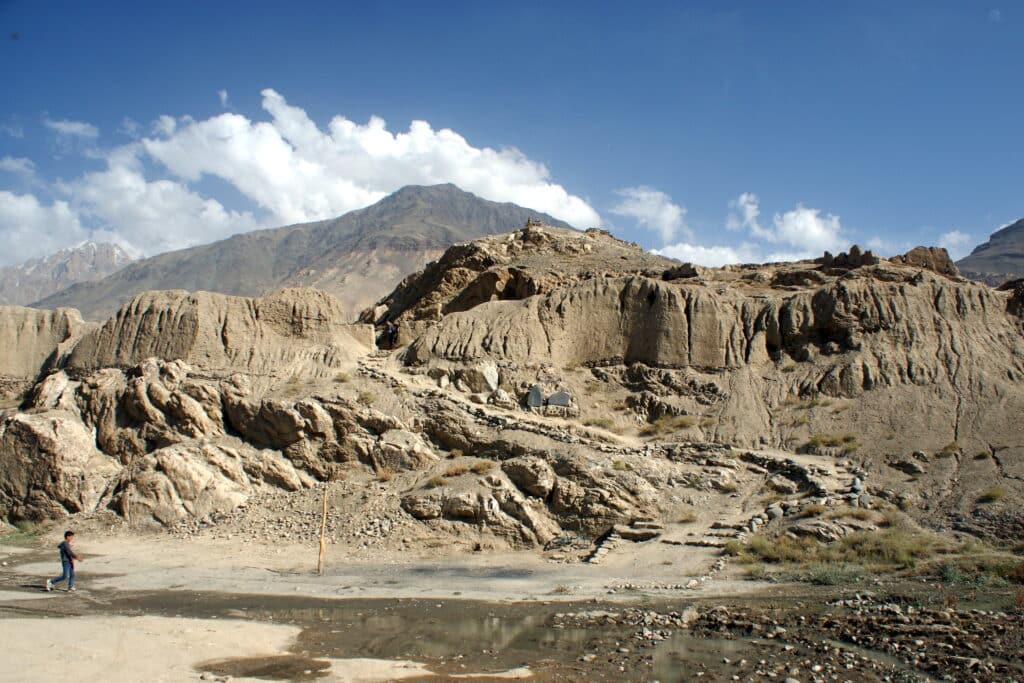
Karon Castle & city ruins
The ancient city of Karon, translating as “located at a height”, was discovered only relatively recently, in the 1990s. Of course, the locals knew about some buried ancient fortress or structure for a long time, but they did not know what historical and archaeological value it represents as its age is estimated at least 4000 years.
It is believed that the city consisted of several parts: public (temples and the central square, the citadels of the governors), living part (the people of the town lived there) and the burial complex (dakhma). In addition, a conditional stadium or field for the polo game with exact dimensions of 50 by 300 m was found. The city had a centralized water supply, ventilation and drainage system
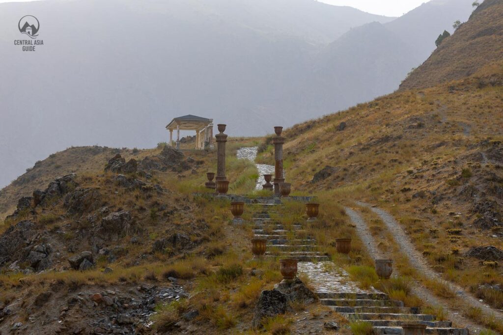
Being at an altitude of about 1700 meters above sea level, the city was located along the caravan route and withheld an enormous advantage against any attacks. Scientists believe that the ancient city of Karon stopped to exist and its inhabitants left around the 15th century due to drying of the springs that supplied water for the city. The road up to the ruins is quite bad and can be barely driven by a 4×4 car with very steep turns of a serpentine road. It is not recommended to drive up the road. If you reach the area with the fortress ruins, the living quarters are located above this area and can be reached through the mostly paved path. Unfortunately there are no any info signs or guides telling about the details of this sight.
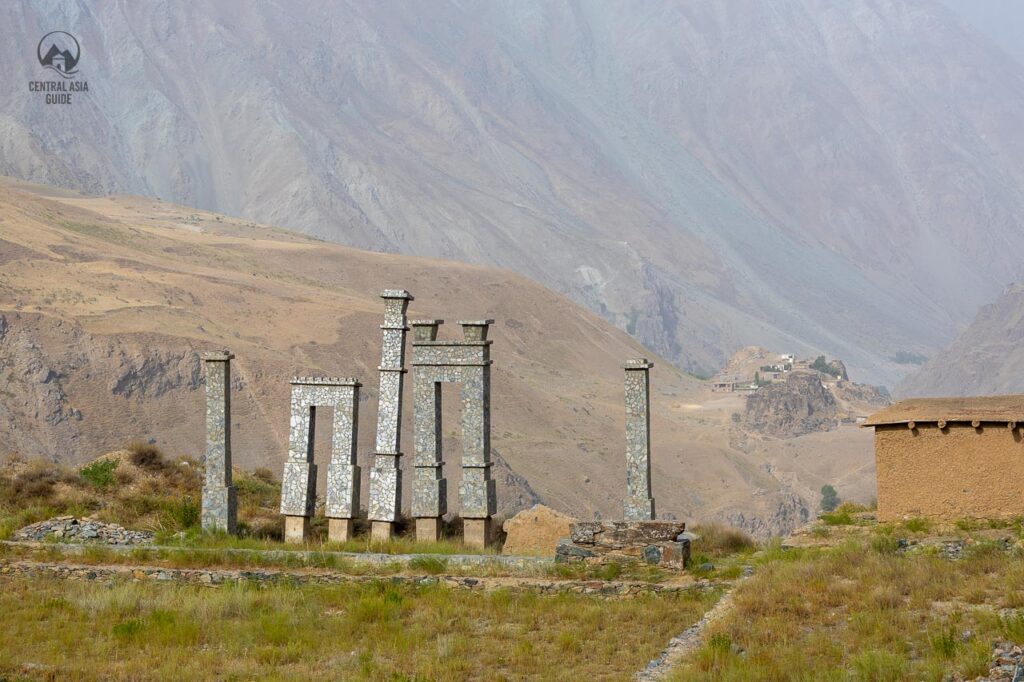
Other Pamir fortresses
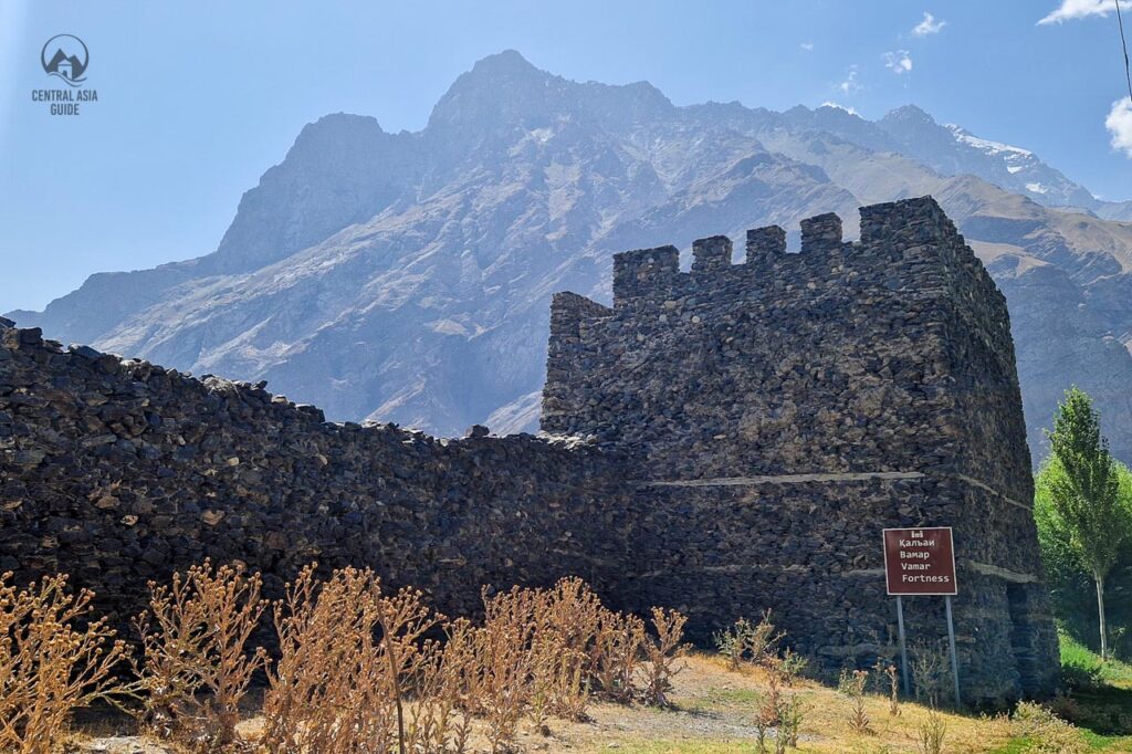
Various lesser-known fortresses, including the one near Savnob village, Deruj Castle near Roshtqala, Mausoleum of Bekbulat near Yashil-Kul Lake, castle in Shashbuvad, Abrashim Qala and Womar fortress (a more recent one) in Rushan, contribute to the rich historical tapestry of the Pamir region. Shokhdara Valley has several ruins of smaller ruined fortresses but their condition is mostly very poor. There are also several ruins on the Afghan side of the border and many of them can be spotted while driving along the Panj river in the Wakhan Valley.
Pamir Highway
The Pamir Highway, (often referred to as the M41 highway) is the second-highest highway in the world, after the nearby Karakorum Highway between China and Pakistan. It passes the whole Pamir region of Tajikistan, running from Osh, through Murghab and Khorog and the road ultimately ends in Dushanbe and based on some sources even as far as in Termez in Uzbekistan. (The M41 road officially starts already from Karabalta, in Northern Kyrgyzstan, not that far from Bishkek.)
The actual Pamir Highway goes from Osh to Murghab, and continues westwards south from Alichur to Khorog but most tourists take a turn towards south the the Wakhan Valley and making a detour along the border of Afghanistan and the Pyanj river. There is also a third alternative road between southern part or Karakul lake and Khorog through the Bartang Valley but the condition of this road is even worse than the other parts of the Pamir. On the other hand Bartang is the valley to find some of the most amazing views and most picturesque villages.

Overall, from Pamir Highway (and its alternatives), you can look at China, have a peek into Pakistan mountains and wave to villagers in Afghanistan in the Wakhan valley. The road stretches for about 1250 km of dramatic landscapes. During your journey, you will meet hospitable locals, hike, see wildlife as well as camp along the magnificent lakes and rivers or dine with the locals in their villages.
Highway is somewhat misleading term for the road that runs through the Pamir mountains as it is mostly a small dirt road or a road that used to have asphalt cover. At some points it is difficult for two cars to pass each other on the narrowest parts of the road. There are still some sections with intact asphalt on the Pamir Highyway, but the heavy trucks traveling to and from China are making sure that it will not last for long.
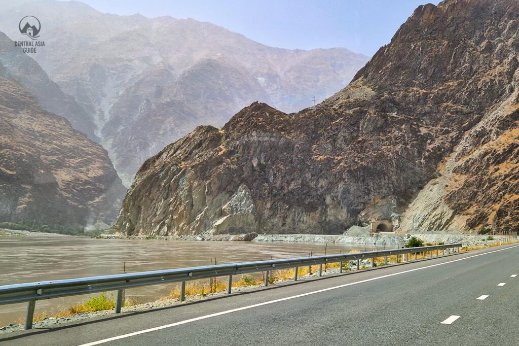
Most of the Pamir highway is gravel and sometimes even sand with some sections very slow to drive due to the lack of maintenance (big holes and bumps) and constant landslides in the steep sections. It is not rare to hear that another bridge has been destroyed by a flood or a landslide and it might take years to restore the bridge while the traffic is being redirected to areas where 4×4 cars can hopefully pass the river during low water times.
This being said, there is heavy reconstruction ongoing, expected to be finished officially by 2025 but our estimation is 2026, in the Western Pamir, between Kalai Khum and Khorog, where ready parts, mostly west from Kalai Khum, are in great condition but the ongoing construction southeast from the town is currently making the road even slower and harder than previously due to the explosion works and the traffic jams caused by the endless rows of trucks trying to maneuver their way through the construction sites. The road can also be occasionally closed for the explosion works and until they clear out the rubble and can allow cars to pass safely again.
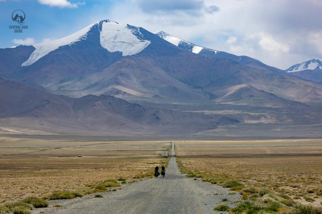
It is possible to drive or even bike through the Pamir highway by yourself but you should have some experience in driving in rugged conditions and mountain regions. We recommend to get a local driver with a good 4×4 car for safety reasons. A pro tip to save in the costs is to refuel outside Pamir in Tajikistan or in Kyrgyzstan depending on your planned route and to have extra fuel in containers to avoid the expensive fuel prices inside Pamir.
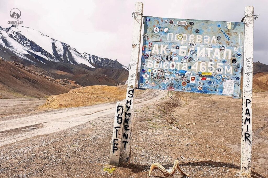
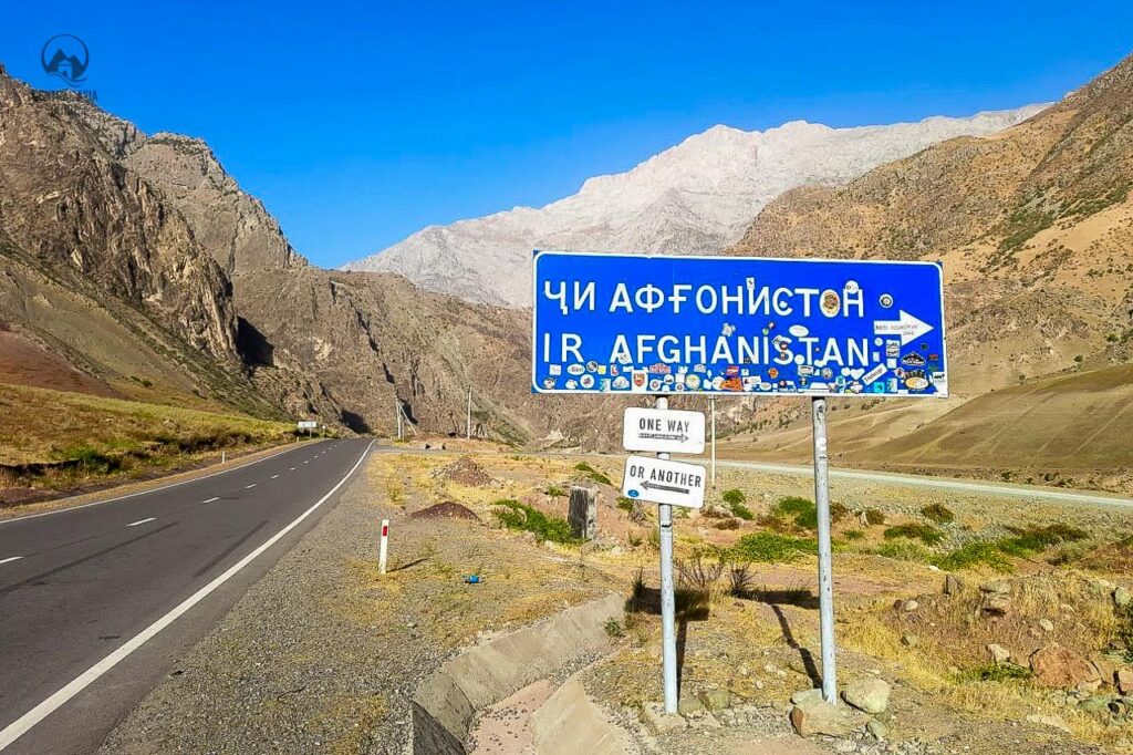
The views along the road are amazing and even though Wakhan Valley is not officially a part of the Pamir Highway, it is recommended to take this detour to have a look at the Afghanistan across the Panj River and to admire the amazing mountains and Wakhan valley sights there. Most of the villages along the Pamir Highway and Wakhan area have at least few guest houses and the larger villages and cities like Kalai Khumb and Khorog have several hotels. but the quality of the hotels is still mostly far behind the hotels in larger, lower area cities of Central Asia. The highest pass along the Pamir Highway is in the Ak Baital pass with the elevation of 4655 m.
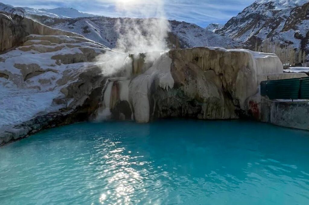
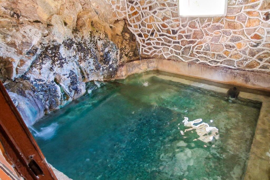
Pamir Hot Springs
The most known Pamir hot spring is the Garm Chashma hot spring and the second most popular is the Bibi Fatima hot spring. There are also many other hot springs, some of them wild, without any structures but also many with decrepit Soviet era (or even earlier) structures that are often not very clean or otherwise welcoming but still interesting for the enthusiasts. Other hot springs include at least:
- Oudzh (30 km from Ishakashim on the road from Khorugh)
- Issyk-Bulok-Madyan (10 km West of Murghab)
- Djelondi or Jelondy (about 110 km from Khorog on the road to Murghab)
- Shaimak (126 km from Murghab, near the Saka graves of Bakhbur).
- Jarty Gumbez hunting camp
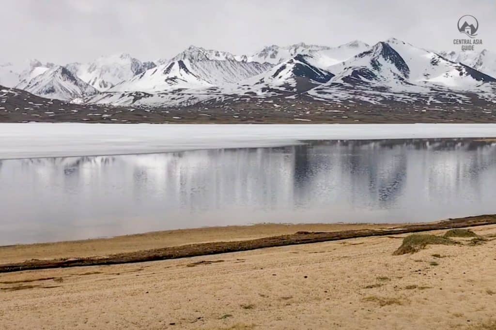
- Yashilkul lake (South side of lake)
Pamir shrines
Pamir is home to probably hundreds of shrines, known also as mazars, are tied to ismaili traditions and local spiritual practices. You might also notice that there are very few mosques in Pamir. These shrines are often dedicated to saints and serve as pilgrimage sites and reflect a blend of Islamic, pre-Islamic, and local beliefs.
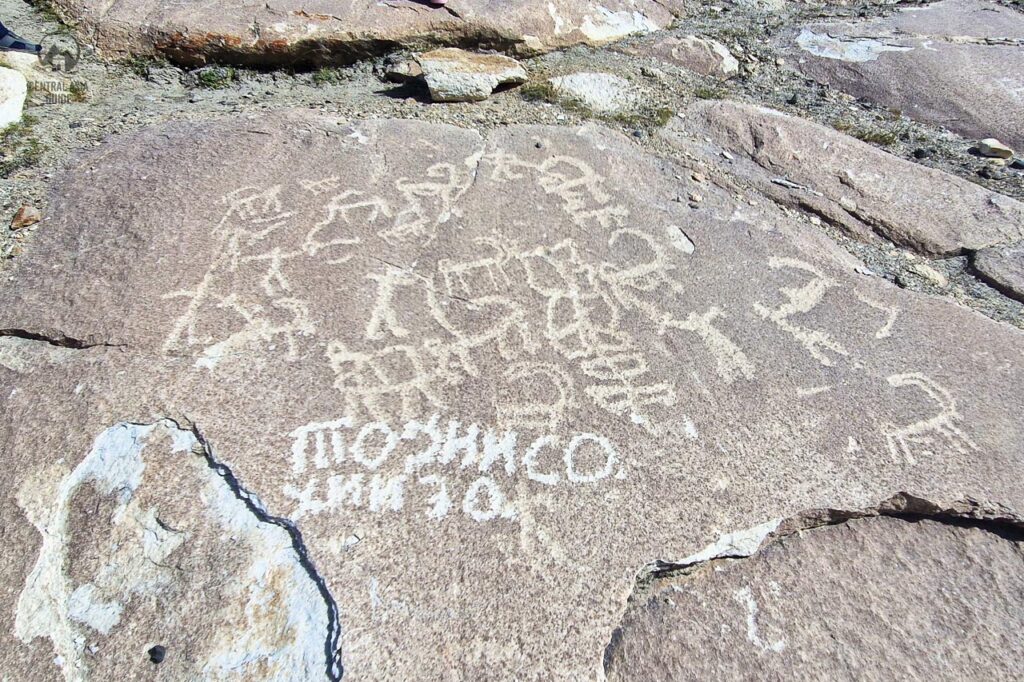
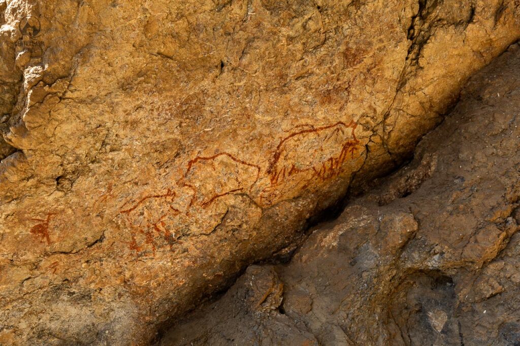
Pamir Petroglyphs
Pamir has an abundant amount of petroglyphs and one can also find them in suitable stony places just by walking around. The most known locations for petroglyphs are the Langar petroglyphs above the town on a steep even mountain face. Another, a more recently found location has very old petroglyphs dating to about 500 years BC is the Shakhty grotto in the high Pamirs. Other petroglyph sites in Pamir include at least Akdzhilga, Kurteke-Sai, Nayzatash, Vybistdara, Bartang and Vanch river valley sites. Pamir also holds several sun dials and other mysterious structures like graves and stone circles.
Other Pamir Sights
One can find a lot of hidden gems in Pamir but seeing many of them require a bit more time as they are not always so close to the main routes while few can be seen easily along the Pamir Highway but can be also missed without keeping your eyes open.
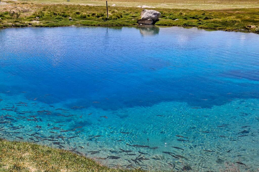
Holy Fish lake
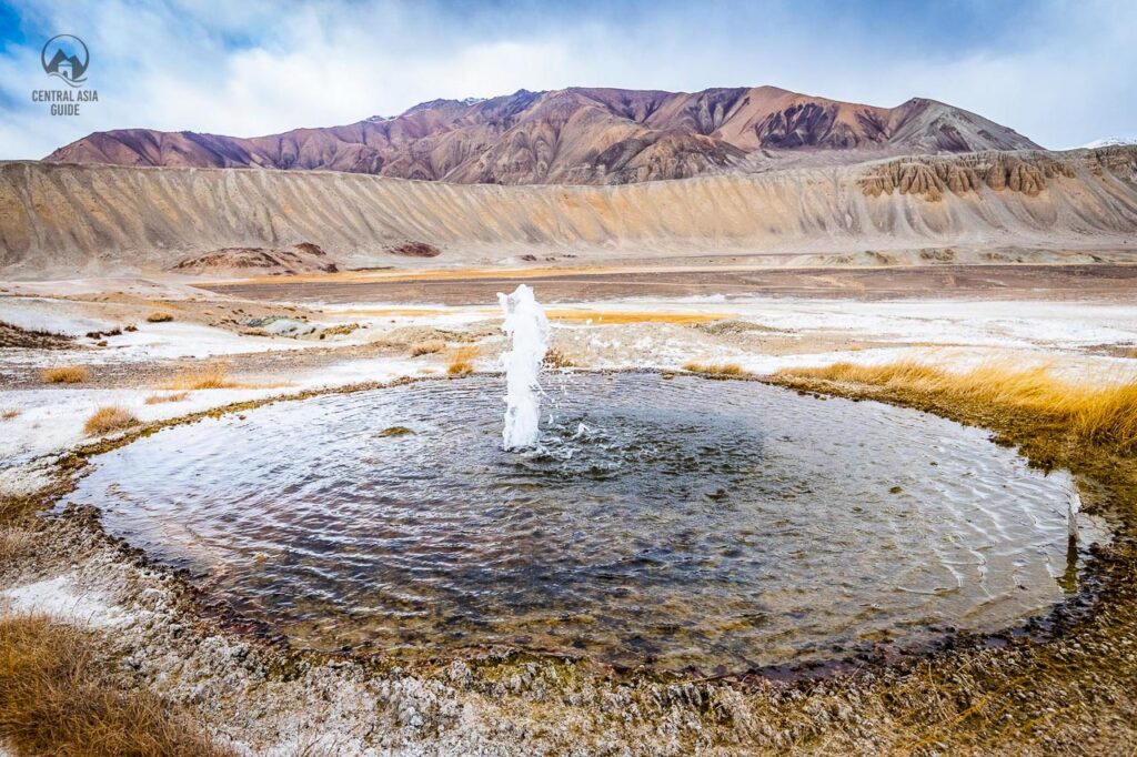
Pamir Geysir
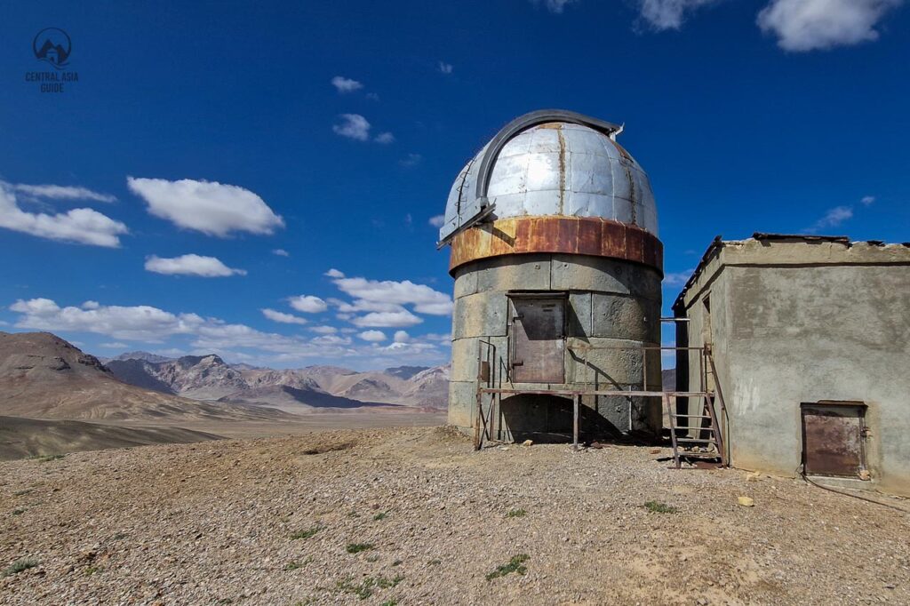
Shorbuloq observatory
Tomb of Chinese Merchant
Zorkul lake
Buddhist stupa in Vrang
Travel to Pamir
Most travelers choose to start their journey to Pamir from Dushanbe and end it in Osh, Kyrgyzstan or the other way around. From the point of view of acclimatization, it is easier to start from Dushanbe as you gain altitude slower than compared to starting from Osh. Nevertheless, it is rare to have any altitude related issues in Pamir. when traveling by car.
The border crossing point to Pamir from Kyrgyzstan’s Alai Valley was fully or partially closed 2021-2025 but is now fully open. No special permits are required anymore.
The Pamirs are isolated and certainly going to be a challenging destination to test one’s body, mind and soul. It is also possible to for example drive through the Pamirs by bike but it will require a lot of experience, pre planning and great physical condition to do so. In order to enter Pamir, you need to get GBAO (Gorno-Badakshan Autonomous Oblast) permit with you visa that will be checked at different military checkpoints on the way. Permit duration has a maximum of 45 days. Keep in mind, that you are expected to also obtain a Tajikistan visa if required for your passport.
Best time to Travel to Pamir
The best time frame for trekking expeditions in Pamir is rather short. Generally, the trekking season in the Pamirs runs from July to September. Before July, there can still be a lot of snow on the trails and water levels are high due to snow melt waters. The high water can make it hard or even impossible to cross rivers that often do not have bridges in the most remote parts.
After September, days get shorter and the cold starts to kick in. Trekking is still possible throughout October and sometimes even November, but you could end up spending most of the day in your sleeping bag sheltering from the cold. Precipitation and rain seasons do not play much of a role for the best travel time as little rain reaches the high desert plateau of the Pamirs.
The season to safely experience the Pamir highway is a bit longer, from May until November but the best and most enjoyable time is from June till September. The early summer offers amazing views of blooming mountain flowers and fruit trees while the autumn displays the autumn colors descending day by day along the mountain slopes.
More information on Pamir Destinations & Sights
Page updated 28.5.2026