Aral Sea, Uzbekistan & Kazakhstan: Travel Guide
Rusting ships in the desert, the Ustyurt cliffs and a sea that has shrunk to a fraction of its size: how to see the Aral Sea today, from Uzbekistan or Kazakhstan.
The Aral Sea at a glance
The Aral Sea, on the border of Uzbekistan and Kazakhstan, is famous for one of the world’s worst environmental disasters: since the 1960s it has shrunk to a fraction of its size, leaving rusting ships in the desert. You can still see it, on a 2-day 4×4 trip from Nukus in Karakalpakstan, or from Aralsk in Kazakhstan, where the northern sea is filling again.
- What: once the world’s fourth-largest lake, shared by Uzbekistan and Kazakhstan. It has shrunk to a fraction of its size since the 1960s, when its rivers were diverted to irrigate cotton.
- In Uzbekistan: the southern sea is still shrinking. The shore is now about 140–150 km from Muynak and its ship graveyard, reached on a 2-day 4×4 trip from Nukus.
- In Kazakhstan: the North Aral is recovering behind the Kokaral dam (2005), and fishing has returned around Aralsk.
- Best time: April–May and September–October.
- How to visit: with a 4×4, a driver and a night in a yurt camp. The last stretch is about 80 km of dirt track across the old seabed.
Aral Sea tours
The Aral Sea is the highlight of our 11-day Full Uzbekistan Tour, which crosses the desert from Khiva to Nukus and spends a night in a yurt camp on the Ustyurt cliffs above the sea. For a shorter private trip from Nukus or Khiva, contact us.
11 days
Full Uzbekistan Tour – Silk Road cities, Deserts, and the Aral Sea
Follow the ancient Silk Road across Uzbekistan — from the blue domes of Samarkand and Bukhara to the silent shores of…
- Culture
- Hiking
- +3
Starts in Tashkent Private departures on request
11 days
Silk Road Oasis Tour
Travel the whole Silk Road of Uzbekistan in 11 days, from Tashkent, Samarkand, Bukhara and Khiva to the desert…
- Culture
- Nature
- Silk Road
Starts in Tashkent Private departures on request
Visiting from Uzbekistan: the 2-day trip from Nukus
On the Uzbek side, the Aral Sea is a 2-day trip by 4×4 from Nukus:
- Day 1: Nukus to the ship graveyard and the Aral Sea museum in Muynak (about 200 km on asphalt, about 3 hours), then about 80 km of dirt track across the old seabed to the Ustyurt cliffs. Sunset over the sea and a night in a yurt camp on the cliffs.
- Day 2: sunrise over the sea, then back across the Ustyurt plateau, past the Sudochye lakes (flamingos in season) and Kungrad, with a stop at the Mizdakhan necropolis on the way into Nukus.
The trip can also start in Khiva (add a day). The yurt camps sit on the cliffs about 3 km above the water, and the way down to the shore is not always open, so ask us about the current access to the shore before you plan a walk to the water.
Visiting the Aral Sea in Kazakhstan
In Kazakhstan the story is one of recovery. Since the Kokaral dam was built in 2005, the North Aral has risen, its water has become less salty and the fishermen are back. The starting point is the old port of Aralsk, now about 12 km from the water, with its rusting cranes and fishing museum. From there you can visit the dam, the fishing villages such as Tastubek, and the few wrecks left at Zhalanash. The former island of Barsakelmes, once the largest island of the Aral and now a nature reserve, is open to organised groups only. Aralsk is reached by train from Kyzylorda (about 5.5–7.5 hours) or from Almaty (about 24 hours).
If you only visit one side, we recommend Uzbekistan. Muynak, the Ustyurt cliffs and the shore camps fit easily into a trip to Khiva, Nukus and the desert fortresses, while Aralsk is far from other sights, apart from Baikonur, which needs a permit.
Getting there
On the Uzbek side, trips start in Nukus, the capital of Karakalpakstan. Several flights a day connect it with Tashkent (about 1 h 35–1 h 40), and the train from Tashkent takes about 16 hours; faster Tashkent–Nukus trains are planned for 2027. From Khiva and Urgench it is about 3 hours by road.
From Nukus it is about 200 km of asphalt (about 3 hours) to Muynak, where the shore used to be, then about 80 km of dirt track across the old seabed to the Ustyurt cliffs, so you need a 4×4 and a driver. Small planes fly Nukus–Muynak on some days; ask us.
On the Kazakh side, the starting point is Aralsk, reached by train from Kyzylorda or Almaty.
Best time to go
April–May and September–October are the best months for the Aral Sea. In summer it is above 40 °C, and frosts start in late October. The yurt camps above the shore usually close in winter.
Sights near the Aral Sea in Uzbekistan
Apart from the sea itself, there are other sights south and west of the Aral Sea that fit into a trip on the Uzbek side.
Ustyurt Plateau
The Ustyurt plateau is a vast area covering a large part of western Kazakhstan and Uzbekistan, from the Caspian Sea to the Aral Sea and the Amu Darya in the east and Lake Sarygamysh in the south. Here we cover only the small Uzbek part by the Aral Sea; our Mangystau and Ustyurt reserve pages cover the larger Kazakh side.
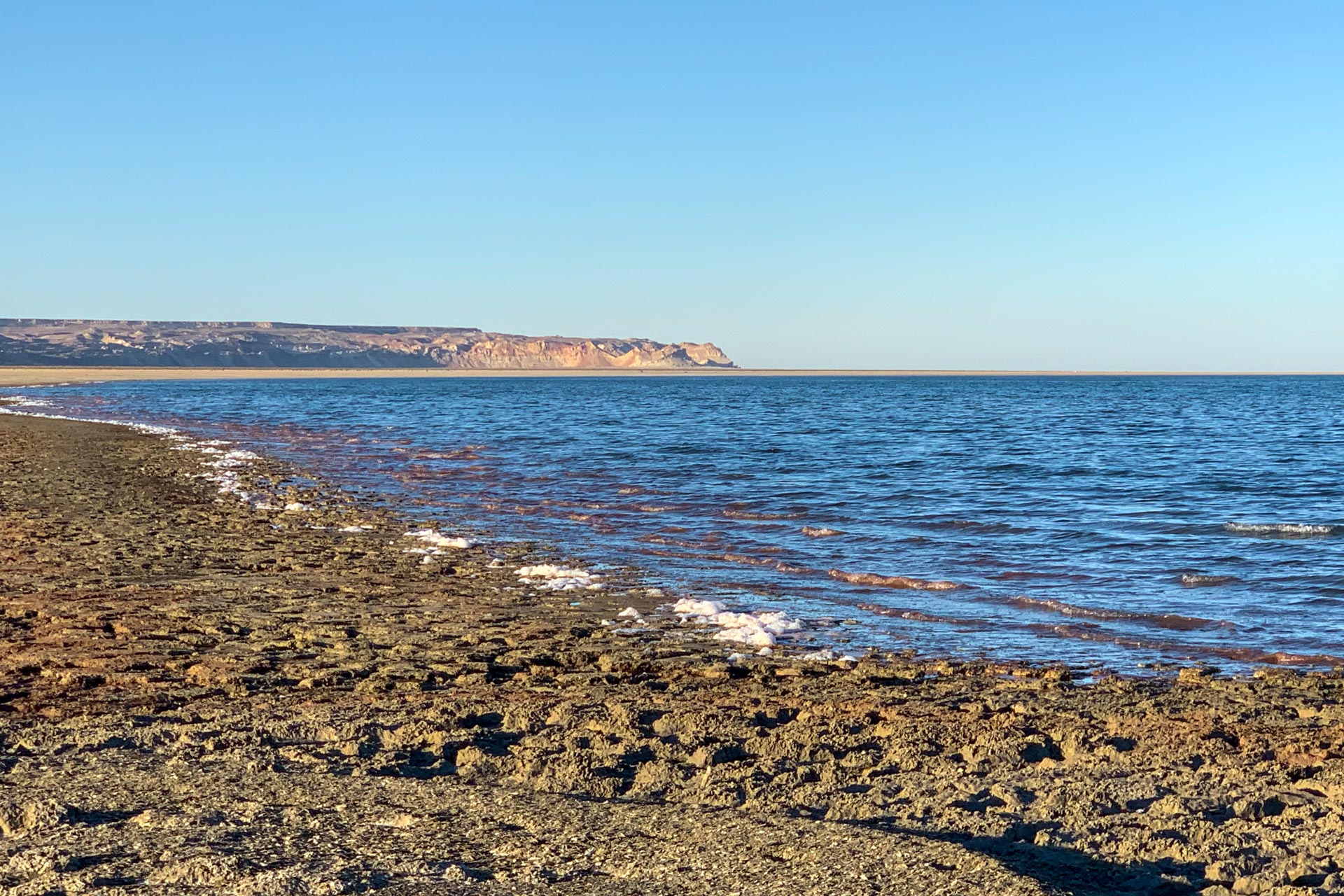
By the Aral Sea, the edge of the plateau forms high cliffs, where erosion shows the sea’s former levels. The plateau is not completely flat: it has unusual formations such as the great Ustyurt canyon.
Sudochye lakes
The Sudochye lakes are a system of lakes that formed when the old Sudochye lake became shallower as less water reached it. They still receive some water from the Amu Darya and the irrigation canals, and in the past they were connected to the Aral Sea. The ruins of an old lighthouse on the shore of one of the lakes recall the time when ships could sail between the two.
Sudochye is an important stopover for migrating birds, especially in spring and autumn. If you are lucky, you can see thousands of flamingos here. There are even records of flamingos nesting in a very remote part of the area, but this has not been confirmed lately.
Salty lake Barsa Kelmes
What is called a salty lake is more like a salty marsh or salt field, southwest of the Sudochye lakes. It is called Barsa Kelmes (not to be mixed with the Barsakelmes peninsula in Kazakh side), which translates as a place of no return. Stretching 70 kilometers in length and 40 kilometers in width, it is believed that Barsa-Kelmes formed part of the seabed for the ancient Tethys Sea of the present-day Karakum and Kyzylkum Deserts and the Ustyurt Plateau.
The death of life and vegetation at Barsakelmes is a direct result of the high concentration of salt which was left behind by the evaporated seawater. This lifeless area is now filled with abundant reserves of salt and can be reached by a path that winds through the sand along the clay and gypsum desert. This hard-to-access and little-researched salt marsh is also dangerous, for when crossing the terrain it is easy to sink through the thin layer of crystallized salt which covers the ground. The salt sparkles like ice in the bright desert sun, making it nearly impossible to look at it without dark sun glasses. Although dangerous, Barsa-Kelmes is fantastically beautiful and is known to evoke a strange mixture of delight and fear in visitors.
A trip to Uzbekistan’s Barsa-Kelmes is recommended only for travelers who are physically fit, and it is strongly advised to take sturdy shoes, light cotton clothing, sunglasses and covering hats for the journey. As the landscape resembles the backdrop for a sci-fi or fantasy film, those brave enough to make this journey will also be rewarded with unique, peculiar and fascinating photo opportunities.
Where you sleep at the Aral Sea
Aral Sea trips sleep in yurt camps on a ledge of the Ustyurt cliffs above the western shore, about 3 km from the water. The camps have up to about 15 yurts with beds, shared showers and toilets, and serve dinner and breakfast. They usually close in winter. The sunsets and sunrises over the sea, in the silence of the desert, are the reason to stay. Contact us about your Aral Sea trip.
Why the Aral Sea shrank
The Aral Sea was fed by two great rivers, the Amu Darya and the Syr Darya. People have irrigated fields along them for more than a thousand years, but in the Soviet era irrigation for cotton grew on a huge scale, and from the 1960s so little water reached the sea that it began to shrink fast. The border between the Uzbek and Kazakh parts of the sea dates from the Soviet delimitation of the 1920s–30s.
As the water fell, the sea split in two. The eastern basin has almost disappeared and is now called the Aralkum desert, and in the west only a narrow, deep strip remains, far saltier than in 2010 and still shrinking. Barsakelmes, once the largest island, is now joined to the mainland. Winds carry salt and dust from the dry seabed over the fields and towns around it, and the fishing that fed the Karakalpaks for centuries has all but gone. In Kazakhstan, the Kokaral dam (2005) has saved the North Aral, which is slowly filling again.
Today the ship graveyard at Muynak, the seashells in the sand and the empty fishing towns make the Aral a place of dark tourism, but also one of the most striking landscapes in Central Asia.
Aral Sea FAQ
Can you still swim in the Aral Sea?
Not on every trip. The yurt camps sit on the Ustyurt cliffs about 3 km above the water, and the way down to the shore is not always open. Ask us about the current access to the shore before you plan a swim.
How far is the sea from Muynak?
About 140–150 km, the last part on dirt tracks across the old seabed. That is why the shore is a 2-day trip from Nukus, with a night in a yurt camp.
Do I need a permit?
Ask us. The rules on the shore change, and we check them before each trip.
Can I visit in a day?
Not the sea itself: from Nukus it is about 200 km to Muynak and then about 80 km of dirt track to the cliffs. In a day you can see the ship graveyard and the Aral Sea museum in Muynak, about 3 hours each way from Nukus. To see the sea, plan 2 days, as on our Full Uzbekistan Tour.
Sights & Destinations near Aral Sea
Tour updated