Ustyurt Plateau, Kazakhstan: Travel Guide
A vast limestone plateau between the Caspian and the Aral Sea, with white cliffs, the Karynzharyk depression and the Ustyurt State Nature Reserve.
The Ustyurt plateau
The Ustyurt is a vast limestone plateau of about 200,000 km² between the Caspian and the Aral Sea, shared by Kazakhstan, Uzbekistan and Turkmenistan; the Mangyshlak peninsula and the sights of Mangystau lie to its west. The Ustyurt State Nature Reserve was created in Kazakhstan in 1984 and protects about 223,000 hectares of the plateau’s south-western part – only a small portion of the whole plateau. For centuries the Ustyurt was a crossroads of caravan routes, and medieval cemeteries with majestic mausoleums are scattered across it.
The reserve is a refuge for rare animals listed in Kazakhstan’s Red Book: the goitered gazelle, the Ustyurt urial (a wild mountain sheep), the caracal, the honey badger, the saker falcon and vultures. The climate is sharply continental: summers are very dry and often above 35–40 °C, and in winter storms and strong winds bring temperatures well below −10 °C.
Ustyurt at a glance
- The plateau: a vast limestone tableland between the Caspian and the Aral Sea, with white cliffs (chinks) up to about 370 m high along its edges.
- The reserve: the Ustyurt State Nature Reserve in Kazakhstan protects its south-western part, including the Karynzharyk depression.
- Bozzhyra: on the western edge of the plateau, but part of the Kyzylsai nature park, not the reserve. See our Bozzhyra guide.
- Season: March to October.
- Getting there: by 4×4 only, via Zhanaozen; most visitors come on a tour from Aktau.
Tours visiting the Ustyurt plateau
Karynzharyk is on our 8-day Mangistau – Karynzharyk Tour. Bozzhyra, on the plateau’s western edge, is on every one of our Mangystau tours.
8 days
Mangistau – Karynzharyk Tour
An 8-day 4×4 camping expedition from Aktau through the deserts and canyons of Mangystau. The first days lead past the…
- Hiking
- Jeep (4x4)
- Nature
Starts in Aktau
Ustyurt Geography
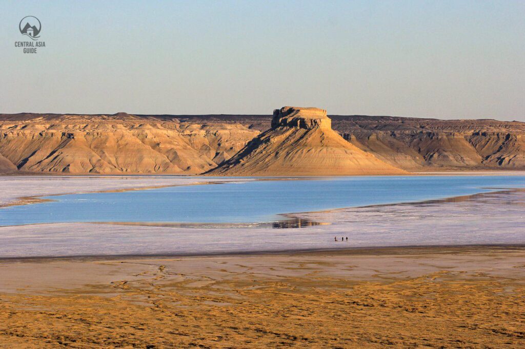
The reserve covers part of the western escarpment of the Ustyurt plateau, which ends in sheer white cliffs, called chinks, from 50 m to 370 m high. Its highest point is about 340 m above sea level on the western escarpment, and its lowest about 75 m below sea level in the Karynzharyk depression. There are no rivers or lakes in the reserve: the only water comes from wells and springs fed by groundwater. The grey-brown, salty soil with layers of snow-white chalk gives the reserve its unique landscape.
Ustyurt Sights
The Ustyurt plateau is rich in archaeological monuments. It was once crossed by several caravan routes, such as the road of the Khorezmshahs that linked Khiva with the lower Emba and Volga rivers. The best-known sites along it – the ancient town of Shahr-i-Wazir, the Beleuli caravanserai and the Allan fortress – lie on the Uzbek side of the plateau, not in this reserve. On the Kazakh side, old cemeteries with majestic mausoleums are scattered across the plateau; many have been studied by archaeologists, but many are still unexplored.
Ustyurt Routes
The reserve has two main visitor routes, Onere and Kokesem, both open from March to October. The Onere route combines driving with short walks; it is about 374 km long, takes a day and passes Zhanaozen and the villages of Kulandy and Akkuduk. The Kokesem route is about 440 km long and takes two days, via Zhanaozen, Senek, the Beket-Ata area and Kyzylsai. Visits must be booked with the reserve administration in Zhanaozen at least 5 working days ahead, with the dates, the names and ID documents of everyone in the group and the cars’ plate numbers; groups are limited to 10 people and 5 cars. The reserve charges an area fee of 865 tenge per person per day plus fees per group and per car, and campfires and litter are not allowed. Since June 2026 visitors may not walk down onto the Karynzharyk salt flat; you see it from the designated viewing points on the rim.
Travel to Ustyurt National Preserve
There are no buses to the reserve, so you need a car – in practice a 4×4 with a driver who knows the tracks. The way leads through Zhanaozen and on via the villages of Senek and Akkuduk to the reserve.
Other sights and destinations near Ustyurt
Written by Anssi Karppinen, Central Asia Guide · Page updated