Atyrau
Atyrau
Kazakhstan’s westernmost large city, Atyrau, has two exceptional features. The first one is related to its location by the Ural River in an area that historically divided Europe from Asia in this region. As the city is located on the western bank of the Ural River, Atyrau is geographically in Europe while crossing the bridge east takes you into Asia.
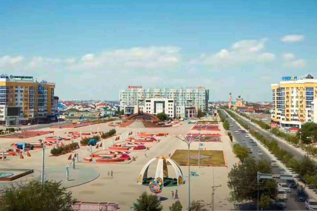
Atyrau is the urban center of Kazakhstan’s oil industry and has a population of about 160 000 people. The distance to Almaty from here is about 2700 km, just to again give you an idea of the size and distances of Kazakhstan. Towards west, there is the Russian city of Astrakhan and to the south lies the Caspian Sea, just 15 km from the city center.
Atyrau is a modern city living mostly of its oil and fish industries. The city has also grown to become a crossroads for transportation routes due to the pipelines and railways between east and west. There are also shipping lines from Atyrau’s sea port to Baku, Iran, Turkmenistan and along the Volga, the Volga-Don Canal and down the Don to the Black Sea and even all the way to Europe.
Atyrau History
Aturay was known as Guryev until 1991 and it was the first Russian town built on Kazakh territory. Atyrau started as a fishing settlement but it soon became a part of the forces of Tsarist Russia to extend its control over the area. After Russia had conquered the khanates of Kazan and Astrakhan under Tsar Ivan IV in the middle of the 16th Century, the Russians found themselves in the instant neighborhood of the Kazakh tribes.
To strengthen their position on the western bank of the Ural, a fortified post was constructed of tree trunks and named Ust Yaitsk. A family of Russian traders, the Guryevs, established a wooden fence here to help to protect the fishery practiced here which was the beginning of the settlement of Nizhny (Lower) Yaitsk. The Russians developed the fishing industry further and farmers, brought here from the Don Basin, settled down on the riverbank.
Regiments of soldiers were also stationed there to provide security which was not welcomed by the indigenous Kazakh inhabitants, who tried to destroy the fortification more than once, only to attract a stronger Russian presence each time. In 1645, the Tsar gave Mikhail Guryev permission to strengthen the town, based on the model of the stone defenses of Astrakhan and between 1647 and 1662, a well-equipped fortress was established. In 1734, the town was awarded city rights and was named after its founder Guriyev. The name stuck at Guryev during the Soviet period, but took the Kazakh name Atyrau in 1992, soon after the independence of Kazakhstan.
Atyrau Sights
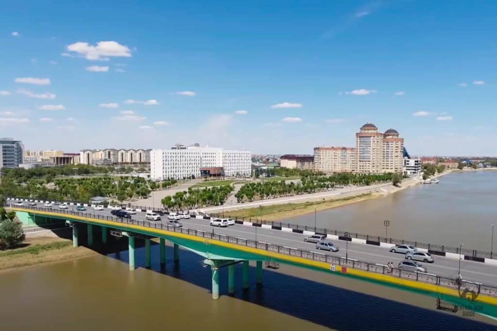
Atyrau is very densely built and you can see all worth seeing within a day. The best place to start exploring the city is from the pedestrian bridge between Victory Park at the western bank and the residental zones at the eastern bank. This suspension bridge between Europe and Asia extends for 405 meters and it was built in 2002 for the oil workers. Once over the bridge, you can walk along the riverbank through the city towards the north, passing the river’s horseshoe curve until you reach a larger bridge for cars. This way you will reach the city center, split into two by the river and stretching no more than two to four blocks away from the riverbank.
Ural River in Atyrau
The Ural River is meandering through the center of Atyrau. In Kazakh language, the Ural River is known as the Zhaik. It is both the focus point and the most charming feature of the Atyrau cityscape. There are several paths along the riverbanks and the walk from the main bridge (Abay road) southwards on the Asian side of the river to the district of Zhilgorodok, is the best part of it.
The Ural river changes its appearance radically with the seasons. In winter, the river turns into a pedestrian thoroughfare as it gets frozen. During summer, attention shifts to the sandy river beaches on the Asian bank, one adjacent to Zhilgorodok, the other just north of the main bridge. During the warmest summer time, beachfront cafes are open and the air is filled with the smells of chips and sun cream.
The different continents of Eurasia are marked by the joined battered metal pavilions at both ends of the Abay Street bridge crossing the river Ural. Those on the western side, at the start of Satpaev Street, are marked ‘Europe’. Those on the eastern side, looking down Abai Street to the tapering caramel-coloured columns of the Kazakh Drama Theatre and named after Makhambet, are marked ‘Asia’.
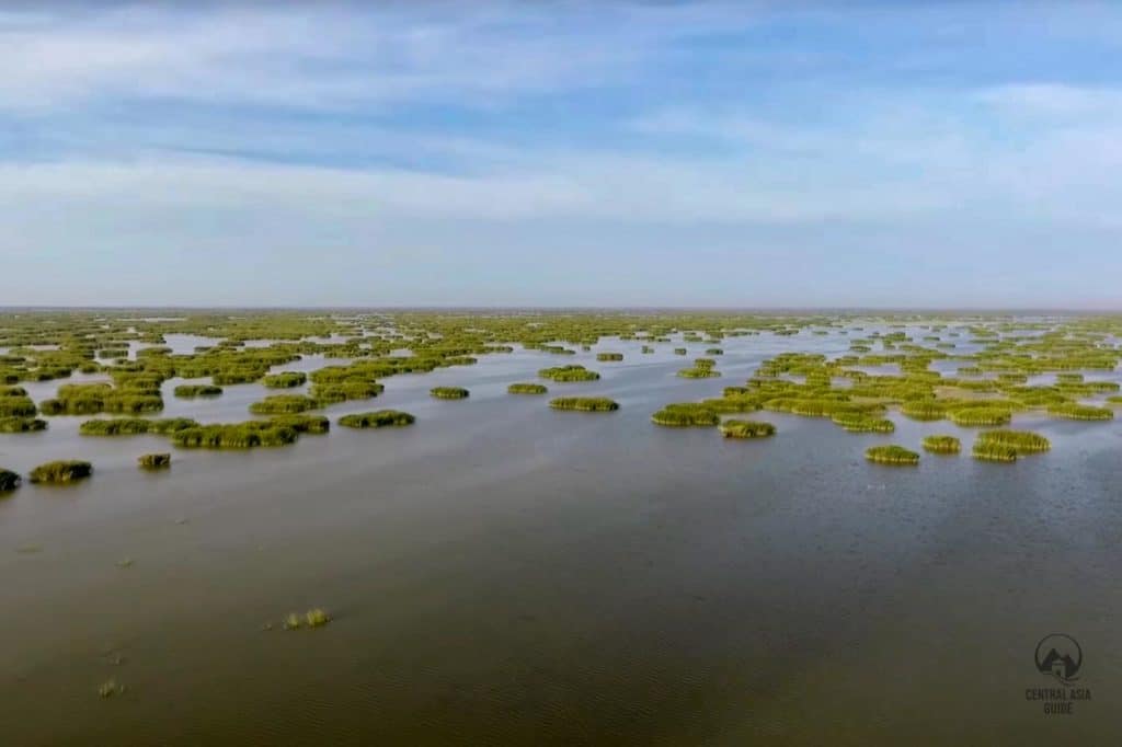
The shallow shores of the Caspian Sea next to the Ural River are a green wetland heaven for birds and other animals. If you are interested in nature, the lush beaches of the Caspian Sea here are the destination for you.
Zhilgorodok District
Zhilgorodok is considered the coziest area of Atyrau. It is a somewhat breaking district, set up after World War II utilizing prisoners of war labor in building it. It lies in one of the horse shoe shaped curves of the Ural River, southwest of the main bridge.
Kurmangazy House Of Culture
Probably the most interesting sight of Zhilgorodok is the graceful, Moorish-tinged Kurmangazy Palace of Culture. The building has its tall domes of its facade facing a quiet square and the remaining sides of the square are fronted by arches. The wooden balconies and window boxes decorating buildings along the side streets and the popularity of this district for summer-evening strolling and as a meeting point for the youth of Atyrau, all serve to reinforce Zhilgorodok’s Mediterranean feel.
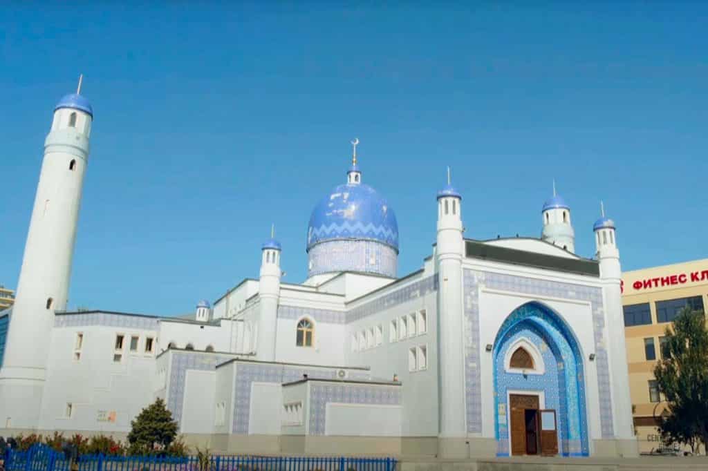
Imangali Mosque
Imangali Mosque was built in 2000 and took its name from the Akim of Atyrau, Imangali Tasmagambetov. This mosque has a blue-tiled dome that stands atop a central drum.
Two minarets, reaching a height of 26 m, flank the building, whose exterior walls are enlivened by decorative tilework. Inside there is a main hall with balconies for 600 seats and a small hall for women with 100 seats. The premises are fenced off from each other by a wooden lattice.
Atyrau Uspensky Cathedral
Uspensky Cathedral rises up with the gold onion domes and a brick building dating from the 1880s. Its exterior walls are painted bright orange. The interior features a tall, pastel-hued, iconostasis, with icons and wall paintings covering most available interior surfaces. Around the cathedral lies the somewhat ramshackle old town of Atyrau, a district of single-story dwellings, some with log walls, most with corrugated metal roofs.
The Atyrau Uspenskiy Cathedral was built in 1883 and is located along Isatai Avenue 4 at the corner with Gagarin Street. The total area of the cathedral is 230 square meters and there are 900 seats inside. It was constructed mostly at the expense of the merchant and philanthropist Fedot Tudakov and his wife, who invested a lot of effort and money in the construction.
Atyrau History Museum / Regional Museum
Atyrau local history museum is located at Momysh Uly Street 1. The museum is focused on the life and work of Makhambet Utemisuly (Utemisov), who lived in the area of Guriyev during the first half of the 19th Century and whose aphoristic and expressive poetry greatly contributed to the education of the common people of the region.
There is also an exhibition about Sarayshik, the capital of the Golden (Nogai) Horde that was first destroyed by Tamerlane in 1395 and later again by the Cossacks in 1580. Remains of the walls of Sarayshik have been found recently during construction work on the Ural, about 50 kilometers north of Atyrau. The city’s own Golden Man can also be seen here. It is an exact replica of the golden mantle of a Samaritan warrior and dignitary. This treasure and many other revealing objects dating from the last 2nd century AD were excavated in 1999 near the hamlet of Kulsary at the burial site of Araltobe.
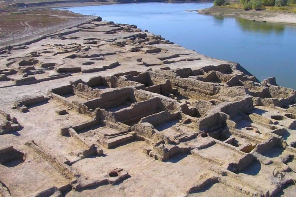
Saraichik Settlement
Saraichik settlement is a town that got famous first in the 13th century as an urban hub of the Golden Horde. Saraichik was sacked by Timur’s troops in 1395 but was rebuilt to serve as the capital of the Nogai Horde in the 15th and 16th centuries, before being destroyed by Cossacks in 1580. Changes in the wandering course of the Ural River have been critical to Saraichik’s archaeological legacy and cultural layers continue to be washed away by the waters even today.
Saraichik memorial complex stands on the edge of the same named village about 50 km north from Atyrau. The complex was built in 1999 and is focused on the 17 m high octagonal based monument known as the Khan Pantheon. Built to a picture of the mayor Imangali Tasmagambetov, the monument takes as its influence the belief that seven khans of the Golden and Nogai hordes were buried in Saraichik. A piled mound of stones in the center of the monument serves as a cenotaph to the khans. There are strips of cloth hanging as votive offerings from the bare branches of a tree that are considered sacred. Beneath the arches of the monument there are engraved funerary stones to each of the khans honored here.
The Khan Pantheon is flanked on one side by a mosque, on the other by a museum. A painting inside the entrance depicts Saraichik in the 14th century as a flourishing Silk Road trading center. The main room of the museum includes a model of Saraichik at this time.
There are assorted fragments of ceramics on display, including some attractively decorated items produced locally in the 14th century, terracotta money boxes and brightly colored items of jewelry. Displays of coins minted in Saraichik in the 13th and 14th centuries are evidence of the importance of the city. On the wall, a cute painting of a girl in a golden boat feeding swans on a lake refers to a local legend.
The legend runs roughly so that Khan Zhanibek had a favorite daughter, for whom he built an artificial lake, on which she sailed allegedly in a boat of gold. The daughter died young, and the distraught Zhanibek had her buried in a golden coffin, together with her golden boat, and loads of gold and jewelry for good measure.
Zhanibek had all those involved in the funeral arrangements put to death, to protect the gold in the grave from looters. It is said that the golden boat still lies beneath the ground. The museum also houses seven modern kulpytas, symbolic gravestones of the seven khans. The displays are in Kazakh only, but you can purchase steeply-priced pamphlets here in English, Russian and Kazakh.
Travel to Atyrau
Atyrau by Plane
There are regular daily flights and Almaty and Astana twice a day operated by Air Astana. There are also flights from Moscow by Aeroflot flights three times a week. SCAT airlines have daily flights from Aktau and Oral as well as three times a week flights from and to Baku.
Atyrau airport is located 6 km west of the city center, along the road that starts from Satpaev street. There are frequent buses running between the airport and the city center.
Atyrau by Train
Atyrau is located on the Moscow – Volgograd- Uzbekistan railway. You can travel to Atyrau by train from Russia (Astrakhan 14h, Moscow 40h or Saratov 21h) from Uzbekistan (Tashkent 49h) Kungrad (town in Karakalpakstan, northwest from Nukus) 20h and Tajikistan (Dushanbe 60h).
Atyrau railway is located 5 km northeast of the city center. Local bus number 14 runs regularly between the train station and the city center.
Atyrau Bus / Taxi
Bus or taxi are not the most convenient option, to travel to Aktau but if you are nearby in Oral or Kulsary there are frequent buses operated to Atyrau.
Atyrau bus station is located next to the train station.
Other Sights & Destinations near Atyrau
Page updated 13.2.2023