Koytendag Nature Reserve
Koytendag Nature Reserve
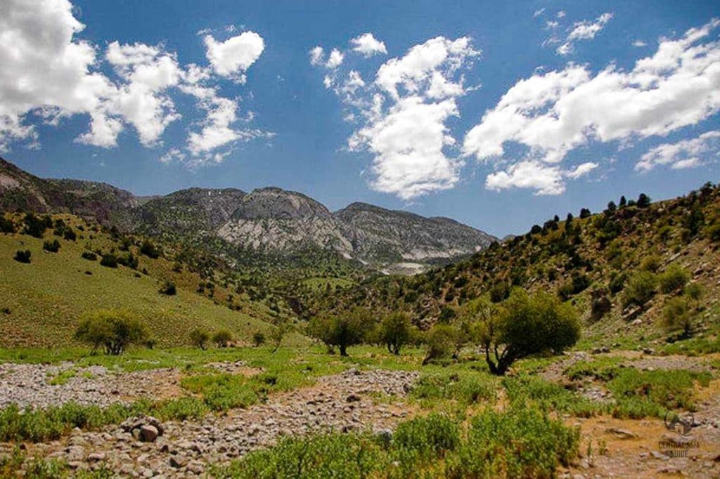
Kugitang Nature Reserve is a designated protected area situated in the stunning Kugitang Mountains of southeastern Turkmenistan, near the Uzbek border. This remarkable reserve, established in 1979, spans approximately 134,000 hectares and is dedicated to conserving the region’s unique natural features and rich biodiversity. The reserve derives its name from the rare markhor mountain goat, which inhabits the area. The Persian translation of Kugitang means “Difficult-to-Cross Mountains,” aptly describing the rugged terrain of this captivating landscape or the “mountains of deep canyons” and this ridge is indeed cut by many deep canyons with steep cliffs, which make the sky sometimes seen only in a form of narrow strip once inside the canyons. Koytendag mountains hold the deepest lakes, the longest caves and even a Dinosaur Plateau bearing traces of these prehistoric reptiles.
Koytendag Nature Reserve is renowned for its extraordinary geological features, including ancient rock formations, canyons, and caves that are millions of years old. These geological wonders draw scientists and researchers eager to explore the region’s history and the evolution of life on Earth.
The Kugitang Mountains are part of the broader Tian Shan mountain range, recognized for their dramatic landscapes and towering peaks. Notably, Airybaba, standing at 3,137 meters above sea level, is the highest peak in Turkmenistan. Located in the Köýtendag Range of the Pamir-Alay chain, it is positioned in the southeast of the country, close to the Uzbekistan border. In September 2004, the Turkmen parliament officially renamed Airybaba to “Mount of the Great Saparmyrat Turkmenbashi,” reflecting its cultural significance. Turkmenistan’s highest point, the Mount Ayrybaba with the height of 3 139 meters is also located here together with the country’s deepest lake called Kattakol.
The Kugitang Nature Reserve is a vital hub for scientific research and conservation initiatives, recognized as a UNESCO Biosphere Reserve. Managed by the State Committee for Nature Protection of Turkmenistan, the reserve invites visitors to explore its distinctive natural features and diverse wildlife, providing an enriching experience for nature enthusiasts and researchers alike.
The region is home to approximately 50,000 residents, primarily living in the Koytendarya Valley, where the key villages include Garlyk, Koyten, Khodzhapil, and Gorshun. The Köýtendag Nature Reserve is celebrated for its abundant mineral springs, stunning waterfalls, and intricate cave systems, making it a sanctuary for a wide array of animal and plant species.
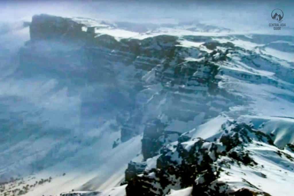
Table of Contents
Köýtendag Fauna
Koytendag fauna refers to the diverse animal life found within the Koytendag Nature Reserve in southeastern Turkmenistan. This ecologically rich area is home to a variety of species, including mammals, birds, reptiles, and insects, many of which are endemic or rare. Notable mammals include the Persian leopard, wild goat, and Turkmen kulan, which are integral to the region’s ecological balance. Birdwatchers can spot species such as the golden eagle and various migratory birds that utilize the reserve as a critical habitat during their journeys.
The rugged terrain of Koytendag, characterized by steep cliffs, canyons, and lush valleys, creates diverse habitats that support this wide range of wildlife. Conservation efforts in Koytendag are essential to protect these species and their habitats, ensuring sustainable ecological practices and promoting biodiversity for future generations. This unique fauna not only enhances the region’s natural beauty but also plays a crucial role in ecological research and tourism, making Koytendag a significant area for both conservation and economic development.
Koytendag Flora
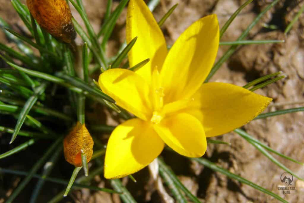
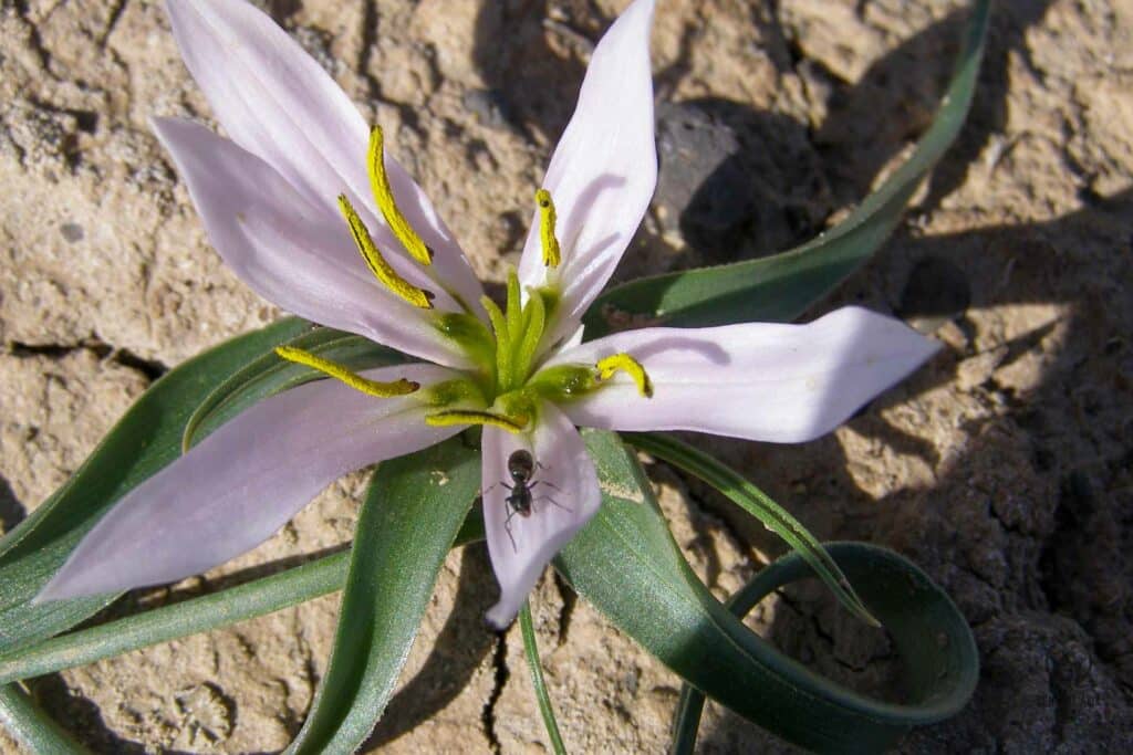
Koytendag Flora encompasses the rich and diverse plant life within the Koytendag Nature Reserve in southeastern Turkmenistan. This region boasts over 1,200 species of vascular plants, including many unique and endemic species, highlighting its ecological significance. The flora is categorized into distinct communities, such as deciduous forests of oak, elm, and poplar, dense juniper and wild pistachio shrublands, and expansive grasslands rich with herbaceous plants. Many of these plants have traditional medicinal uses, contributing to the cultural heritage of the area.
The preservation of Koytendag Flora is vital for maintaining the ecological balance and biodiversity of the region, as it provides essential habitats for various animal species, including some that are rare and endangered. Conservation efforts in this area are crucial, promoting sustainable tourism and research while safeguarding this unique environment for future generations.
The Koytendag foothills are painted in red color because of outcrop of the variegated rocks. The slopes at medium altitudes are covered with rare groves of juniper (cedar) with various grasses, flowers and shrubs. In addition, these mountains often feature mulberry trees, sycamores and various fruit trees.
Hojapil Sanctuary
The Hojapil Sanctuary, or Hojapil Zakaznik, is a vital protected area in southern part of Kugitang Nature Reserve. It dedicated to conserving its unique ecosystems and biodiversity. This sanctuary is home to a wide array of flora and fauna, including endemic and threatened species, providing critical habitats for various wildlife. Its diverse landscapes, which include steppes, mountains, and forests, enhance its ecological richness and serve as a significant site for scientific research in ecology and conservation biology. Local communities are actively engaged in its management, fostering a sense of environmental stewardship and promoting sustainable practices.
Additionally, Hojapil Sanctuary presents excellent eco-tourism opportunities, allowing visitors to explore its natural beauty while generating economic benefits that raise awareness of the importance of conservation. Overall, the Hojapil Sanctuary exemplifies Turkmenistan’s commitment to preserving its natural heritage through research, community involvement, and sustainable development.
Köýtendag Сaves
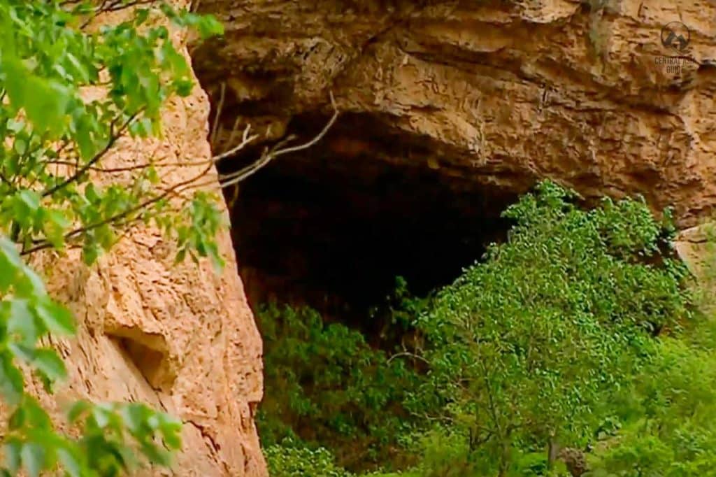
The Köýtendag Caves are a remarkable geological feature located within the Köýtendag Nature Reserve in southeastern Turkmenistan, renowned for their stunning natural beauty and historical significance. These caves, formed over millions of years, showcase unique rock formations and ancient petroglyphs that provide insights into early human habitation in the region.
Ninety million years ago, while the current desert territory of Central Asia was covered by plentiful rains and a large ocean reached the foothills of the young mountains, the water started to dissolve the rock and to seek shelter in new caves. Later, the caves were packed with clay and stayed that way for a long time, from the Neogenic to the Middle Quaternary. The mountains rose, along with the caves full of clay, whereupon the clay was washed away and the karst cave system was born.
The most famous cave, Köýtendag Cave, is known for its impressive stalactites and stalagmites, attracting both researchers and adventure seekers alike. Visitors to the caves can explore the captivating underground landscapes, making it an ideal destination for eco-tourism and geological studies. Furthermore, the Köýtendag Caves contribute to the rich biodiversity of the area, serving as habitats for various species, including bats and rare plants. With its combination of natural wonder and ecological importance, the Köýtendag Caves are a must-visit for anyone exploring Turkmenistan’s unique landscapes.
Kyrk Gyz Pilgrim Cave
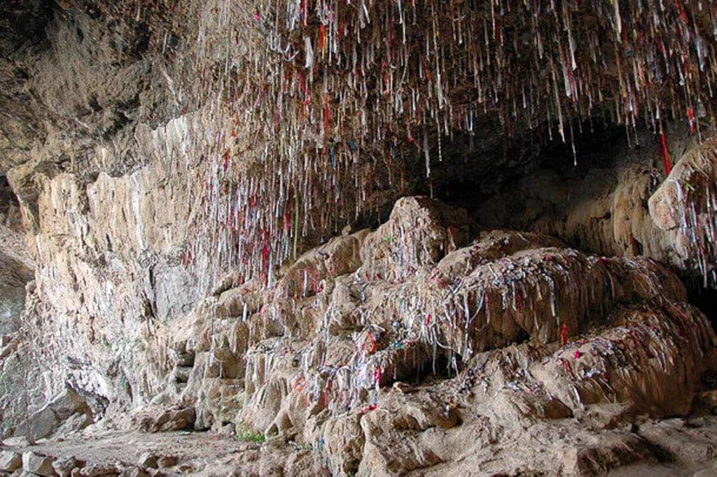
Kyrk Gyz Pilgrim Cave, also known as the Forty Girls Cave, is a culturally and historically significant site in the Köýtendag. Renowned for its stunning geological formations, the cave features impressive stalactites and stalagmites shaped over millennia. Its name derives from local legends where forty young women sought refuge in the cave, symbolizing bravery and resilience.
Additionally, Kyrk Gyz is considered a pilgrimage site, attracting visitors who seek blessings and participate in local rituals. Situated within the Köýtendag Nature Reserve, the cave contributes to the region’s biodiversity and provides habitats for various species. On the roof of the cave, you can see bits of mud from which dangle strips of cloth. According to local tradition, a wish come true if the pilgrim can fling the mud pie and cloth to the ceiling and make it stick. Numerous rare species inhabit here including the spiral-horned markhor goat, and the Bukhara urial, a mountain sheep.
Accessible for tourists, it is advisable to visit with a local guide to gain insights into its history and folklore. For adventure seekers, Kyrk Gyz Cave offers opportunities for spelunking and exploration, making it a must-visit destination for those interested in Turkmenistan’s rich heritage and diverse landscapes.
Karlyk Caves
Although the potential of this area for speleological tourism has not yet been fully realised, non-specialist visitors can explore the Karlyuk Caves with experienced guides from the nature reserve. Karlyuk Caves or Garlyk Caves are the limestone caves that are considered the most extensive network of caves in Central Asia.
Rich in local folklore, the Karlyk Caves are also associated with ancient legends and tales, adding to their cultural allure. The caves serve as a vital habitat for various species of bats and other wildlife, contributing to the biodiversity of the region. Accessible to adventurous travelers and nature enthusiasts, the Karlyk Caves provide an extraordinary opportunity for exploration and discovery within the breathtaking landscapes of Turkmenistan.
The caves in Kugitangtau are also of special value and unique for Central Asia. First of all, they are in huge amount and they form an actual dungeon system, which in addition includes a lake. For example, the lake found in a valley near Karlyuk village harbors the blind loach (Troglocobitis) – a fish that lives in the darkness of the cave all its life. Not far from this place there are also several other caves: Gulgirin, Khashimoyuk, Tashyurak and others.
Kapkytan Cave
Kapkytan Cave is one of the accessible caves for visitors since other caves have not been prepared for the tourist crowds. Trekking deep into the caves with one of the park rangers could be both scary and exciting, with some astonishing stalactites and stalagmites. Some of these natural miracles have been named by locals according to their form, including Medusa, a maiden and others of a more phallic nature.
The entrance to the Kapkytan Cave is sealed by a large metal door and opens to a 300m-long horizontal shaft that was cut in Soviet times for the extraction of onyx. At the end of the shaft is the cave network, which includes passages, galleries, and smaller caves with stalactites and stalagmites that resemble mythological characters, animals, and even human reproductive organs.
Koytendag Dinosaur Cave
Another popular cave in the Kugitang Nature Reserve is the Dinosaur Cave, which is known for its ancient fossils and unique rock formations. The cave is believed to have been formed over 300 million years ago and contains a variety of unique geological features, such as the “Dinosaur Footprint” and the “Organ Pipes.” The caves may be difficult to access and may require a guide to explore safely. The caves and dinosaur plateau are also on the Unesco tentative list.
Kugitang Waterfall
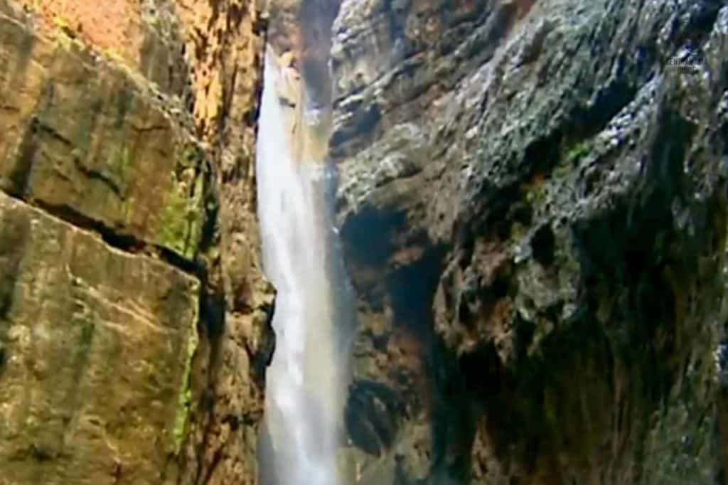
The Kugitang Nature Reserve is a beautiful waterfall that cascades down a rocky cliff into a pool of crystal clear water below. The surrounding landscape is rugged and mountainous, with deep valleys and gorges carved by rivers and streams. The waterfall is located in a remote area of the reserve therefore visitors are advised to hire a guide who is familiar with the area and can help you navigate the mountain trails safely if you wish to visit waterfall.
Dinosaur Plateau
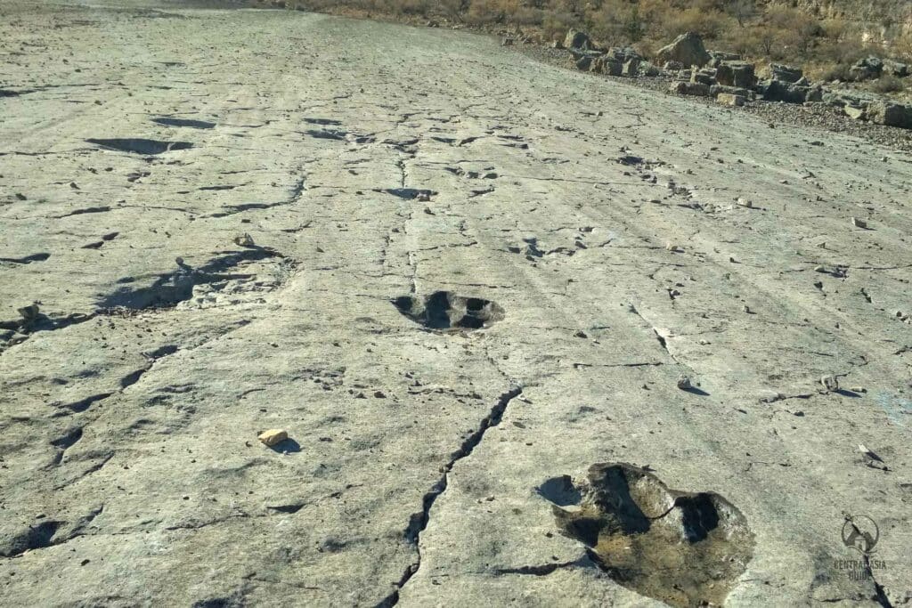
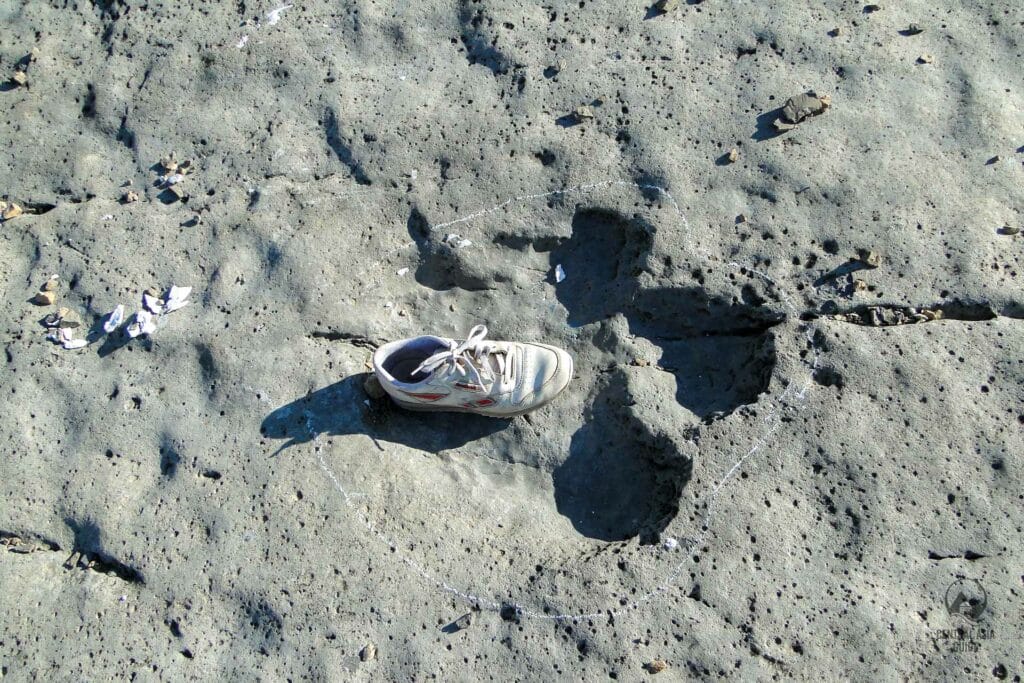
Dinosaur footprints have been discovered at other locations in the Kugitang Mountains, counted more than 2,500 trails in total, dating from the Jurassic period. Turkmen scientists claim that the footprint evidence is suggestive of at least three previously unknown dinosaur species, and have suggested the names Gissarosaurus, Hojapilosaurus and Turkmenosaurus. Furthermore, the residence of the villagers believed in legends that the tracks at Hojapil were created either by the elephants of Alexander the Great’s army or elephants brought back from India by a local holy man returning from a religious pilgrimage.
Koyten Dag is also well-known for its “Dinosaur Plateau” with 438 fully preserved fossilized dinosaur tracks, and its caves are rated the most impressive and intriguing caves in the former Soviet Union. If you wish to discover the mountain can be discovered you should follow climbing and trekking paths placed along the entire ridge. Dinosaur Plato lies in the northeast part of Reserve, in Kugitangtau mountains, at the height of 1,500 meters. It is a large limestone slab lying on a hillside, the extent to which, from the small village of Khodjapil, takes half an hour. The spot was first investigated in 1980, which soon gained a great as at “Repository“of dinosaur tracks. Alike dinosaur footprints were also found in Uzbekistan, Tajikistan, China and even in the United States, yet none of them is equal in number to Turkmenistan. There was discovered about 150 paw prints of different sizes and conditions.
Population of Köýtendag Valley
The majority of the population, approximately 50,000 residents, resides in the Koytendarya Valley, with the main villages including Garlyk, Koyten, Khodzhapil, and Gorshun. The Köýtendag Nature Reserve is renowned for its abundance of mineral springs, waterfalls, and caves, and it also serves as a habitat for a diverse range of flora and fauna.
Travel to Köýtendag Nature Reserve
Kugitang a considerably difficult place to reach due to the road condition and remote location. The drive from Turkmenabat, through Atamurat, should take around six hours. Since you are still in Turkmenistan you need a permit for these spots therefore plan accordingly and get a permit beforehand from the travel agencies.
Visitors can reach the reserve by following the road along the Kugitang River valley, passing through Koyten village and the old lead-mining settlement of Svintsovy Rudmk, and continuing on to the hamlet of Hojakarawul. There is a small museum in Hojakarawul that visitors may miss, which contains exhibits such as a stuffed markhor, a gypsum model of a dinosaur footprint, and displays of minerals and fossils in glass cases. There is also a mock-up cave with stalactites and stalagmites.
Sights near Koytendag Natural Reserve
Page updated 14.10.2024