Lake Zaysan
Lake Zaysan
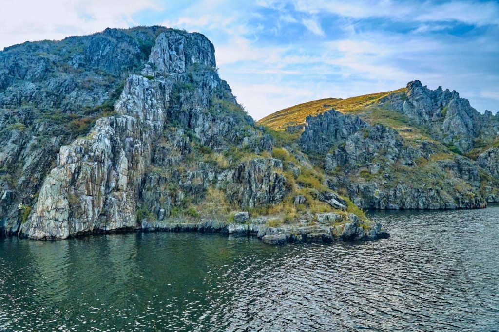
Zaysan or Zaisan lake is the largest lake in Eastern Kazakhstan and one of the oldest lakes in the world. Zaysan lake was formed already approximately 60 million years ago. It stretches from southeast to northwest in a flat plain called the Zaysan depression at an altitude of 420 meters.
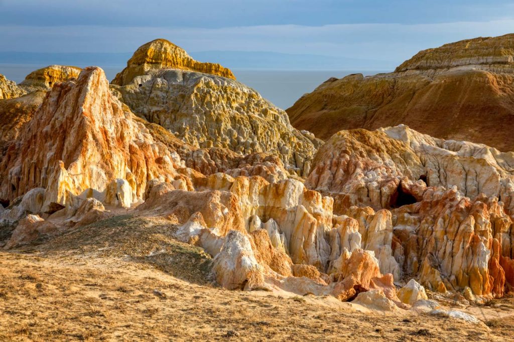
The Zaysan depression is a tectonic intermountain depression between the Zhonghar Altay mountains and the foothills of the Mongol Altai mountains and next to another geological sight called the Kiin Kirish valley and part of the shores of Zaysan are covered by similar geological formations.
Zaysan lake is filled with many rivers like the Black Irtysh, Kokpekty, Zharma, Kendirlik and others but only the Irtysh river flows out of it. Zaysan lake is 100 km in length, 22 – 48 km in width and used to cover an area of 1900 square km with an average depth of only about 8 meters. Due to the creation of the Bukhtarma hydroelectric power station, the area of the lake got at least doubled to 3500 km2 or even more. Zaisan has unusually clean, transparent, and soft water. There are no large settlements or industrial enterprises on the coast of Zaisan and therefore the ecological situation in the lake is favorable. Zaysan is famous for its abundance of fish, where the most valuable species is the trout.
For camping travelers, stopping at the Zaisan lake is an adventure. In the evening with the appearance of stars in the sky, you can hear a melodic ringing, similar to the hum of wires. Due to this characteristic sound, the lake received its second name “Lake of Bell Ringing”. About 100 years ago, this area was inhabited by wild Bactrian camels, Przhevalsky horses, kulans, gazelles, saigas, thousands of bustards, tigers and even nowadays you can meet here bustards and other rare animals. Beware of the mosquitos as there are large swampy areas in the delta areas. Other areas around the lake are mainly steppes often without a single tree.
Zaysan Northern Shore
On the north shore, the lake is surrounded by mountains Kalabinski and Altayskiy ridges. It is from where the high Altai begins with wet taiga vegetation.
The height of the mountains reaches up to 4500 m and in the east, the Saur mountains, a spur of the Tarbagatai range, have large larch forests and several peaks up to 3900 m.
In addition to the canyons of Kiin Kirish, there are also other beautiful geological formations on the northern banks of the lake. The red and yellow colored hills are commonly known as the Mars hills of Kazakhstan.

Zaysan Southern Shore
On the south shore the lake extends until the mountains spurs of Manyrak ridge with the top height of up to 2500 m as well as the majestic snow-covered Saur range with its 3 816 meters icy peak called Muztau at the Chinese Kazakh border. In the nearby ridges of the Tarbagatay mountain range, there are desolate areas where the argali sheep and snow leopards still find refuge.
The great Black Irtysh widened in the eastern end of Zaysan forming a large delta spreading for 200 km in length and 150 km in width. It is a natural haven for a large number of different animals.
Interesting Spots near Zaysan Lake
Akshuat Fisherman Village
Akshuat settlement is one of the many fishermen’s villages on the shores of Lake Zaisan. This is a settlement is made special by the unusual architecture and a unique subculture of Kazakh fishermen of the place. Local families are very hospitable and friendly to tourists. If you wish, they can give you an orientation tour, which will allow you to plunge into the atmosphere of traditional fishing life.
Ashutas is a picturesque coast with flooded shores with bizarre shapes of clay of different shades, like Kiin-Kerish. This is a pretty good place to rest. Not far from the beach, anyone can jump into the cool water of the Zaisan.
Zaysan depression is the road to Kiin-Kerish. Moving in the south-western direction of the Zaysan depression along a poorly covered road, you can see the changing landscape, flora and fauna inherent in the mountain-steppe and desert areas.
Zaysan town is located 45 km southeast of Zaisan lake, near the Chinese border. The town has recently gotten more wealthy due to the Chinese traders making business in Kazakhstan. Famous Nikolai Przhevalsky stayed here during his third Central Asian trip.
Bukhtarma Reservoir
The Bukhtarma reservoir was formed by a dam for the Bukhtarma hydroelectric power station on the Irtysh river. The Z-shaped reserver’s filling began in 1960, the last charge was laid in 1966. ome land with villages of course was lost when the Irtysh was turned to this water basin, 340 km long, 25 km wide and up to 68 m deep. The reservoir consists of two sections: a river section, along the Irtysh river valley and Lake Zaisan, where it is formed over more wide area due to the flat geography.
Bukhtarma Reservoir is not only the largest reservoir in Kazakhstan but also the fifth-largest reservoir in the world by surface area. A valley with rocky soil was filled up, ending in a clean, natural-looking lake.The reservoir was formed to fulfill multiple purposes like to support a power plant of 675 MW which has a storage capacity of 49,8 km3 and accounts for a quarter of Kazakhstan’s total freshwater fish production.
Formation of the reservoir also allowed of the development of the lakeside beach resorts especially for the residents of Ust-Kamenogorsk. There are numerous holiday centers, which are open in the summer season, offering sand and a range of watersports. They come here to grill on the shore, swim, sunbathe and fish.
Furthermore, there are two ferry routes of interest for those on their own transport. They work only in the summertime, begin to operate from mid-April to mid-October. One is the ferry connecting Kurshim and Kaznakovka, which heads to the southern road into Altai to Zaysan and Markakol Lake. The another ferry route is called Vasilevskaya Pereprava and connects the shore of Samarskoe and Ulken Naryn. It costs only about $4 for a regular car to cross the lake with the ferries.

Other Sights & Destinations near Zaysan Lake
Page updated 29.12.2021