Merv
Merv
Merv, an ancient city and UNESCO World Heritage Site since 1999, was one of the most significant oasis cities on the Silk Road. Over its 2500-year history, Merv served as the capital under various dynasties, starting with the Achaemenian Empire. Known as “Merv – Queen of the World”, during its prime, it was a center for commerce, religion, and culture, rivaling cities like Damascus and Baghdad as the major cities of Islamic world. Although much of the city was destroyed by the Mongols, its vast ruins, including palaces and mosques, remain a treasure trove for archaeology enthusiasts. Merv is included in many of our Turkmenistan Tours and Central Asia Tours.

As a major heart of religious study and a base of the Silk Road, it had a great value to the commerce and refinement of Central Asia. Before the sons of Chinggis Khan turned this great city into the ash, Merv had been a melting pot of religious faiths and ethnic groups. Its buildings made of fired brick, towered over the green oasis including palaces, mosques, caravanserais and thousands of private homes. Now only a spread around ruins, including fortified walls, brick foundations and gazillions of shards of pottery, remain in the area.
Merv is all about ruins and if you are an archaeology lover you will definitely enjoy walking around the ancient settlements here. However, if you are not a fan of the ancient settlements, you may feel bored with these dusty, windswept remains and its better to leave this sight for others.
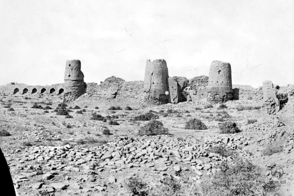
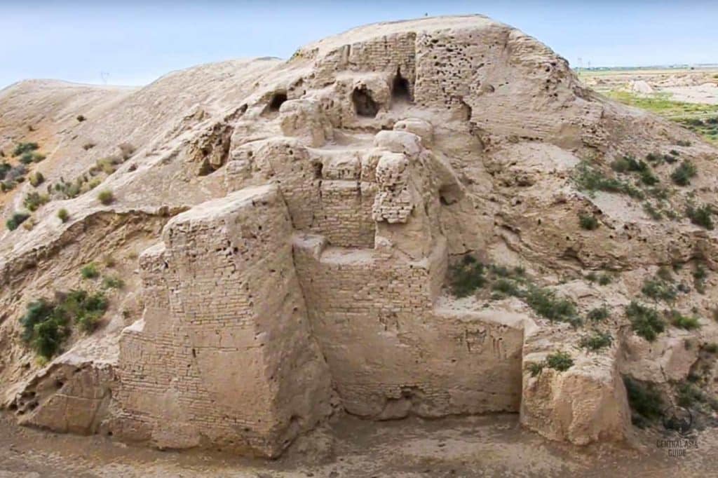
Table of Contents
Merv History
Merv, historically known as Margiana or Margush during Alexander the Great’s era, was a culturally diverse city under the Persian Sassanians, where Christians, Buddhists, and Zoroastrians coexisted. It thrived during the 11th and 12th centuries under the Seljuq Turks, becoming a vital hub along the Silk Road.
Merv might have been an inspiration even for the tales of Scheherazade’s Thousand and One Nights. Over the course of its history, Merv experienced a number of attacks, but rather than restoring older ruins, Merv slowly expanded and moved towards west. Overall, five cities were formed next to each other, mainly due to the slowly shifting river locations.
Over time, Merv expanded westward, with five cities forming due to shifting river paths. The most notable ruins include Erk Kala and Sultan Kala. In 1218, Merv was devastated by the Mongol invasion, marking the end of its grandeur. Chinggis Khan demanded a generous tribute of grain, along with a pick of the city’s most beautiful young women.
The Seljuqs made the disastrous decision to assassinate tax collectors sent to collect tribute, prompting a brutal response from Tolui, one of Chinggis Khan’s sons. Three years later, he arrived with an army, accepting the terrified citizens’ surrender before massacring an estimated 300,000 people.
Merv saw a brief revival in the 15th century, becoming a focal point in territorial conflicts between Bukhara, Khiva, and Persia. Persian influence grew when noble Bairam Ali rebuilt a dam, revitalizing agriculture and trade. However, in 1795, the Emir of Bukhara captured and destroyed Merv. Russia annexed the area in 1884, renaming the settlement Bairam Ali while controlling events from the nearby town of Mary.
Merv sights
Gyaur Kala was a significant urban center in Merv’s history, utilizing Erk Kala as its northern fortress. Erk Kala is among the most fascinating and ancient sites in Merv. Both Gyaur Kala and Sultan Kala are substantial in size and host various attractions. Sultan Kala is located just a short walk west of Gyaur Kala, making these sites easily accessible for visitors exploring Merv’s rich historical landscape.
Ancient Settlements of Merv
Gyaur Kala
Gyaur-Kala is one of the most formidable ancient fortresses in Central Asia, covering an area of over 300 hectares. Constructed by the Sassanians in the 3rd century BC, the fortress features robust walls, with three openings where gates once stood. The square walls are approximately 2 km long, and a pathway leads from the southern gate to the citadel and around to the northern gates. At the heart of Gyaur-Kala lies the 11th-century Beni Makhan Mosque, a notable architectural highlight.
Erk Kala
Erk Kala is a significant ancient site in Merv, Turkmenistan, known for its rich historical and architectural importance. Built in the 3rd century, this fortress features impressive, thick walls and a strategic design that exemplifies ancient engineering. Visitors can explore its ruins, which include towers and gateways, offering a glimpse into the architectural achievements of Central Asian civilizations. Erk Kala remains a fascinating destination for those interested in the region’s vibrant history and heritage.
Sultan Kala
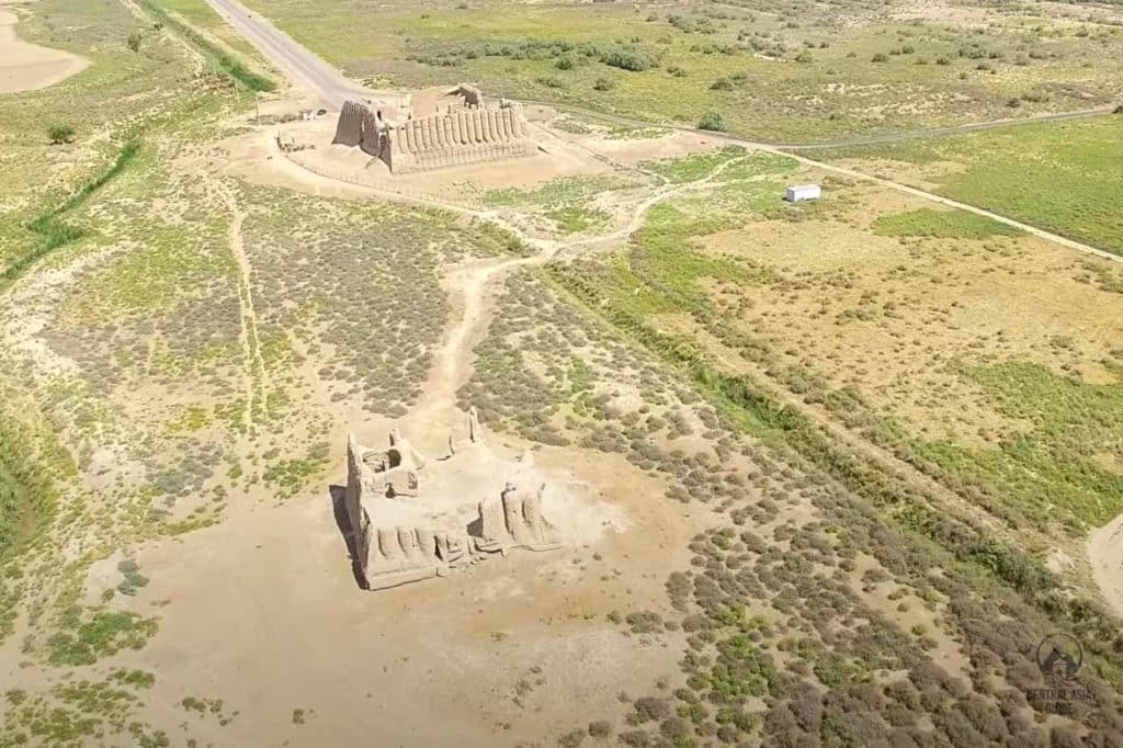
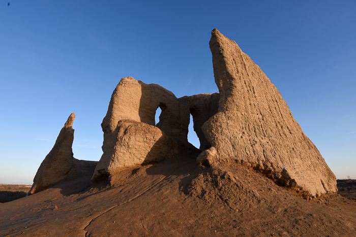
Great Kyz Kala
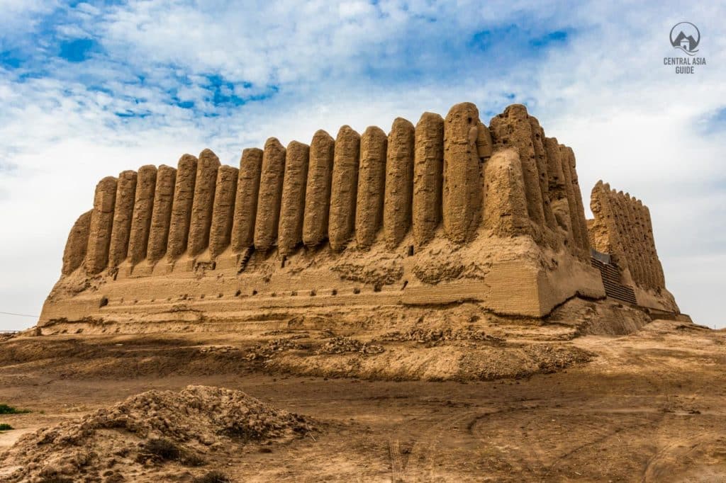
The Great Kyz Kala, or “Maiden’s Castle,” is the largest ancient group of structures outside the west wall of Sultan Kala. It includes, the Great Kyz Kala , Lesser Kyz Kala, the Kyz Bibi mausoleum and two more köshks, or fortress-like buildings. Archeologists identified that these two fortresses were built according to the same plan. The immediate vicinity of the buildings has been preserved and the ground surface displays little sign of change. Residential and utility rooms that formed a courtyard were built inside both fortress.
For the steppe, it was an extremely convenient structure: in summer it was always cool here, and warm in winter. This structure was also used as a barn where harvested foodstuff were stored, so it is not surprising that the fortress could face a long siege. The two parts of the Kyz-Kala fortress were connected with the help of the eastern gate, on which towers were erected. Great Kyz-Kala had two floors: on the first floor there were 5 rooms and a staircase leading downward passing through an arched corridor. According to the fragments of the second floor, it also had 5 rooms located around the courtyard.
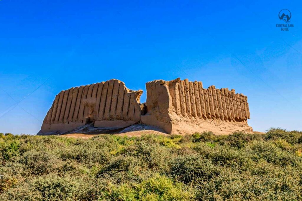
Little Kyz Kala
Unlike Great Kyz-Kala, little Kyz-Kala is not that well preserved. The little Kyz-Kala stands about a hundred meters to the south from Great Kyz-Kala. Its layout was the same yet it has survived in far worse condition. The folded facade can be seen only on the eastern side of the structure.
Abdulla Khan Kala
Abdulla Khan Kala is located in the southern part of the Merv site within the group of monuments linked to the Timurid rule in the 15th century. Abdullah Khan Kala lies some 3 km south of Sultan Kala and was built in 1409 by Shah Rukh, who had taken control of the empire of his late father Timur, known as Tamerlane in the West.
This fortress has a square plan and its city crumbling walls, made from the mud-brick, are its most prominent surviving feature. You can also still see the canal surrounding the walled city.
Bairam Ali Khan Kala
Bairam Ali Khan Kala is another landmark located just next to to the Abdulla Khan Kala. The fortress has the shape of a three-wall structure and is linked to the western wall of Abdullakhan-Kala. The date of the fortress construction is not known but it was named after the governor Bairamali-khan (1781-1785) who was greatly respected by the residents of those times.
Bairam Ali Khan was the ruler of Merv in the latter part of the 18th century, killed in 1785 by Uzbek forces led by Shah Murad of Bukhara. His demise led to the final decline of Merv during the following decades.
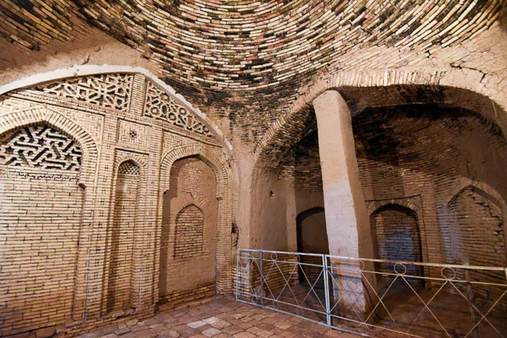
Beni Makhan Mosque
The Beni Makhan Mosque is a historic mosque located in the center of Gyaur Kala in Merv, Turkmenistan, dating back to the 11th century. Renowned for its exquisite architecture, it reflects the artistic and cultural achievements of the time. The mosque features intricate tile work and a large prayer hall, making it a significant site for both worship and historical study. Today, it attracts tourists and scholars interested in Islamic architecture and the rich history of Central Asia.
Merv Buddhist Stupa
The Buddhist Stupa in Merv is an ancient structure that symbolizes Buddhist teachings and is a vital part of the region’s religious heritage. Dating back to the early centuries of Buddhism, this stupa served as a place for meditation and worship. Its design typically features a domed shape and a raised platform, reflecting the architectural styles of the time. The site attracts researchers and tourists interested in Buddhism and Central Asian history, showcasing the area’s rich cultural diversity.
Shahriar Ark Citadel
Shahriar Ark Citadel is a prominent historical fortress in Merv. Dating back to the 11th century, it served as a royal residence and military stronghold. The citadel exemplifies the architectural grandeur of the Seljuk era and features impressive defensive walls and towers. It played a vital role in Merv’s strategic significance during its peak as a cultural and economic center in Central Asia.
Walled Shahriar Ark Citadel is located east side of the road, after passing the Sultan Kala. The building was based around a central courtyard, surrounded on each side by iwans. The best-preserved building in the Shahriar Ark, however, stands to the northeast of the palace. It is a about 20 m long rectangular building and around 8 m in height. Its outside walls have a distinctive design of vertical corrugations.
Kempter Khana
Kempter khana is the inner part of the Shahriar Ark. Based on one theory, it was used as a “pigeon house” due to its niches, but there is no academic consensus as to the purpose of this unusual building. It is the inner part of the Shahriar Ark. Kempter khana site served as a guesthouse during the Seljuk period, reflecting the region’s hospitality and the importance of trade along the Silk Road. The building showcases intricate designs and offers insights into the social and economic practices of the time.
Merv Mausoleums
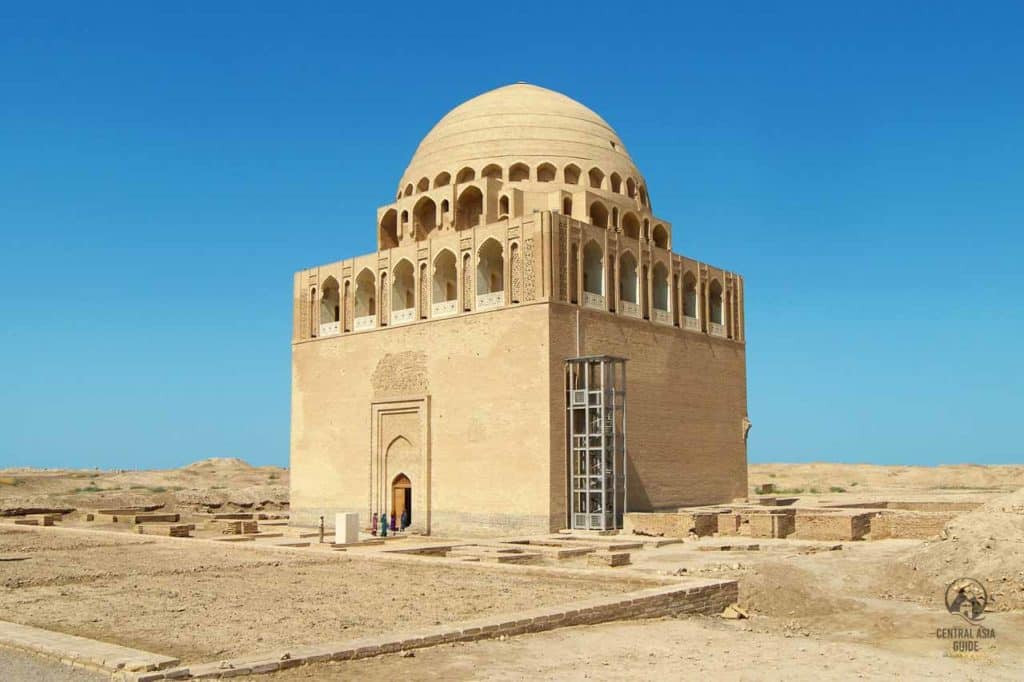
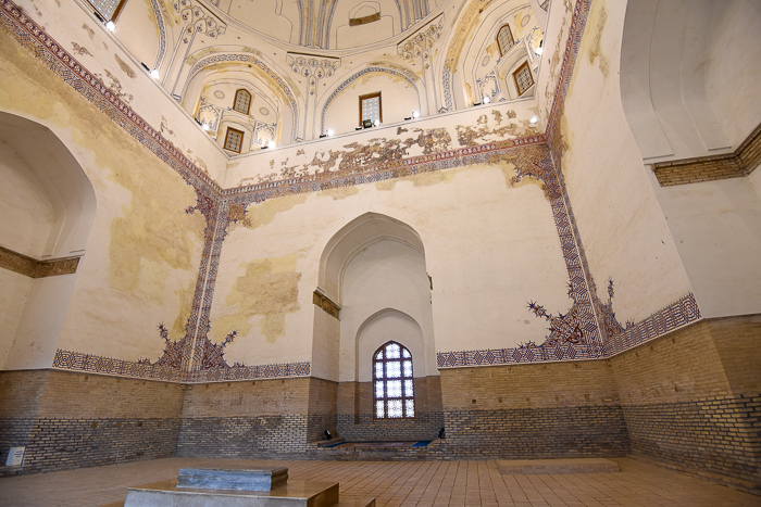
Soltan Sanjar Mausoleum
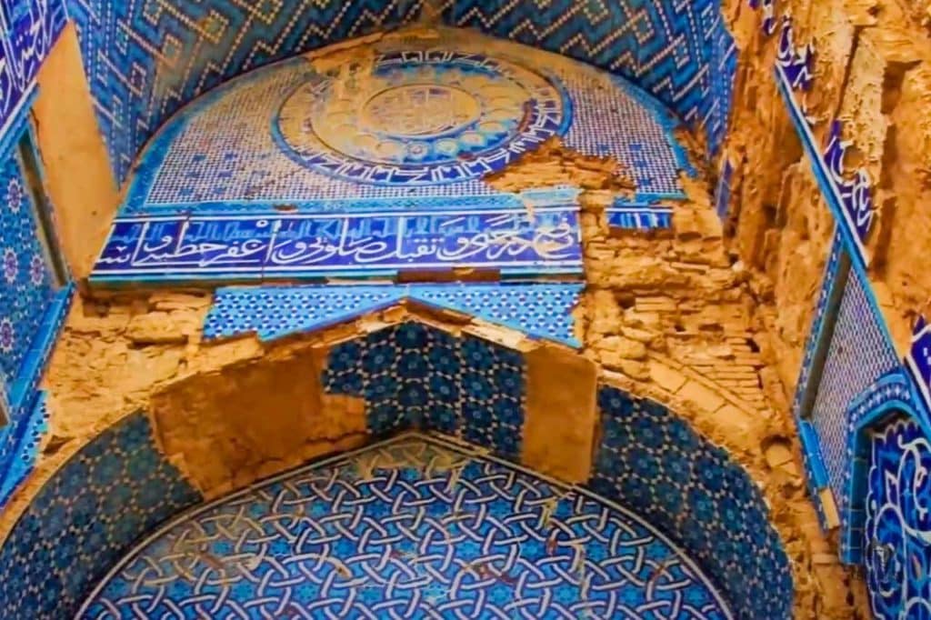
Sultan Sanjar Mausoleum is one of the rare buildings in Merv that have survived to this day intact. It lies in the middle of the Sultan Kala. The tomb was restored with the aid of the Turkish and Turkmenistan governments and today it is listed as one of the UNESCO World Heritage sights in Merv. The tomb is also known as ‘Dar-al-Akhyre” (The Other World). It strongly indicates the greatest achievements and prosperity of Seljuks. Next to it, there are the ruins of large monumental buildings – the palaces of Seljuk rulers and a mosque.
Sultan Sandzhar Mausoleum is a genuine ancient tower of cubic shape crowned by a two-level dome with turquoise encasement. Three-level galleries run beneath the dome in the form of alternating openwork arches. The mausoleum was erected by the order of Sultan Muizeddin Sandzhar. He was buried in 1157 but in 1221 when Mongolian troops attacked Merv, the remains of the Sultan were reburied in an unknown time and place. Therefore there is an empty grave under the tombstone of the mausoleum.
Mosque and Mausoleum complex of Hodja Yusup Hamadani
The mosque and mausoleum complex of Hodja Yusup Hamadani is one of the most popular places of shrine pilgrimage in Turkmenistan. Hodja Yusup was a Sufi scholar of the 12th century, whose teachings formed a significant factor in the development of Sufism in Central Asia. He studied theology in Baghdad and settled later in Merv, where he enjoyed the support of Sultan Sanjar.
He was buried in the city after his death in 1140. The mosque here was one of the few ones in Turkmenistan, that were allowed to operate, albeit under tight control, during the Soviet period. The open-sided square mausoleum, towards the rear of the complex, is a recent reconstruction. A group of buildings along the west side of this, around a central ivan, were possibly initially built in the Timurid period.
Muhammad ibn Zayd Mausoleum
The Muhammad ibn Zayd Mausoleum, located near the Sultan Sanjar Mausoleum, is an important historical and religious site built to honor Muhammad ibn Zayd, an influential Shi’ite cleric from the 8th and 9th centuries. Zayd played a key role in spreading Shi’ism across Iraq during the turbulent reign of Al-Ma’mun, the 7th Caliph of the Abbasid Caliphate, from 813 to 833. Despite the Abbasid Caliphate’s hostility toward Shi’ism, Zayd’s efforts were significant, particularly during the unrest caused by various uprisings, including the revolt of Abu al-Saraya, which proclaimed Zayd as a new imam.
The Abbasid Caliphs were often antagonistic toward Shi’ism, with some caliphs being openly intolerant. Under this political environment, Shi’a Muslims faced oppression, and uprisings, like that of Abu al-Saraya, became common. Zayd, who was the son of Musa al-Kazim, became a notable figure within the rebellion. His opposition to the Abbasid regime led him to Basra and Kufa, where he became a symbol of resistance. However, the rebellion was swiftly suppressed, and Zayd was captured, executed, and his death marked the end of his direct influence. The mausoleum, built around 1140 during the reign of Sultan Sanjar, commemorates his legacy and serves as a symbol for the local Shi’a population.
The mausoleum is built of baked bricks and exhibits a simple yet remarkable design, with a rectangular shape and several domed chambers. Its most notable feature is the memorial chamber, located in the southwest corner, which is oriented to the west-southwest (WSW), aligning with the qibla direction toward Mecca. Although it was not used as a mosque, the presence of a mihrab (niche) within the memorial chamber suggests its symbolic significance in guiding worshippers.
The building’s design is similar to other Seljuq-era structures, such as the Ismail Samani Mausoleum in Bukhara, characterized by its use of unadorned brick and intricate architectural details. The construction of the mausoleum includes highly detailed squinches, tympana with herringbone patterns, and a calligraphic band in Kufic script around the perimeter, showcasing the skill and artistry of the time. The simplicity and elegance of the structure reflect the Seljuq preference for unembellished, yet architecturally sophisticated brickwork.
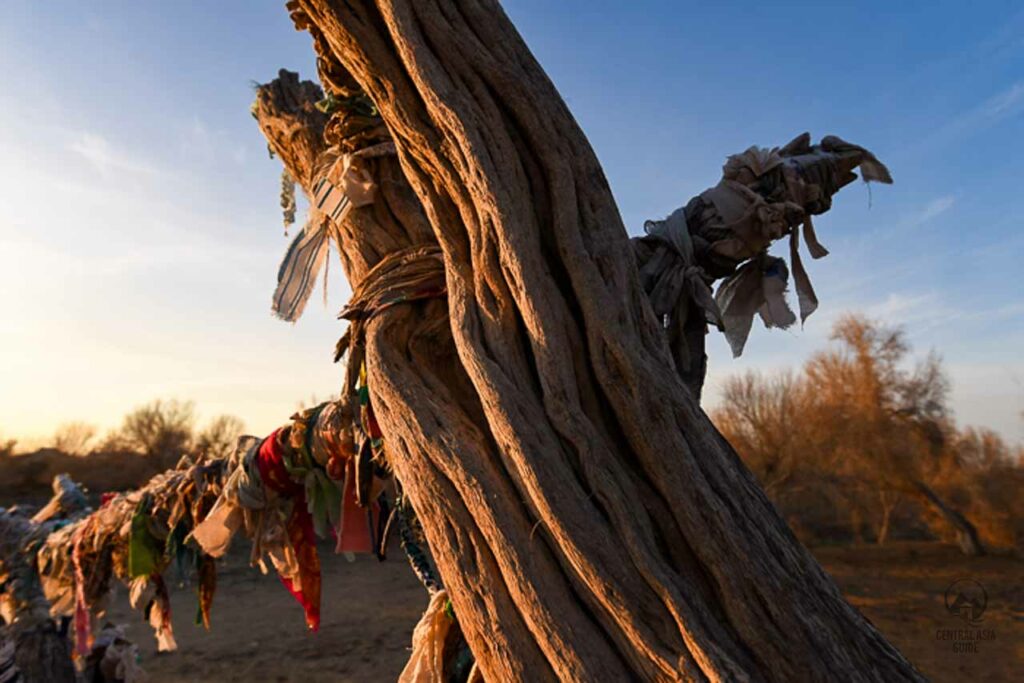
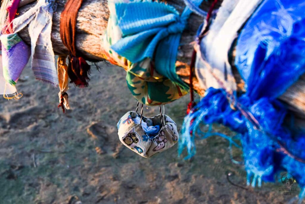
Merv Pilgrimage Site and Surrounding Area of Muhammad ibn Zayd Mausoleum
In addition to the mausoleum, the area features several ruins, including the remains of a caravanserai, indicating that the site once hosted pilgrims. A step well, known as a sardoba, is also present, though it no longer holds water.
Today, the mausoleum is a site of pilgrimage, where visitors often leave small offerings such as scraps of fabric tied to trees or tiny ornaments, especially in hopes of blessings such as fertility. This ongoing tradition highlights the continued reverence for Muhammad ibn Zayd and the mausoleum’s significance in both historical and spiritual contexts.
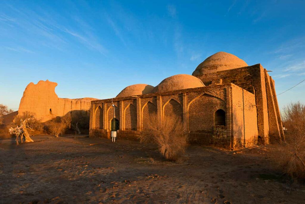
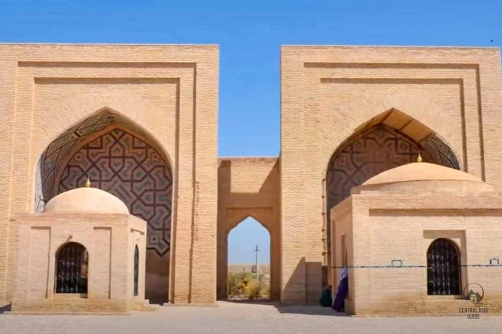
Askhab Mausoleums
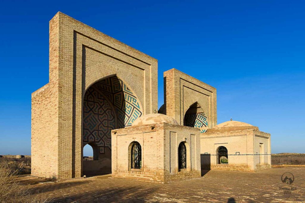
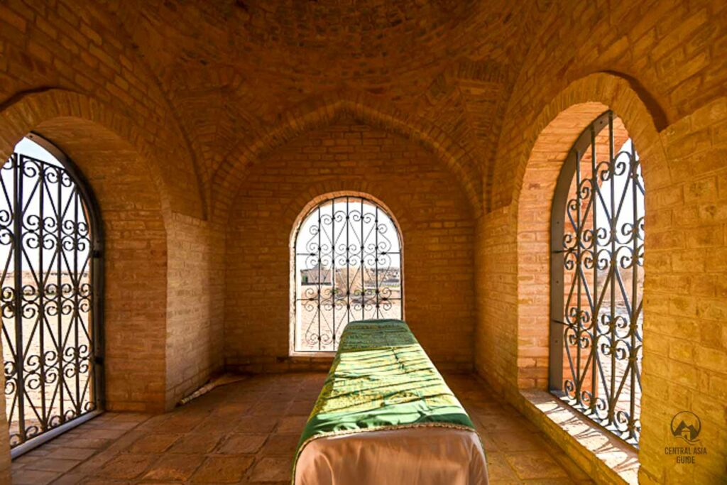
The Askhab Mausoleums, located in Merv, were built during the Timurid era to honor two of Prophet Muhammad’s earliest followers, Abu Dhar al-Ghifari and Abu Buraidah al-Aslami. These mausoleums consist of two iwans, which are monumental portals commonly used in Timurid architecture. The original structures were likely built in the Seljuq era but were destroyed during the Mongol invasions in the 13th century. The Timurids reconstructed them in the 15th or 16th century.
The iwans were restored in 1992 and feature intricate tile work with geometric patterns and Kufic inscriptions. The colors used in the tile work are cobalt blue, turquoise, and tan-colored brick. The conservationists carefully matched the original colors to create a seamless blend of old and new tiles. The iwans serve as backdrops for the two small tomb chambers that house the cenotaphs of the two companions of Muhammad.
In addition to the tombs and iwans, there is a small sardoba located nearby that was once used as a source of clean water. Unfortunately it has been polluted with trash and may no longer be suitable for drinking. The site also features a modern prayer hall and a refectory. It is believed that the mausoleums were originally intended as sites of ritual commemoration, and not the actual burial sites of the two companions.
Kyz Bibi Mausoleum
Kyz Bibi is a small reconstructed square mausoleum, open on all sides and located west of the Sultan Sanjar Mausoleum and South of the road. It is not known who is buried in the tomb and there is no sarcophagus inside the tomb. However, some scientists believe that this may be the burial place of Sultan Sanjar’s wife, Turkan-Khatun. Pilyavskiy, who researched the tomb before the renovations, dated the tomb to the 11th-12th centuries.
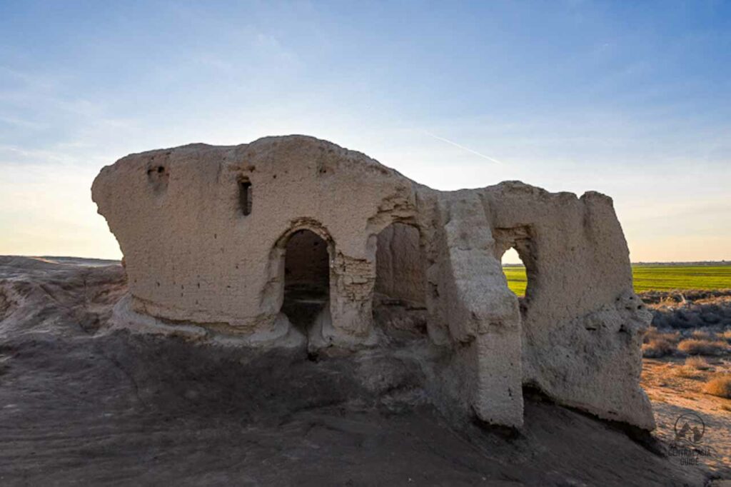
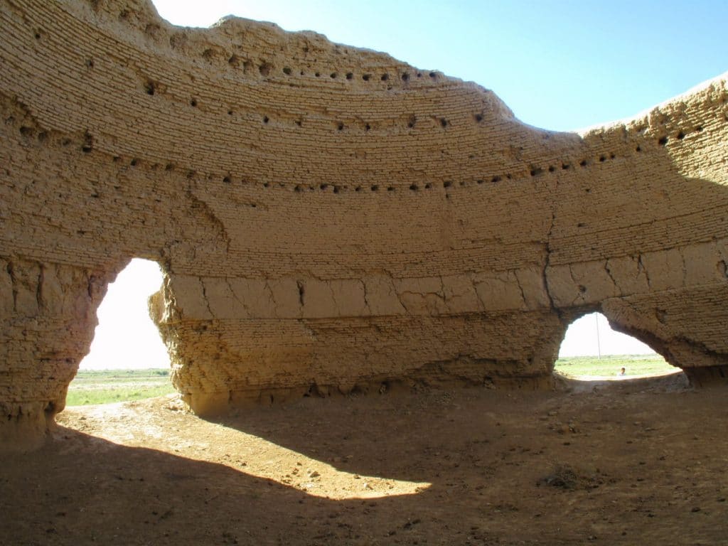
Merv Ice Houses
These large ancient “freezers”, made from brick and covered by a conical-shaped roof, were used to keep meat and other foods frozen during the summer. They can be found south from Gyaur Kala.
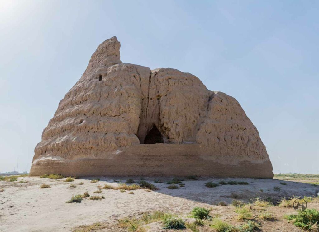
First Ice House
A building with the diameter of 13 m, believed to be a Timurid ice-house, is located in wasteland about 500 m to the north of Abdullah Khan Kala. Today it is a roofless building of rounded pyramidal shape and its interior walls pierced with many beam-slots. Most archaeologists believe that the buildings were used for the storage of ice, although some sources claim that they may have been water wells.
Second Ice House / Koshk Imaret
Some 100 m to the southeast from the first ice house, you will reach the second ice-house. It is a building known as the Koshk Imaret. This is a Timurid pavilion, that would once have lain in the heart of gardens. It is rectangular in plan, with its main, arched, entrance on the west side of the building, flanked by arched niches. Traces of plaster have been found on the inside of the building, still preserving the pink color in which the pavilion was originally colored.
Third Ice House
This ice house has a rather different form from the others, having a taller and steeper design. Fragments of wooden beams have survived in many of the slots around the internal walls. Some researchers believe that the buildings may date from the Seljuk rather than the Timurid period. This ice house, the closest to Giaur Kala, is perhaps the best-preserved structure among the three.