Ugam-Chatkal
National Park
Ugam-Chatkal National Park
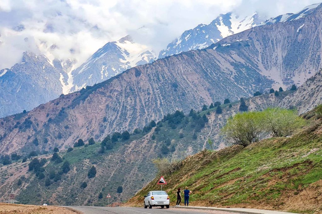
Ugam-Chatkal National Park is the national pride ecosystem of Uzbekistan and conveniently only an hour drive away from Tashkent. It was established in 1990 based on the Chatkal Biosphere Reserve and is mostly located in the Greater Chimgan mountains. Since 2017 it has been included in the UNESCO World Heritage List. The area of the park is a staggering 668 350 hectares.
The Chatkal Mountains stand out from the steppe 80 km northeast of Tashkent, presenting one of the most scenic landscapes of the Uzbek nature with thousands of flora species and hundreds of fauna as well. Ugam Chatkal park in Uzbekistan is squeezed between the borders of three neighboring countries that share the vast mountainous area with Kyrgyzstan (Besh Aral state Reserve) and two Natural Reserves with Kazakhstan (Aksu-Zhabagly and Sairam-Ugam). Together they form a large network of protected nature reserve.
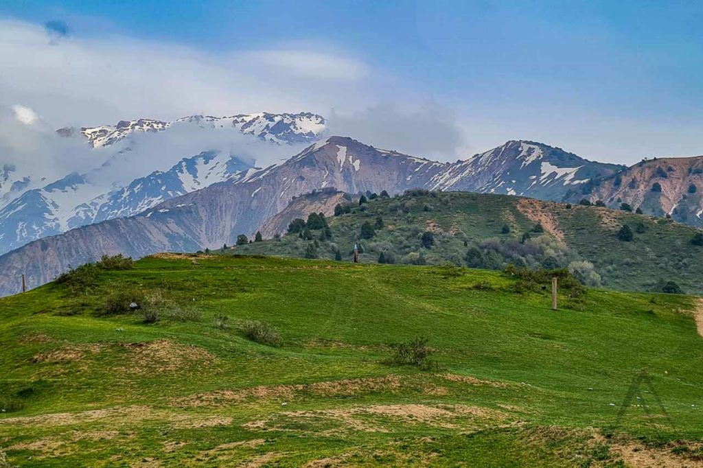
Chatkal National Park is not only mountain forests and steppes but also alpine meadows, high-mountain glaciers and several climbing trails. The reserve zone of the park is closed for free visits by tourists, but a large portion of the park is open for tourism.
The open part includes trails leading to valleys, rocky areas, gorges and mountain peaks. Furthermore, petroglyphs can also be found on the banks of the Tereksay river. The reserve is a perfect recreation getaway destination for Tashkent and Shymkent residents who come here for hiking, climbing, picnics, rafting in the fast-running rivers, or heli-skiing at rock-bottom rates. The best season for summer activities is from May till July. Skiing season varies yearly depending on the snow conditions.
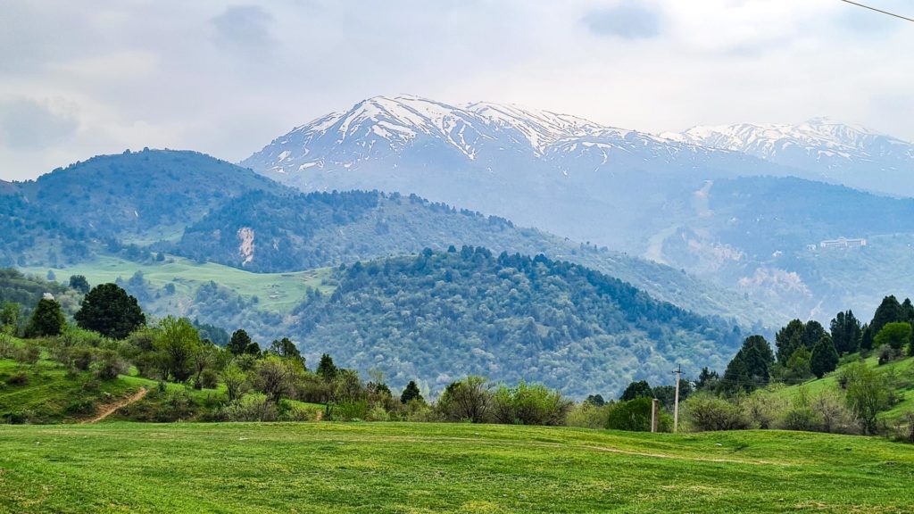
Table of Contents
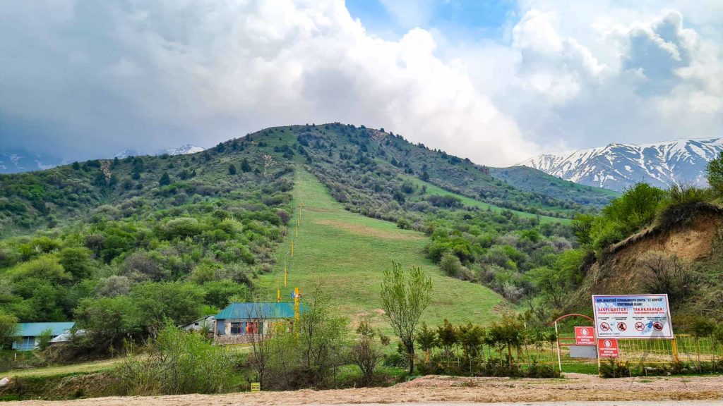
Chimgan Ski Resort
From December to March, the Chimgan Ski Resort gathers ski enthusiasts from Tashkent and visitors of the capital. The majority of skiers take the chairlift up to Great Chimgan (3309 m), the highest peak in order to race down the Kumbel track, but it is also possible to fly up to 3000 m and be deposited on virgin powder snow. A day’s lift pass is only about 10 000 sum and skiing and snowboarding gear is available for rent. In the summertime, Chatkal Park becomes an ideal trekking ground. There are many routes suitable for all degrees of fitness: serious trekkers should take a guide and a border permit to reach the glaciers of the Pskem Mountains alongside the Kyrgyzstan border, but there are also opportunities for more casual trekkers with a day or two to spare.
Ugam-Chatkal National Park Rivers
Chatkal River
Chatkal is a powerful river that originates from the southwestern slopes of the Talas Alatau ridge in Kyrgyzstan with a length of 217 km. On the territory of Uzbekistan, several tributaries flow into the Chatkal, including Akbulak, Kazanaksay, Paltau and Chukuraksa. Waterfalls, cascades of rapids, whirlpools and rocky gorges all offer physical challenges, but the landscape is diverse and the route is filled with excitement. The autumn months are the ideal months for rafting.
RAFTING: The first canyon contains a perilous waterfall, with two steps, each of around 4 m. It is followed by a 100 m stretch of rapids, and the confluence of the Chatkal and Ters rivers. The rapids here are considered one of the most difficult parts of the route. In the second canyon, the stone walls tower high above the river on both sides. The third canyon is narrow; the river winds through a corridor 200-300 m high, the rocks pitted with grottoes and caves. Cornices overhang the water, in places blocking out the sky. The riverbed narrows to just 6 m wide but then opens out again to floodplains of forest and meadow. Peak Chatkal (4503 m) rises majestically in the distance.
Crossing the fourth canyon is relatively straightforward, but you quickly enter the most dangerous rapids of the trip, situated in the fifth canyon. The rocks narrow into a corridor known as ‘the diaphragm’, after which the river calms and widens. There are sandbanks and rock beaches on both sides of the river here. The final stretch of rapids is after the fifth canyon at Aurahmat. They occur only when dams upstream are opened for irrigation.
Paltau River
Paltau is a mountain river (Sai) in the Bostanlyk region of the Tashkent region and a tributary of the Chatkal River flowing directly into the reservoir Charvak. The valley of the Paltau River in the lower and middle parts is flat. About 4 kilometers from the mouth, the river makes a sharp bend. Here, among the rocks, there is also a waterfall called Paltau. The sources of the Paltau River are located in the spurs of the Koksuy Range, near the state border with Kyrgyzstan.
Paltau flows into Chatkal reservoir two kilometers upstream from the road bridge, not far from the town of Obi Rakhmat. The tributaries of the Paltau are mostly dry in the summertime. The slopes of the Paltau river gorge are overgrown with mixed forest – birch groves, fruit and berry trees. Many flowers and medicinal herbs grow along the slopes of the gorge. In the valley of the Paltau River and its tributaries, you can also pick mushrooms but be sure to have a local guide to make sure you are picking the good ones and leaving out the possibly poisonous ones.
Paltau or Pulat-tau, which means “Iron Mountain” as these places are rich in iron ore. In the Middle Ages there was a mine and the remains of smelting furnaces are still preserved. Geological explorations were conducted in the Paltau gorge in the 1930s and 1940s resulting with some fluorite deposits but the project turned out to be unprofitable. Access to the Paltau valley is possible currently only with special permits due to the proximity to the state border. You can obtain an entry permit through the local travel agencies.
Obi-Rakhmat Grotto (Cave)
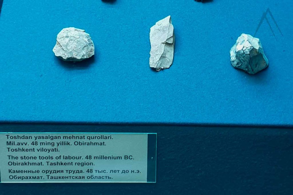
The Obi-Rakhmat grotto lies in the valley of the Paltau River. An archeological team discovered the site accidentally while examining the area of the future Charvak reservoir in 1962. The cave’s age is estimated being at least 50 000 years. During the further study, the team managed to find about 500 stone items from the cave.
The cave is about 9 m long, 20 m wide at the entrance and lies at an altitude of 1250 m above sea level. Numbers of artifacts such as teeth on large scales, unidirectional blades and flake shafts (mostly retouched blades and retouched pointed blades), while other common types of artifacts include incisors, atypical end-scrapers and many more items were found at the site.
(photo on the left from the Tashkent history museum)
The artifacts found in the Obi-Rakhma have common feature artifacts of the Late Middle Paleolithic and with elements of the Early Upper Paleolithic ages of Southwestern Asia and Mountain Altai. It appears that the Upper Paleolithic age in Altai arose as a result of the local culture of the Middle Paleolithic age, that formed on the territory about 100-50 thousand years ago.
The path to enter the cave leads you through charming rock formations, located above the Paltau channel and just below the houses of a small farm. You will most likely notice first the big holes made by the archaeologists, who dug a ten-meter deep and about 3×5 m wide hole in the process of excavations. In order to go down you might need a rope.
Hiking up you will notice the entrance to the cave. At first glance, you can feel the chaos of the abundance of bones here of a mass grave than centuries-old layering. Right in the center, below, on the ruins from the crumbling wall, lie in a heap, someone collected human remains from jaws and several large bones.
Ugam-Chatkal Waterfalls
Paltau Waterfall
The powerful and easily accessible waterfall of Paltau is located in the Paltau track. Its height is about 35-40 meters. Previously, it was called the “Academic” waterfall, because there used to be a rest house of the Academy of Sciences of the Uzbek SSR while the excavations of the Obirakhmat grotto were carried out. Paltau waterfall’s source is mountain Sai and the Chatkal River, which begins high in the mountains, in the spurs of the Koksuy Range located near the border with Kyrgyzstan. You can reach the waterfall from Tashkent by a good dirt road and a trail passing from the Tashkent-Burchmulla highway going to the village of Paltau.
Chukuraksu Waterfall "Bride's Veil"
This large gorgeous waterfall is located not far from the Charvak reservoir. Chukuraksu is a tributary of the Chatkal River, which in turn feeds the Charvak reservoir. The height of the Chukuraksu waterfall is about 25 meters. According to the locals Chukuraksu waterfall is one of the most beautiful and popular destinations in Uzbekistan. This beautiful waterfall is hidden in the depths of the Chatkal river gorge. The trail winds through a gorge among thickets with a narrow path. The best season to visit the waterfall is June when nature is all about deep green colors and the fresh waters of the waterfall are pleasant. To visit the waterfall you will need special permission from the authorities since it is located in a restricted zone on the border of Uzbekistan and Kyrgyzstan.
Ugam-Chatkal Lakes
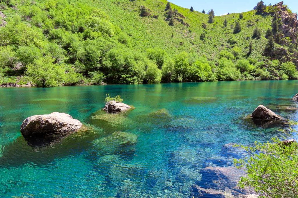
Urungach Lakes
Uzbekistan has some scenic mountain lakes and as usual, many of them are located in hard-to-reach areas. Among them are the Lower and Upper Urungach lakes, also known as Jade lakes for their beautiful blue and green mix colored waters. Urungach lakes are placed in the Ugam-Chatcal National Nature Park in rather hard to reach territory about 160 km from Tashkent. There is still a good trail leading to the first lake.
The water on the lower lake is very cold but the scenes are marvelous. Peace is all around and the bright beauty of the place just fascinates with the views. The lakes have been formed in a natural way after rock collapse that created a natural dam. The level of the small lake differs greatly depending on the time of year. In the springtime, the lakes are full and look brighter whilst after the hot summer they lose a lot of water and you almost can not recognize them being the same lakes in the autumn. Since the area is quite close to the Uzbek-Kazakh border, you need to obtain permission in advance to entering the lakes.
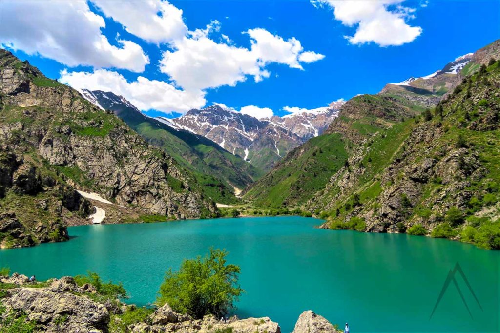
Badak Lake
Another pearl of the Ugam-Chatkal National Park is the Badak Lake, which is located at an altitude of 1700 meters above sea level. The name Badak, Turkic origin (baytak) means “wide”. If you climb the dam, you can see that the lake stretches from east to west for more than a kilometer and is more than 200 meters wide. The lake has an interesting phenomena during summer as it changes the color depending on the time of the day. In the early morning, it is blue-green, towards midday it becomes bluish, and at sunset it becomes silvery.
Badak is also one of the largest water storages after the Lake Bolshoy Ihnachkul. Badak lake is also associated with the legend of the “Deva” who lives in the lake and drags people away underneath the water. For this reason, the superstitious locals avoid swimming in the lake.
Ugam-Chatkal Canyons
GulkamCanyon
Gulkam Canyon, nestled in the Greater Chimgan Mountains, is a breathtaking natural wonder sculpted over a million years by the Gulkamsay River. This narrow gorge, with its towering cliffs that soar hundreds of feet, sees sunlight touch its floor only at midday. Known for its steep walls, dramatic gorges, and colorful rock formations, the canyon is a paradise for adventurers and nature enthusiasts. Visitors can explore trails of varying difficulty, with some paths requiring scrambling through rugged terrain. Its rugged beauty and thrilling challenges make it a favorite destination for lovers of mountain landscapes and outdoor adventure.
The canyon is particularly stunning during spring and summer when its lush greenery and blooming alpine flora are at their peak. Accessible from Tashkent, the journey often begins near Chimgan village or the nearby tourist camp, leading to the Sandy Pass (1,820m), which provides panoramic views of the Chimgan Mountains before descending into the gorge.
Deeper into the canyon, highlights include a magnificent 10-meter waterfall and crystal-clear pools, which require navigating narrow ledges and steep cliffs with the help of ropes. This exhilarating section is a must-see, though a memorial near the waterfall serves as a sobering reminder of the risks involved, especially during the rainy season. Eventually, the canyon opens into gentle hills with vistas of the Charvak Reservoir. For those seeking a less strenuous experience, alternative routes offer glimpses of the canyon’s beauty without the more extreme challenges. Whether you’re looking for a thrilling trek or a peaceful escape, Gulkam Canyon delivers an unforgettable journey.
Kulasya Canyon
Kulasya Canyon is a hidden treasure of the western Tian Shan Mountain range. This remote and picturesque canyon is known for its dramatic cliffs, deep gorges, and rock formations shaped over centuries by natural forces. A river runs through the canyon, carving its way through the rocky terrain and creating a series of small waterfalls, streams, and tranquil pools. These water features, paired with patches of greenery, offer a striking contrast to the rugged wilderness and provide serene spots for relaxation.
The canyon’s trails vary in difficulty, making it an excellent destination for both casual hikers and experienced adventurers. Narrow paths and rock formations invite exploration and light scrambling, rewarding visitors with stunning panoramic views of the mountains and valleys. The tranquil atmosphere of the canyon, combined with its relatively untouched and uncrowded nature, makes it an ideal retreat for those seeking solitude.
Spring and autumn are the best times to visit, as the weather is mild and the landscape vibrant, while summers can be hot, and winters bring snow and ice that can make hiking more challenging. Accessible from Tashkent, the journey to Kulasya Canyon typically involves navigating mountain roads, so hiring a guide is recommended for safety and ease. Visitors should wear sturdy footwear, bring water and snacks, and respect the pristine environment by following Leave No Trace principles.
Destinations & sights near Ugam Chatkal
Page updated 27.11.2024