Ala Archa
Ala Archa National Park
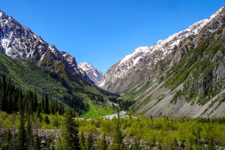
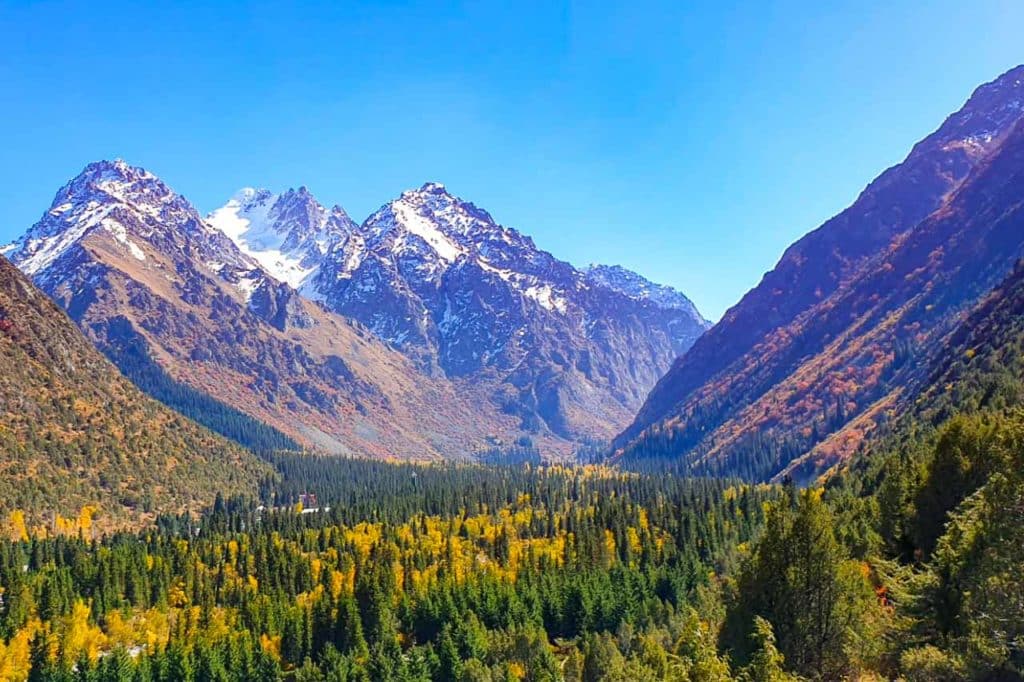
Ala Archa is a valley and a National Park located about 40 km south from Bishkek. In Kyrgyz language Archa is a juniper family tree which gives the park its name. Ala means multicolored so the name of the park translates as the multicolored juniper tree and it is easy to notice why while visiting. Kyrgyz people have traditionally held their juniper tree in a special esteem, using smoke from its burning branches to chase away evil spirits and also to clean the air from bad smells and the smoke from the burning or the Archa branches actually has a nice smell to it. This is considered a tradition originating from Zoroastrianism.
Archa trees can be found in abundant locations in the valley and the branches are sold still today in the bazars and sometimes in the streets of larger towns as well. Inside the park there are of course a lot of archa, but also spruce forests by the mountain slopes and lots of shrubs and birch trees growing in the lower areas.
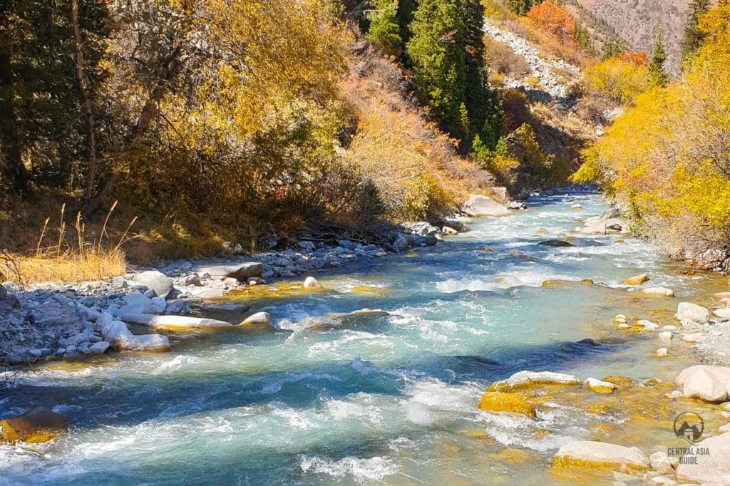
In Ala Archa valley, you can also find a good sized river, also called Ala-Archa, that runs all the way along the road to Bishkek through the Osh bazar and until the Ala Archa reservoir which is located at the north side of Bishkek and finally joining the Chu river that acts as the borderline between Kyrgyzstan and Kazakhstan. Ala-Archa is an easy way to get to know with Kyrgyz mountains, flora and fauna and you can also do different length hiking trips within the valley.
Ala-Archa is also one of the closest places to breathe the fresh air after Bishkek’s poor air quality. The park is also a suitable place to visit with kids and there are tables along the walking way from the alp lager (2200 m) where you can have a picnic and walk safely in the shade given by the trees in the picnic area. It is a great day trip to run away from the bustle of Bishkek and heat especially during the hottest summer period. Ala Archa is included in many of our Kyrgyzstan Tours and Central Asia Tours. The parks tends to get crowded during the summer weekends as the locals flock the area so that it could be hard to find a parking place.
Ala Archa National park
The alpine Ala Archa national park covers an area of about 200 km² and stretches for over 35 km of the western Tien Shan (Celestial Mountain) range. The national park’s altitude ranges from about 1 500 meters (5,000 feet) at the entrance to a maximum of 4 895 meters at Semenova Tian-Shanski, the highest peak in the Kyrgyz Ala-Too range (a part of Tien Shan near Bishkek). As the park is located on the north slope of central part of the Kyrgyz Tien Shan ridge, the park has become in many ways the symbol of Ala-Too mountain ridge itself and is a great location for day trips and hiking for both casual walkers and serious mountaineers alike.
The region’s most famous and highest peaks of the Ala-Too Mountains rise out from the Ak-Sai glacier. They are called Korona (4860 m), Semenov-Tyan-Shan peak (4875 m) and Free Korea (4740 m) peaks and all of them are higher than anything Europe has to offer. In addition to more than 50 mountain peaks, Ala Archa gorge is also a home to more than 20 glaciers and 30 mountain passes. It is possible to trek to almost 5000 m in Ala Archa, but most people stay near the lower reaches just for picnics or shorter hikes. There are about 140 classified mountaineering routes of various levels of difficulty and complexity that have been mapped out and yet places still unexplored.
In addition to the Ala-Archa river, there are two other significant rivers confluencing with it ,called the Adygene and Ak-Sai, that are both also fed by glacial melt-water. These rivers also mark some of the most visited hiking trails. There are also several smaller tributaries called Top Karagai, Teke-Terre, Tuy-Suu Adygine, Jindi-Suu and so on.
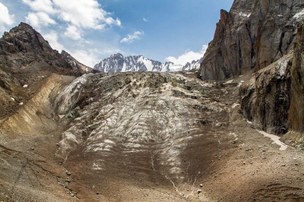
Ala Archa (Ak Sai) waterfall and glacier
For adventurous ones there is a lot more of the valley to explore than just the picnics. One can venture all the way up to Ak-Sai glacier and even further to the higher areas. If you want to test yourself it is best to have a local guide with you unless you already have some experience of mountain hiking. Be prepared to bring snacks, water and good hiking equipment to try the eastern path along the Ak-Sai river that takes you first to the Ak-Sai Waterfall and finally up to the glacier’s lowest part, which is 3,3 km above the sea level.
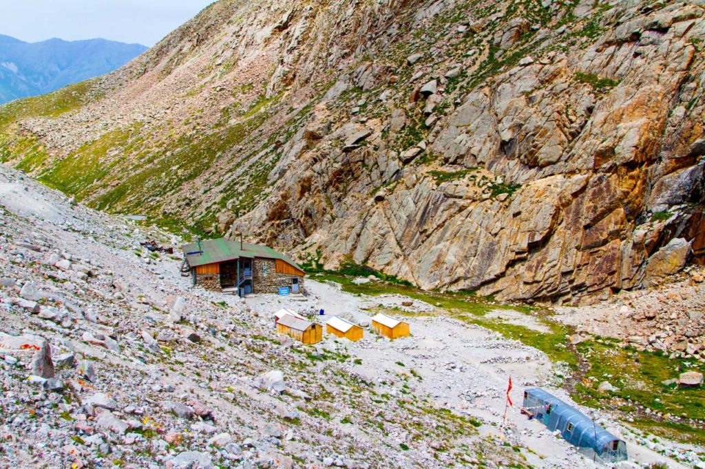
There is also a small stone made hut (Ratsek hut) just next to the glacier. We only suggest this one to the strong footed and considerably fit ones as especially the path to all the way up to the glacier needs some preparation and is not for very beginners.
It is possible to stay in the Rachek hut for the night as it has beds and blankets. The conditions of the hut have been improved lately from the earlier rather Soviet condition and it works as a camp for the climbers where even beginners (rock climbing) can take rock climbing courses and rent equipment.
Here one can also replenish food and water reserves with the pure glacier water.
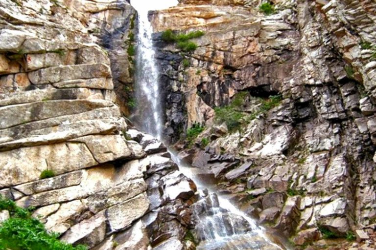
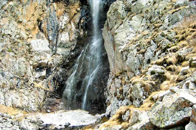
The Ak-Sai waterfall with a height of about 40 m is located at an altitude 2860 m above sea level at a distance of 4,7 km from the Ala-Archa camp site. To get there, you need to take the eastern path starting from the accommodation camp and continue to the left fork of the path up the hill. After 1,5 km you reach two huge rocks lying on the steep slope of the gorge Ak-Sai and have a marvelous view of the Ala-Archa Valley behind you.
The trail continues east, firstly with a small uniform elevation, and then with a slight descent reaching the river Sharkaratma coming from northwest and joining the Ak-Say river. The waterfall might not have that much water or even no water at all during the dry summer months so it is best to visit during spring time or in the early autumn. After crossing the Sharkaratma river the trail continues towards the waterfall towards South-East and is about 1 km away from this point.
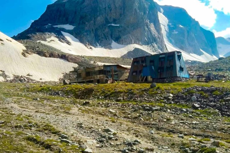
Upper Ala Archa ski base (abandoned)
There is also the option to venture further south all the way up to the abandoned old skiing center called the Upper Ala Archa. There is an old road all the way there but it is not in a condition to be driven. The skiing center is located just next to glaciers and peaks of more than 4 km above the sea level.
There are also several mountain lakes in the vicinity of the ski base. The base itself is at the height of 3400 m. The hike to reach this place is about 15 km and the elevation of height during the route is 1200 meters so this is not for beginners.
Ala Archa flora & fauna
The main attraction of the park in addition to the mountains, rivers, waterfalls and glaciers are is the unique wildlife. Ala-Archa Gorge is rich in flora and fauna with over 800 species of plants, 160 species of birds and about 170 specials of animals in total. In order to protect its tremendous natural diversity, it was made a national park already back in 1976 to protect rare species of animals, plants and trees. The mountain meadows and snowfields above 2500 m elevation provide an unique habitat for wild goats, roe deer and marmots. The valley’s steep wooded slopes, pristine water and craggy cliffs also provide habitats for such species as eagles, Marco Polo sheep, bear, lynx, wild boar, wolves and even the rarely spotted snow leopard. In addition to snow leopard, there is also the very rare blue bird, that the Kyrghyz call “a bird of happiness”, living in Ala Archa.
Everyone entering the park will notice the spruce, birch and juniper woodlands dominating most of the steep slopes of the park. The diversity of flowers and plants are a day dream in spring time (end of May / Beginning of June) for alpine flower enthusiasts as blossoming flowers cover the newly green slopes. Beautiful alpine flowers such as the Crocus cover the meadows in drifts of color each spring giving way to the others following after them. Please bear in mind that as Ala Archa is a protected area, picking flowers or berries, collecting medicinal herbs, catching butterflies or other insects, is prohibited.
Accommodation in Ala Archa
It is also possible to stay in Ala Archa for the night as there are government rented rooms available. If you want to organize a day trip or to rent a room or other facilities like conference hall or for example a yurt, please contact us. As Ala Archa is close to Bishkek, it is not often required to stay there unless preferred by the guests.
Trekking and hiking in Ala Archa
There are clear signs and maps indicating what your hiking options are in Ala Archa. In principle, you can either go left or right. The trail to the left, “Ak-Sai Waterfall Trail,” leads you to a waterfall taking 2-3 hours and further to the Ak-Sai Glacier in 4 – 6 hours one way.
The trail to the right is labeled “Ala Archa River Trail” following the river and old road to the ruined skiing center and is considerably easier. If you have sufficient time and are looking for a challenge, we recommend hiking to Ak-Sai Glacier. If you have less time and want to enjoy a leisurely walk and picnic (like the locals), opt for the River Trail.
Ak Sai Glacier hike in Ala Archa
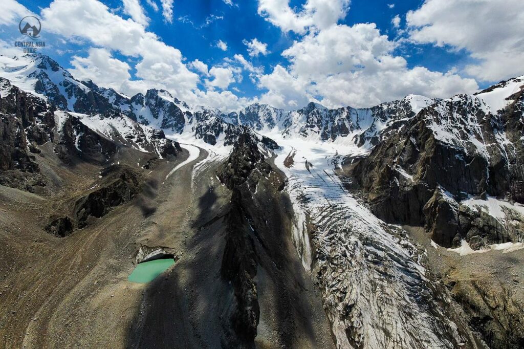
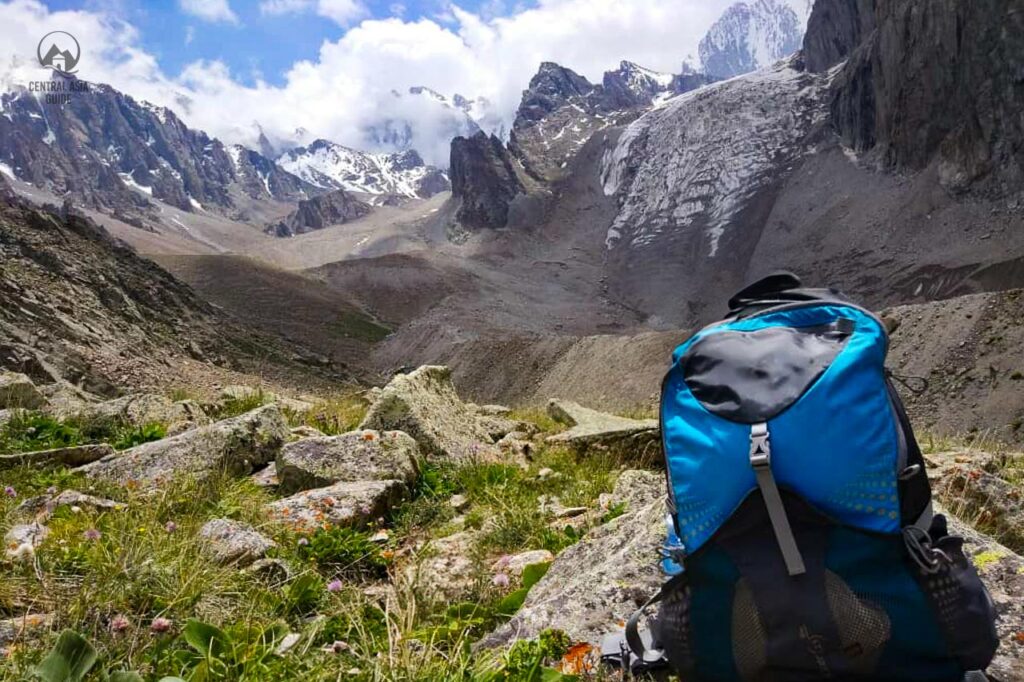
The hiking trail to Ak-Sai Glacier is 6,4 km one-way with the elevation gain of about 1,1 km and is marked by an occasional blue and white trail marker, but the footpath is clear. For further guidance, you can always refer to Maps.me. The trail ascends initially through a forest before reaching a marmot-filled meadow carpeted in wildflowers. In each direction, you’ll see beautiful mountains rise above the river valley.
After a 4 km hike on a mostly flat trail, you’ll arrive at the waterfall camping area at 2655 meters elevation. The trail doesn’t directly intersect the waterfall, so if you want a close-up view, you’ll need to venture off the trail. Next, the path ascends steeply for another two hours to Razeka station, elevation 3300 meters. Here, you’ll find a mountain hut where you can eat and rest during the summer time and also a camping area. As you approach Razek hut, Ak-Sai glacier becomes increasingly more impressive. The best view of the glacier is from the ridge above Ak-Sai mountain (Razek hut) which also marks the end of the trail.
The hike to Ak-Sai Glacier is a doable day hike if you get an early start but for a beginner it is most likely too much as. The trip can be done easily in two days by overnighting in the Razek hut camping area. Many climbers use this area as a base, before exploring the various peaks in the park.
Given the altitude of the hike, it’s not uncommon to experience shortness of breath and even AMS (Altitude Mountain Sickness). We recommend drinking a lot of water and hiking at a slow, steady pace. Hiking poles will be tremendously helpful, especially for the segment between the waterfall and Razeka station.
Travel to Ala Archa
You can reach the park by hiring a taxi almost anywhere from Bishkek, or by trying hitchhiking along the road going south to Ala-Archa. You should be able to find a ride for a few hundred som. Some tourists also rent a bike to reach the park, but bear in mind that the elevation difference from Bishkek to Ala Archa is significant.
In May 2025, new electric buses began operating at Ala-Archa National Park as part of a broader strategy to promote sustainable tourism and improve the visitor experience. There are two electric shuttles operating in the park that transport visitors free of charge from main points like Ak-Bata, Saz, Karagai-Bulak, Cher-Zhaz, and Ak-Sai.
Moreover, a special semi-express bus line (Route No. 1) was organised from Bishkek to Ala-Archa for the May holidays, running from May 1st through 11th. These buses departed from T. Usubaliyev Square and operated from 8:00 AM to 7:00 PM. The fare was 50 KGS for cash and 40 KGS for non-cash payment.
Private petrol or diesel-driven cars will no longer be allowed to enter the park from May 2025. For the benefit of visitors, a massive parking area is being developed near the park entrance where tourists can park their cars and travel further in electric buses. It aimed at reducing environmental pollution, keeping the natural surroundings of the park, and providing a more eco-friendly and enjoyable experience for visitors.
Other sights & Destinations near Ala Archa
Page updated 22.4.2025