Navoi
Navoy
Navoi (or Navoy) is located in an area where nomadic shepherds share the steppe-land around the city with state held cotton farms. Despite the arid climate, cotton is still grown here with the help of the irrigation waters from Zarafshan river, though Navoi is mostly nowadays living from mining and processing of minerals and substances like gold, natural gas and production of chemical fertilizers. The northwestern part of the region is occupied by the Kyzylkum plateau, the Nurata mountain ranges stretch in the east and the Zarafshan River borders the southern part of the region.
Navoy city resembles a typical Soviet/Uzbek new town, formed originally from almost nothing. The region has the lowest population density in the country, which is understandable, as the region falls within the vast Kyzyl Kum desert (Red Sands) which is the largest desert plain in Central Asia, covering around 300 000 square kilometers.
Navoy History
Since ancient times, the most important trade routes have been passing through this territory along the Zeravshan river that originates from Tajikis mountains and connects Navoi with ancient cities like Samarkand and Panjakent. The Silk Road from China to the Mediterranean and further to Europe, as well as the trade route connecting the western and northern neighbor and further countries with India.
Earlier there was the village of Kermine (Now a part of Navoi named Karmana) at the site of modern Navoi, which was once part of the Bukhara Khanate. In 1958, according to a government decision, the construction of a mining and metallurgical plant began in the area of the village and a new city was founded little bit south of Karmana.
Navoi has a convenient geographical position between Bukhara and Samarkand at an altitude of 347 meters above sea level, at the south bank of the Zarafshan River, 100 kilometers northeast of Bukhara.
Althought Navoi is mostly an industrial city it has some history left from the earlier times making it a place worth of visiting after one has seen the major sights of Bukhara and Samarkand or while driving between the cities. The old parts of the town are located at the Northern part of Navoi, next to the meandering Zeravshan river.
Soviet history lovers will also find a lot of monumental buildings and other things to see in Navoy.
Navoi sights
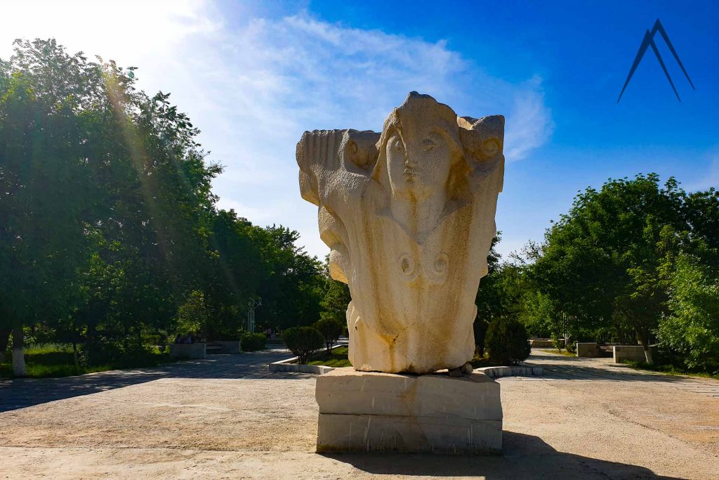
Navoi grew out of the desert in the 20th century. You can take a walk in the big Victory Park where there is also a man made Lake of the same name as the park and of course a statue of the famous poet himself. Next to the victory park there are also an amphitheater, water park and a zoo. In Novoi you can stop also for camel trekking or desert safaris, check the Bronze Age petroglyphs of Sarmysh and to check the medieval caravanserai little bit away from the city. You can also go for bird watching in the Lake Aidarkul and experience staying in a yurt.
Karmana Town
Karmana is an urban-type settlement located at the Northern part of Navoi, along with the Zerafshan. Karmana is the old town of Navoi and it used to be a favored place of rest and recreation for the Bukharan or Karakhanid emirs and governors. The town was also a stopping point on the Silk Road as testified by the caravanserais and rabats that remain.
You’ll surely notice the difference between Navoi and Karmana: Whilst Navoi is modern and includes far too much concrete, large parts of Karmana are still made from traditional mud brick and the pace of life seems slower there. Karmana settled into commercial and political obscurity following the establishment of Navoi in 1958 but it retains a certain charm and all the old sites worth to visit are in the Karmana area of city.
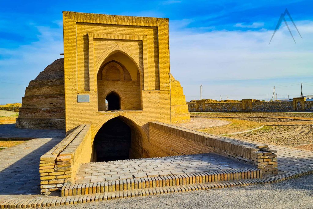
Mir Said Bakhrom Mausoleum
There is an 11th-century brick-built tomb of Mir Said Bakhrom Mausoleum with its dome and monumental portal located next to the Karmana cultural park. It served as an architectural model for many later structures, perhaps including the Ismail Samani Mausoleum in Bukhara. Like Arab Ala in Tim, this 11th-century portal and dome composition marked the birth of a style that would dominate architecture for the next few centuries.
The porch is furnished with a Kufic inscription but unusually this is not made from mosaic or painted onto larger tiles but rather depicted with certain bricks raised out from their surroundings. The mausoleum was added to the tentative list of UNESCO World Heritage sites in 2008 in recognition of its importance as an architectural prototype.
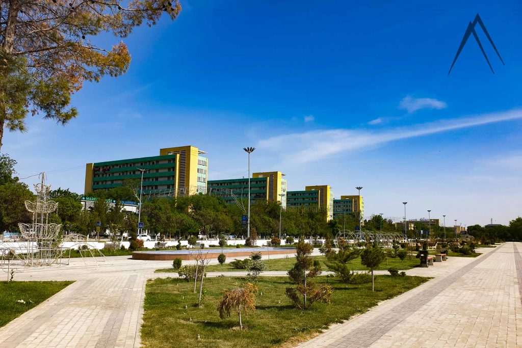
Alisher Navoiy Park
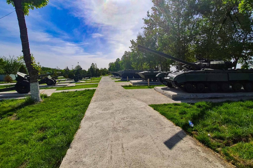
Navoi grew out of the desert in the 20th century, so there’s sadly very little architecture to see around the in city itself. In the center of the city stands a big park of Alisher Navoy with the artificial Lake in the middle. There is also a statue of the great poet himself together with a biggish display of Soviet era military equipment.
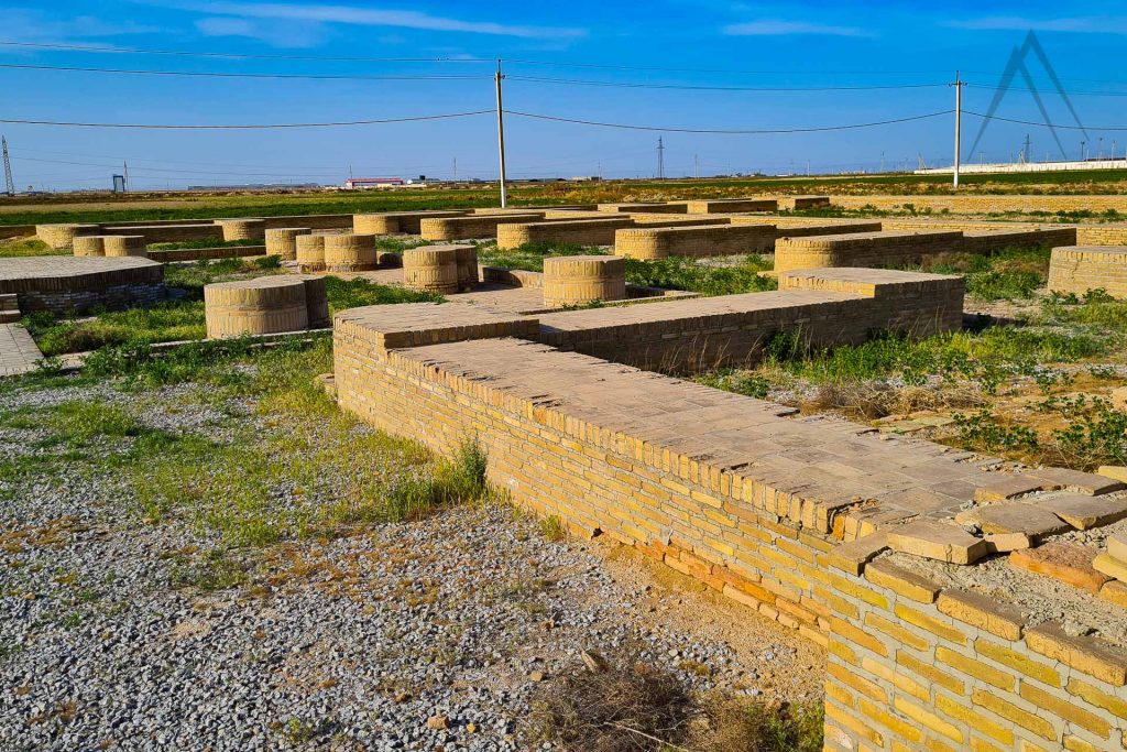
Rabat Malik Caravanserai
Archaeological work reveals the original plan of the caravanserai. It was surrounded by walls ranging from 5,4 to 5,6 m high. On each corner of the enclosure, there was a tower. In total, the caravanserai held a total of 8,277 m². In 1220, Bukhara was destroyed by Mongol conquests and only the portal of the caravanserai remains today. It is built from adobes of size 25x25x4 cm. This “peshtak” with a flying buttress arch and a rectangular opening is one of the oldest and largest in Central Asia. The rim is decorated with inscriptions in Arabic. It has been partially restored but remains mostly authentic.
In front of the caravanserai there is an underground water reservoir called Sardoba Rabati Malik that served as the water source for the caravanserai. It still holds water inside and is located only about 100 meters from Navoi International Airport.
Navoi Outskirt Sights
Deggaron Mosque
Degaron Mosque is one of the oldest mosque buildings in Uzbekistan. This mosque is situated about 30 km west from Navoi near the village of Hazara not far from the Zarafshan River (north from the main road M37). The date of construction of the mosque is assumed to be around the 11th century. The name of the mosque is linked with the name of one of the representatives of the Sufi Shaykh Hozhagon Maloney Deggaroni, who was born in 1313 and was buried in 1376 in this village. Many consider him as a founder of the Sufi school of Bohauddin Naqshbandi.
The mosque is very small but it has a nice park area next to it with some other sights like a cemetery. A chance to see some Uzbek village life on the way. The mosque is surrounded by a very large burial area. Some say that the mosque would be even from the 11th century making it a pre Mongolian mosque which is extremely rare in Central Asia. From the inside it has features that are alike to Armenian built churches making it very peculiar structure in Central Asia.
Burkuteppa Hill Fort
Burkuttepa Hill Fort is another pretty old historical monument, located at the eastern part of the Navoi. The archaeological excavations that were conducted by the Institute of Archaeology of the Academy of Sciences of Uzbekistan decided that it is one of the most ancient citadels in the Central Asian region.
Fragments of boilers, bowls, hums, pans (broiler), pots, jugs, and other utensils materials belonging to 4-3th centuries BC. were found during the excavations. Therefore the settlement was confirmed as one of the most ancient Sogdian urban areas. It is known that the founders of the settlement were settled tribes, later called “karmanintsi.”
Chordar Castle
Chordar Castle is the area’s oldest historical monument of antiquity, located in the town of Kanimekh, not far west from the A379 road. It is a strong castle dating from the 5th century BC. The walls and doorways have been built in the form of arches and are relatively well preserved to this day. The main material for the construction of the castle was large adobe bricks, as well as blocks of broken clay.
Well preserved fragments of pottery that was widely used in the 5th century BC were discovered during the excavations helping to establish the exact date of the construction of the Chordar monument. Adobe bricks measuring 50x30x10 cm were also found, which were also used at that time throughout Asia.
Chormgar – Chorbogh
Four Gardens of Navoi
Chormgar-Chorbog is a historical architecture monument, located in the settlement of Kunya-Ark, Karmaninsky district, Navoi region of Uzbekistan. It was a country palace of Bukharan Emirs, who ruled in the 19th century. The name Chorbag is translated as «Four Gardens». The exact date of palace construction has not yet been confirmed, however, according to residents, the structure of the palace dates back to the 18th century. This historical monument was destroyed several times and repeatedly reconstructed. Till today a large garden, a small house, and a premise that was supposedly used as a storage room, have been preserved on the territory of the palace. Chormgar-Chorbog Palace can be also called a harem of the Bukhara emirs, which in architectural terms was unique and very beautiful.
Sights near Navoy
Page updated 14.4.2022