Altyn Emel National Park
Altyn Emel National Park
Altyn Emel National Park is the largest park in Kazakhstan covering an area of 520 thousand ha. This vast desert type location is located Northeast of the Kapchagai reservoir between the Ili River and the mountains of the Dzhungarskiy Alatau in the Almaty region. The name of the Altyn-Emel park is linked with a Mongolian legend and means “golden saddle”. According to the legend, at the beginning of the XIII century, Genghis Khan crossed this area with his army. During a sunset, the legendary commander saw mountains on the horizon, which were covered with yellowed grass and exclaimed: “Golden saddle!” and it is true that the Altyn-Emel pass really looks like a saddle.
The park was established in 1996 to focal for eco-tourism and for the protection of rare and endangered species together with several notable archeological and cultural sites and in 2023 Altyn Emel was officially inscribed on the UNESCO World Heritage List as part of the transnational site “Cold Winter Deserts of Turan”. Among the natural values are the Przewalski’s horse, one of the last truly wild horse populations living in its native habitat. There are four main attractions of the park: the Singing Dune, the colored Chalk Mountains of Aktau, the remains of lava in the Katutau mountains and the Besshatyr burial mounds.
Singing Dune of Altyn Emel
The Singing Dune is a 150 m high and 3 km long sandhill within the Altyn Emel National Park. The dune has been formed by the wind blowing light sand from the banks of the Ili River to the Greater and Lesser Kalkans mountain chains when part of settles to continuously form this famous site. The dune is called the “singing dune” due to the amazing, organ-like sound that ranges from a squawk to a roar and is produced by the shifting and friction of sand grains rubbing against each other.
One of the interesting facts of this dune is that it does not move within the valley but has stayed for millenias in the same place and holding the same form. From the southwest the slope is invariably smooth and from the Northeast it has several ridges with gentle slopes. According to legend, the dune is a sleeping devil who lies in rest, and the sound is his angry groaning from when someone tries to raise him from his slumber
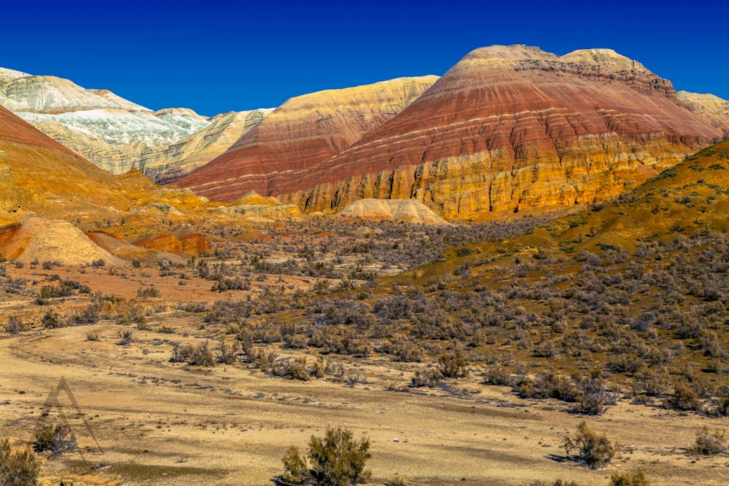
Cretaceous Mountains Aktau
The Aktau Mountains are one of the most famous ones in Altyn Emel National Park. The colors of the mountains are mainly whitish but in some sections they expose a wide range of shades and colors.
They are an about 400 million years old unique geological formation explored by only a small bowl of paleontologists from around the world. Within the dull hills of the Aktau mountains, you can find old remains of plants and animals, displaying the richness of the history of the planet.
Researchers believe that these mountains were formed by the currents of changing layers on top of each other under the Tethys Sea during the Mesozoic era. Ak means white in Kazakh and Kyrgyz and Tau translates as the mountain.
Volcanic Mountains of Katutau with remains of lava
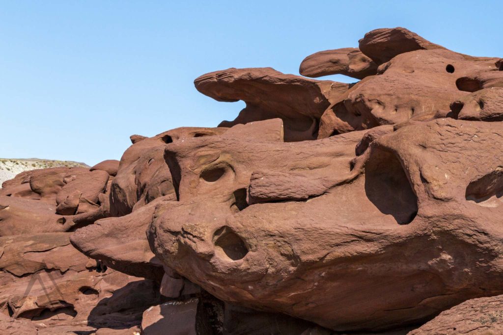
In the Eastern part of the National Park you can observe Katutau mountain (translation from the Turkic means Severe mountains). They were formed from the solidified lava of two large volcanoes that were once active in these parts.
Katutau mountains are very ancient ruined mountains where the active volcanoes used to create chaos long ago.
The leftovers of lava flow ruled by the sun, frost, rains and wind appear as wonderful images carved on the rock. The highest point of Katutau reaches a height of 1720 m.
Besshatyr burial mounds
Besshatyr Saka Mounds (Bes-Shatyr is “five tents” in Kazakh) is a complex of royal tombs, dating back to the 1st millennium BC, one of the most remarkable objects of the historical and cultural heritage of the Altyn-Emel National Park and the whole Semirechye (Jetysu, Seven Rivers) region.
The Besshatyr necropolis is located in the western part of the Altyn-Emel National Park, on the north bank of the Ili river, in a place called Shylbyr and between the Degeres ridge (Dzhungarian Alatau) in the west and the Small Kalkan mountains in the east.
Besshatyr (bes translates as “five” and shatyr as “tent or a pavilion” from Kazakh) is the necropolis of the leaders of the Saka Tigrahauda nomadic tribe (Better known as the Eastern Scythians), which inhabited this territory in the 6th-4th centuries BC. The age of the Besshatyr mounds is believed to be between 2 – 2,5 thousand years. The 31 mounds in total, that look like pavilions from afar, are made of stones. Of these, 21 burial mounds are with stone cover and the rest made mostly from soil.
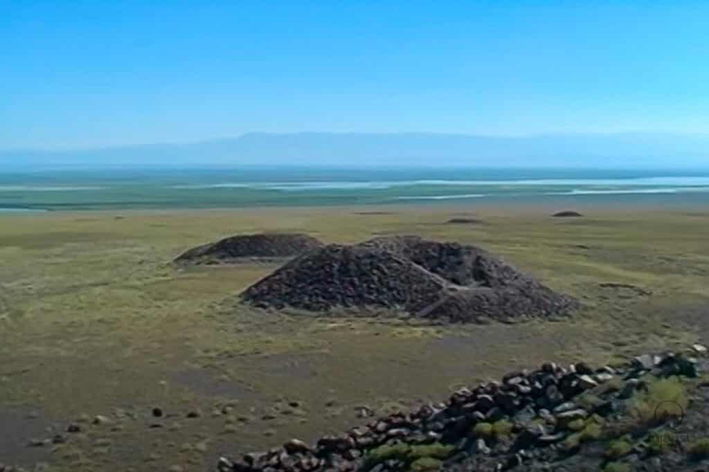
The mounds stretch 2 km from north to south and 1 km from west to east and are divided into large, medium and small ones. For the leaders of tribes and unions, rulers, kings, burial mounds with a diameter of 50-100 m were erected; for famous warriors, heads of clans, nobility – from 30-40 m; mounds from 15-25 m were erected for simple men-at-arms. The largest, the so-called Royal Mound, is 17 m high and 105 m in diameter.
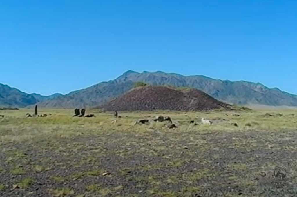
Complex underground passages have been discovered in the large mounds. From the inside and they are supported with wood from the Tien Shan spruce, which was harvested in the Zaili Alatau mountains, 200-250 km from this place, and floated down the Ili river.
The Besshatyr necropolis was explored by the Semirechye archaeological expedition in 1957, 1959-1961. During the excavations, many historical artifacts were discovered that gave an idea of the Saka nomads lifesyle. Unfortunately, the royal burial mounds were plundered in ancient times, and from the remaining objects and the grandeur of the structures, one can only guess about the value of the missing things. However, the Besshatyr mounds themselves are of great cultural value as a historical artifact.
The name “Besshatyr” (“five tents”) comes, apparently, from the number of the largest tombs in this territory. On the way, you can see many smaller burial mounds scattered throughout the territory between the Sholak mountains and the Ili river.
Travel to Altyn Emel
The most optimal way to get to Alty Emel is from Almaty. One way trip will take about 6 hours. You can also get there by your own car or rent a minibus if you are a group. Make sure to get an entry pass before entering the area. If you wish to book one of our Kazakhstan tours to get to Altyn Emel, the pass is always included in the tour price.
You can enter to the park only through the village of Basshi. There is also a museum where you can take a tour and learn more about flora and fauna and the history of the formation of geological objects of Altyn Emel. The best time to visit Altyn-Emel is March-May and September-November, in dry weather. Make sure to bring a large bottle of water, a hat, sunscreen and good shoes with you.
Sights & destinations near Altyn Emel
Page updated 29.10.2025